
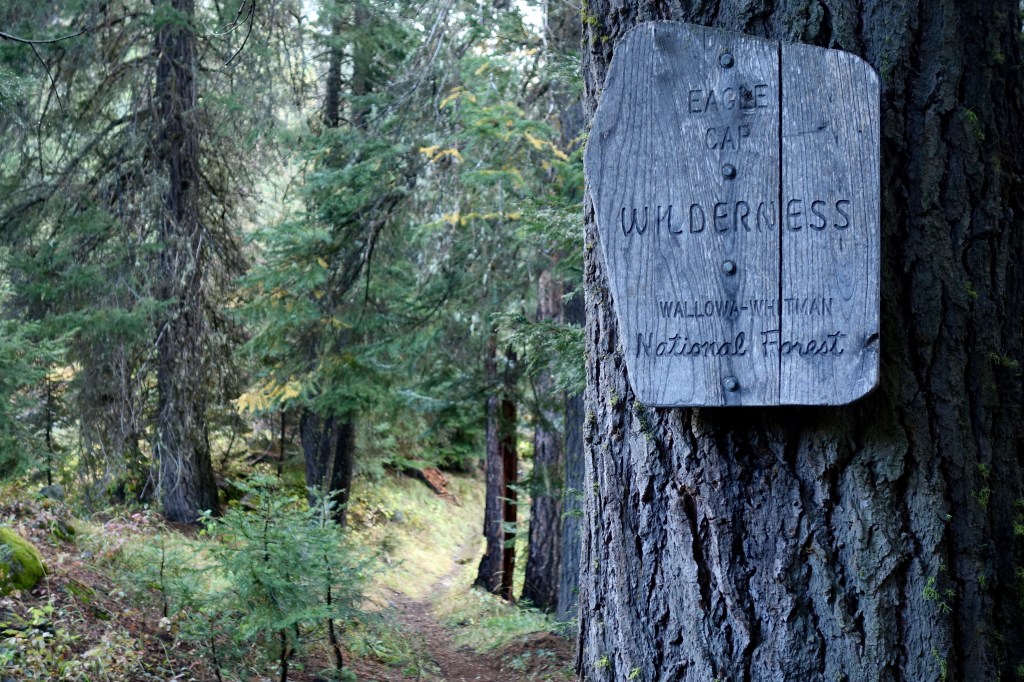
Rain hissed on my windshield and the wipers squeaked in rhythm. The stormy weather that had convinced me to postpone my trip to the Wallowas for two days, was settling in as my companion for the six-hour drive from Portland to the eastern Oregon trailhead. As spray kicked up by adjacent semi-trucks lashed my vision, I felt wise for having tempered my enthusiasm for putting feet on the trail. I felt humbled too, reminded that the drive to the trailhead or back home is probably the most dangerous part of any backpacking trip. I was happy to not be hiking in the rain, definitely, but this drive was keeping me on my toes.
The final 20 miles of gravel road were viewed in the restrictive beam of my headlights. Although it was only around 6pm, the storm had advanced the already-early, late season darkness. I pulled into the soggy trailhead, nestling my small hatchback next to a handful of pickups under large Douglas fir. I walked a small loop around the lot by headlamp to stretch my legs before retreating to the back seat for the night. I scarfed cold pasta (carbo load), escorted a curious spider from the vehicle, then snuggled under my quilt. Heavy rain came and went as I drifted towards tomorrow, feeling extra cozy and, again, glad to be here and not out there.
Day 1
Miles hiked: 22.6
Elevation gain/loss: 6,839 ft / 2,836 ft
By 8am the next morning, I was crunching up the trail, eager to explore a new range. I felt nervous anticipaption as well. The weather was supposed to improve, so that was cool, but I was apprehensive that I might have bitten off more than I could chew when I sketched out my itinerary. Enthusiasm overwhelmed restraint and the result was a 75-mile loop with plenty of elevation gain that I worried might crush my soft, city legs. Day 1, today, seemed especially burly, with two major climbs totaling roughly 6,800ft elevation gain. That would be a big number even with CDT fitness. I scooted ahead, honestly unsure of whether I had it in me.
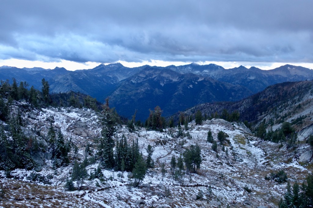
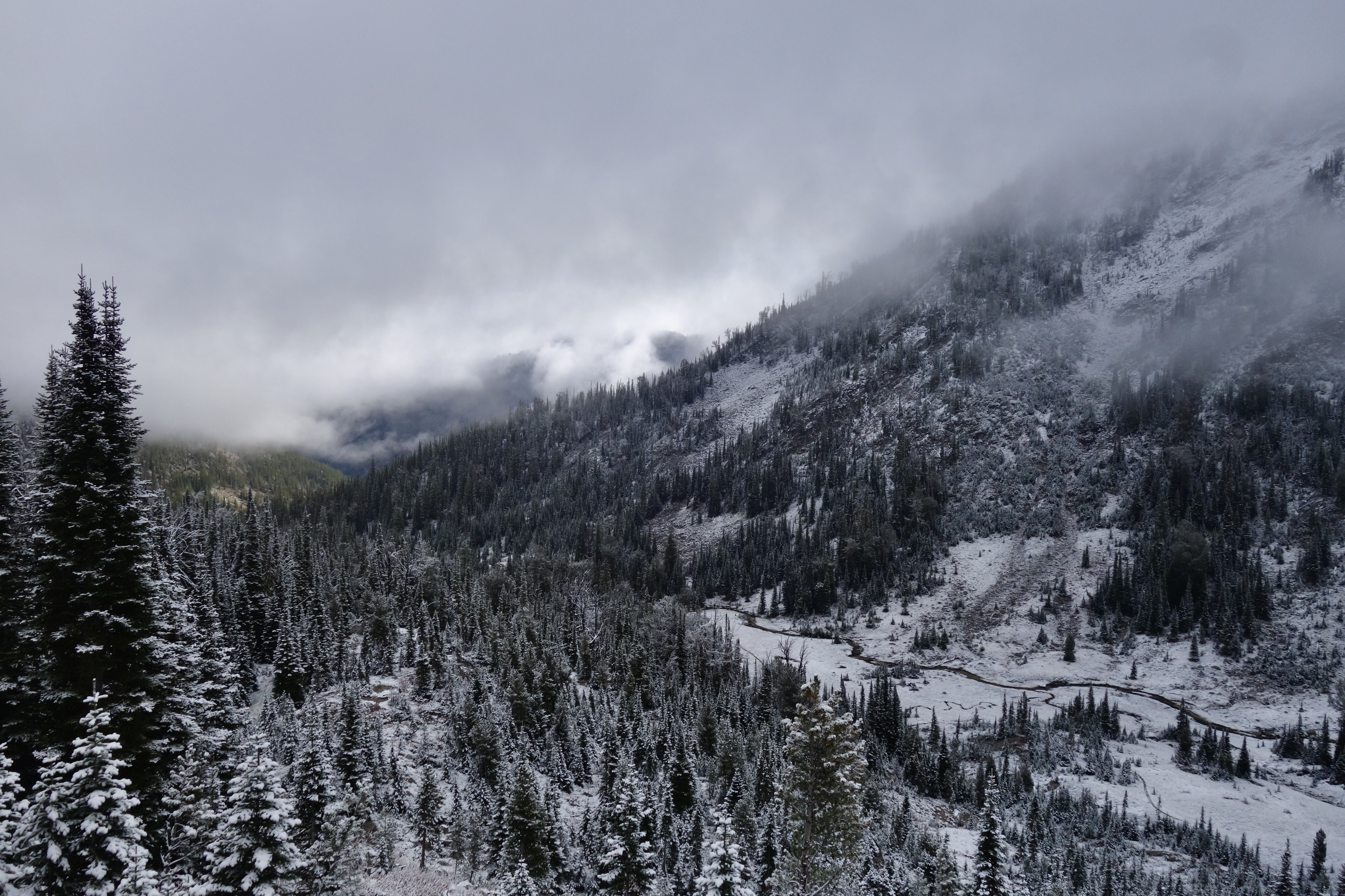
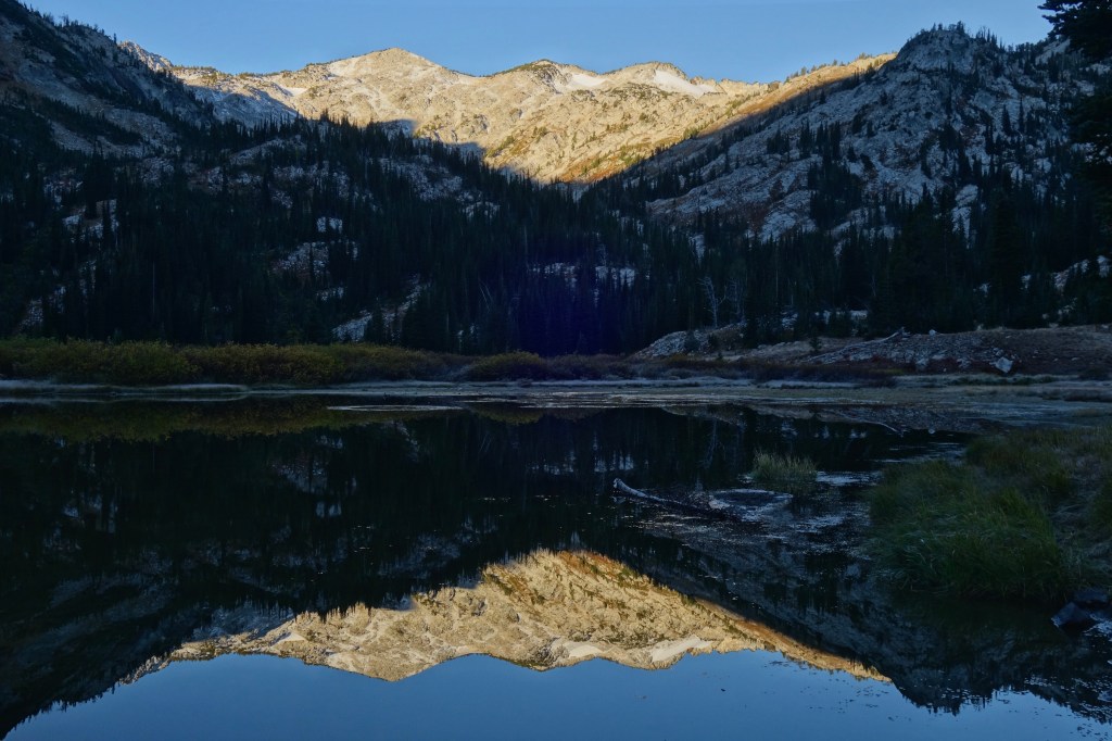
The junction where the trail departed the gravel mining road was difficult to see, but I got lucky with a bird that pulled my gaze in that direction. Water droplets hung from layers of vegetation, remnants of the downpour that was responsible for the small trench carved in the pine duff trail tread. The trail climbed gradually up a long valley along the East Fork of the Eagle River and I needed to keep moving to stay warm in the damp morning shade of clouds and mountains. The tree canopy gave way to wide meadows. Rusty orange and yellows blanketed the open spaces, rising up the sides of the valley to where the gray of rock and cloud both hinted at and hid the alpine landscape above. A dusting of snow crept down from this transitionary boundary confirming that, yes, it was cold.

I kept a close eye on the sky above. The forecast called for a cold, but clear day. I hoped the sun would melt most of the snow that fell in the night so that I would have the chance to do some off-trail scrambling when the time came tomorrow. Though patches of blue populated the sky on the range’s periphery, the direction I was headed was still socked in. Just after the junction to Hidden Lake (mile 6.9), a sprinkle of snow rustled the dry brush. Huh, not looking so clear after all.
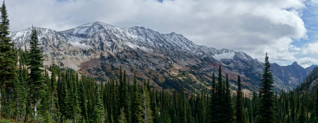
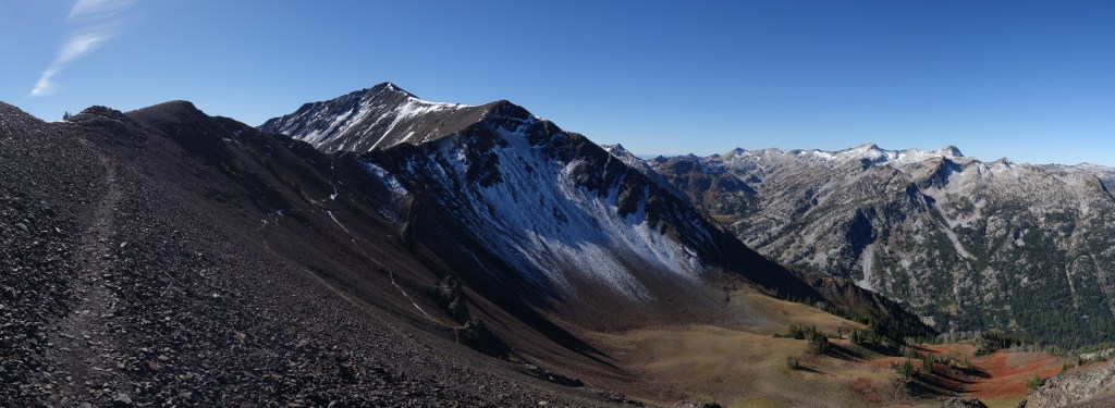
After turning left towards Frazier Pass at the next trail junction (mile 7.7), the gradual upslope became less gradual. Fortunately, the improving views were more than worth the extra panting. The clouds were now just tickling the ridgeline spread before me. With a limited knowledge of the area, I guessed that I was looking at Eagle Cap and Glacier Peak. There was plenty of snow up there, which didn’t bode well for tomorrow, but it sure looked pretty today. At noon I made the final gasp to Frazier Pass (7,534ft, mile 9.1). A warm patch of sun and an alright view made it an easy choice to plop down and eat some things.
From there, the day got much colder and less casual. Dark gray reinforcements filled the blue patches in the sky and I said my farewell to the sun. The trail dropped steeply off the other side of the pass to the bottom of the next ludicrously long glacier-carved valley. At the bottom, I hopped across the Minam River then paddled through a flooded meadow where a canvas hunting tent chugged the smell of comforting warmth from its little chimney. With many miles left to hike and no time or warmth to waste, I didn’t hang around for an interaction that I didn’t want in the first place. I turned left down the valley and hit eco-boost.
The next eight miles were a blur of trees and Clif Bars. The trail paralleled the Minam River, just close enough to hear, gradually losing 1,800ft. It was easy walking and I turned off my brain, occasionally finding distraction in the peaks to my left. Thin veils of snow blurred the ridges, but I was too happy to be in the presence of granite again to let the lingering wet weather get me down. Optimistically, I told myself that if I made it through the night, tomorrow was bound to be a warm, sunny day.
Just before 4pm, I took a breather at my last junction of the day (mile 18.4). From here, I had at least 3,000ft of climbing in less than five miles on the unmaintained Granite Trail. With the “heat” of the day (~43°F) solidly in the rearview, I hoped my legs had enough juice in them to keep me going and keep me warm as the temperature dipped with the gathering evening and increasing altitude. I washed down a grip of chocolate chip cookies with a few gulps of caffeinated electrolytes. Here we go.
I worked up a good lather on the tight switchbacks that carried me up the steep valley wall. The refuel served me well as I powered up and up. As I felt my leg muscles contract and release with every step, I wondered if I was mortgaging my tomorrow by pushing myself too hard today, yet remained reassured that the fallout was indeed, tomorrow’s problem. Mighty Ponderosa pine clung to the steep slope and I counted my progress using their pixilated trunks as rulers. Seeing these old friends again brought me back to wonderful days on the CDT in New Mexico when I fell in love with these magnificent giants.

After 1,400ft in 1.2 miles, the switchbacks petered out while the upward progress continued on a long traverse on the rounded slopes beneath unnamed peaks. Turning an abrupt ridge corner and into a field of granite, the views back across the Minam valley spread across the dimming horizon. Big mountains that way. More exploration needed. Surveying the sky for any hint of where the weather was headed, I was heartened to notice that despite a solid cloud layer, it had lifted and the snowy showers were absent. Visions of a clear night and cowboy camping entered my mind.
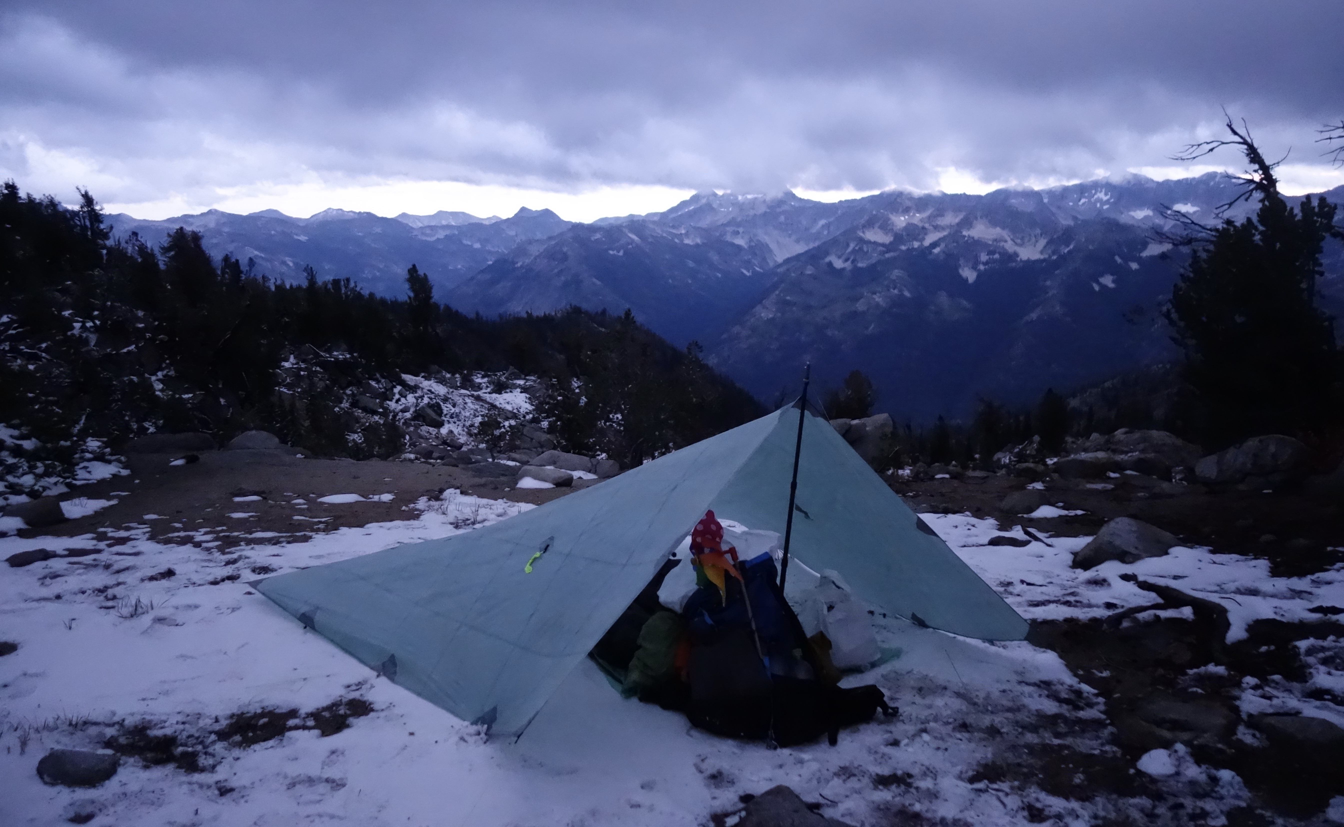
But I had bigger problems than weather at the moment. Although I was ready to call it a day, I needed to find water and flat ground. I got lucky with a few puddles in a soggy meadow, quickly filtering two liters of icy agua, but flat ground proved elusive. A spot barely long enough for my sleeping pad tempted me, but I would have been screwed if I needed to set up my tarp. I kept going. A snowy meadow came next, but the rising wind left me wanting for some tree cover. I slipped around on the worn remnants of tread on my final pair of CDT Lone Peaks, looking for that perfect spot, then just any spot. None was forthcoming. Before I knew it, I was on top of an unnamed pass (8,400ft, mile 22.6), now really exposed to the biting wind. It howled through the stunted tree tops and I considered a partial retreat to the less-windy meadow.
But I hate hiking backwards. Hoping that the wind wouldn’t shift in the night, I pitched my tarp on a sandy flat next to a large boulder. Not giving a second thought to the vast panorama in front of me, I bundled into my shelter, quickly put on all my layers, and got under my quilt. It was dark by the time I finished spooning cold beans for dinner. Though the temperature now dipped below freezing, I was warm, and relaxed for the first time since lunch.
Day 2
Miles hiked: 17.9
Elevation gain/loss: 3,361 ft / 4,582 ft
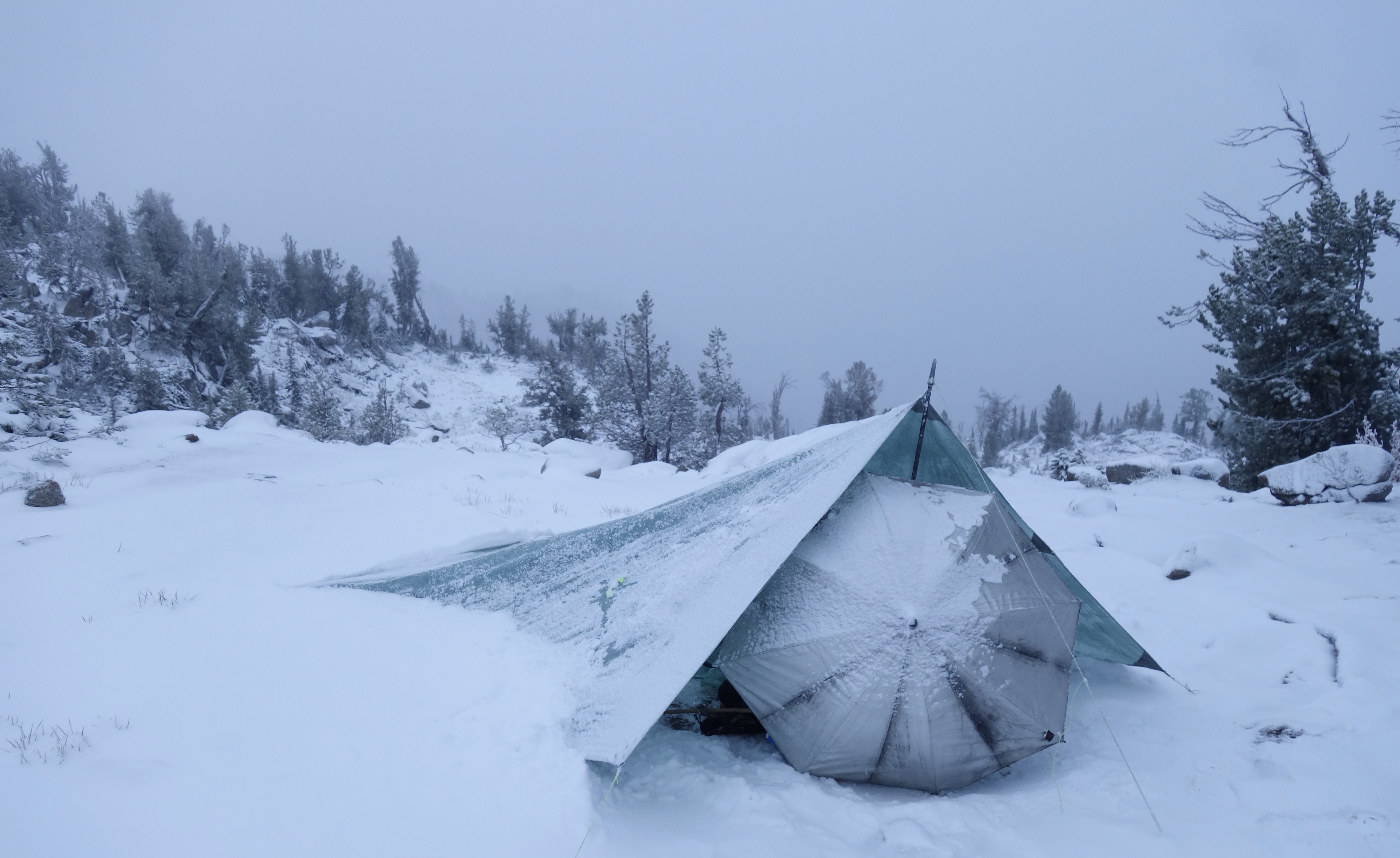
I’ve had better nights of sleep. I was plenty warm, but no matter how I positioned my umbrella, snow flakes tickled my face throughout the night. I wiped the crud from my tired eyes when the sky began to brighten, grateful for the new day and itching to get out of the snow zone to lower altitudes.
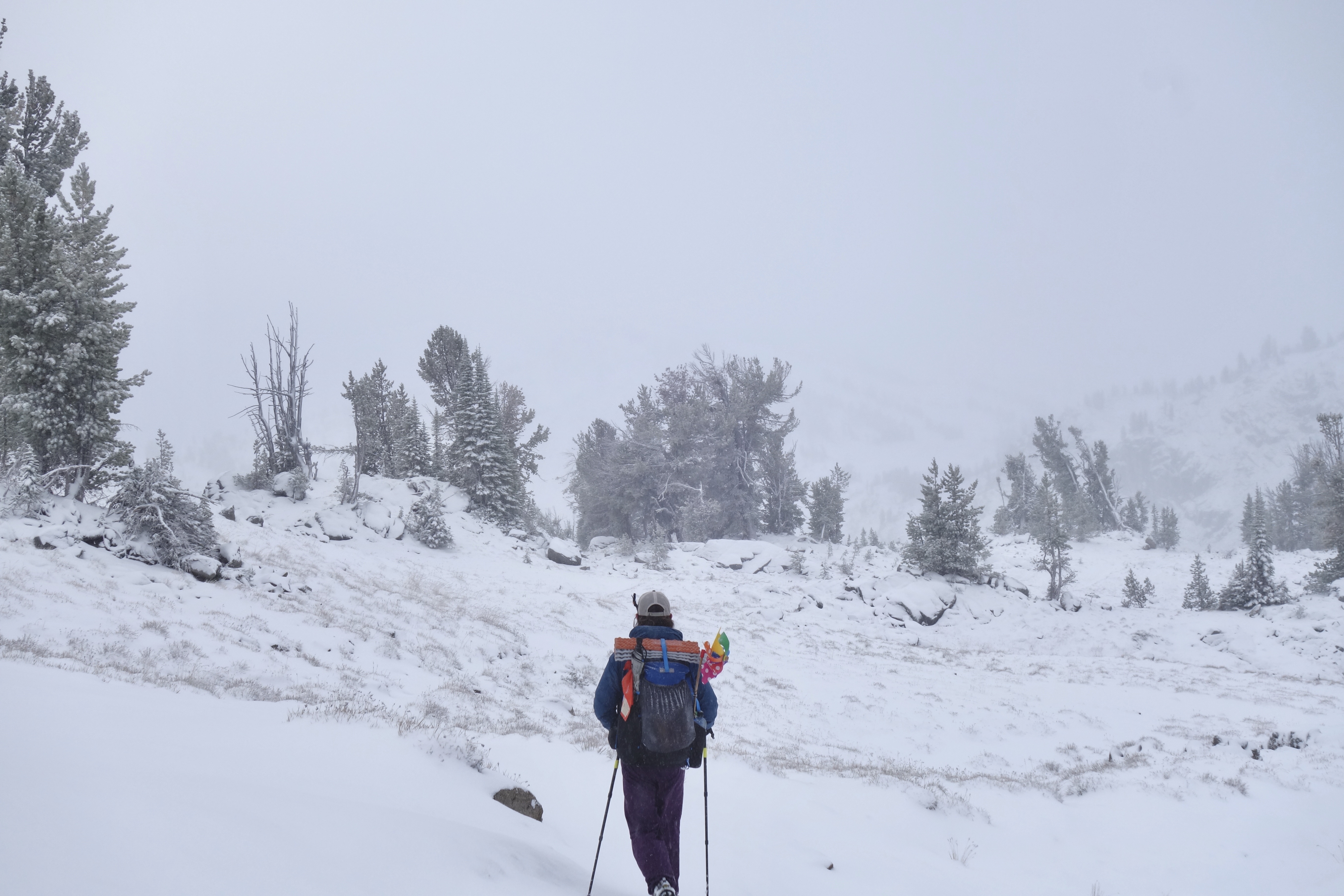
A couple inches covered the ground, though I was thrilled to notice that I could still make out the trail. Once I took care of the unpleasant task of rolling up my frozen tarp and started hiking, I was actually able to enjoy myself. My thermometer hovered around 20°F, but the wind was absent so I kicked through the drifts warm and dry. A firmly perched cloud blocked all the epic mountain views, so I soaked in the peaceful calm instead. I was alone, safe, and comfortable in a personal winter wonderland.

The meandering flats gave way to a switchbacking descent along Elkhorn Creek as the bright dot of the sun burned through the clouds. A few showers dusted me with my own festive coating, but the warmth now pumping in from above forced me to shed layers anyway. Turning along Copper Creek, the trail took me out of the cloud, then out of the snow entirely to my first patch of direct sunshine on the banks of the wide Lostine River. I raised my face and arms to the sun, thanking it for existing. The snow was kind of awesome, but I’m definitely a sunshine person.
I turned right at a trail junction (mile 28.5) towards Minam Lake. The clouds broke apart, revealing more blue than white as I chased fresh horse prints up the muddy trail. Meadows of gold and red sped by, and by the time I reached the lake (mile 31.6) I was ready for an early lunch. I yardsaled all my wet gear to dry along the muddy shore and packed in a few calories before loading up again for the next climb.
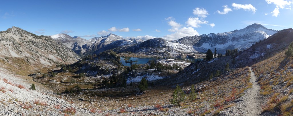
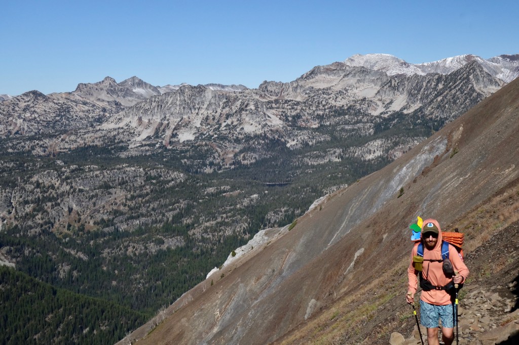
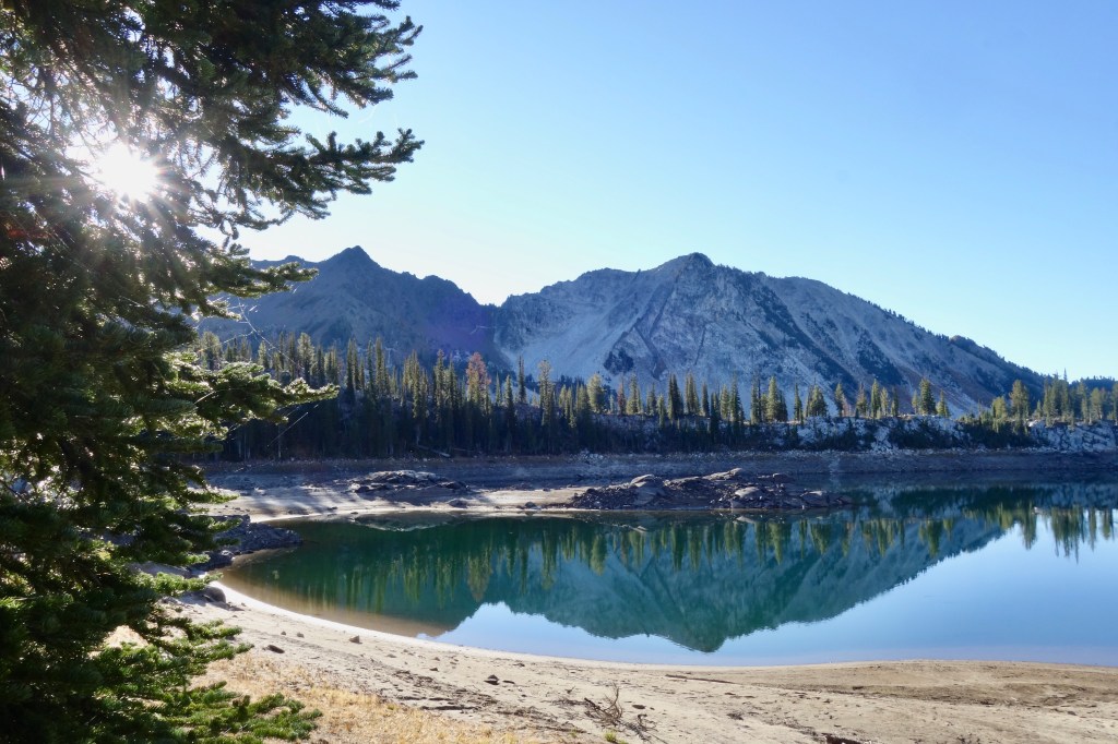
Another junction pointed me left, and an hour later I was on top of Ivan Carper Pass (8,515ft, mile 33.9). The sky was mostly clear now and the panorama was incredible. Scanning my gaze, last night’s discomfort melted away as I gawked at the tremendous visual drama all around. Snow-blanketed peaks, sapphire lakes, yellow meadows, tree-studded hillsides. I sank down for second lunch and to gaze at this wide wonder. Map in hand, I strained my eyes to find Polaris Pass, the big effort tomorrow, but settled for getting the names of a couple lakes and peaks instead. Mirror Lake, Moccasin Lake, Matterhorn, Eagle Cap. Cool stuff.

After one too many peanut butter tacos, I clomped down to Mirror Lake on chilly knees. An acute pain pinged in my left by the time I reached the granite shoreline (mile 33.6). I gave it little attention, figuring that it would soon evaporate like so many other discomforts of the trail. However, by the time I had gained that elevation back at Glacier Pass (8,470ft, mile 38.4), it appeared to have settled in to stay for a while. That bummed me out a little bit, but I wrote it off as tomorrow’s problem. My legs recovered from a brutal Day 1, so maybe my knee would be fine after a night of relaxation.
I again scoured the distant ridgeline for a hint of Polaris Pass, but settled for the ominous thought that the unmaintained trail had been wiped clear of the mountainside over years of neglect. With a creeky knee and mysterious trail ahead, a mood of intense melancholy descended with me below the beauteous gem of Glacier Lake. The sky was clear. My mind, not so much.
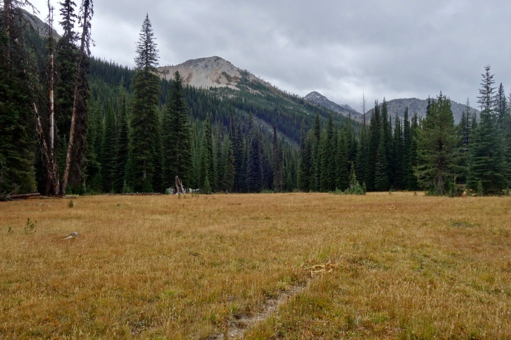
The most gradual descent put me at Frazier Lake, home for the evening (mile 40.5). I filtered water, then ate my dinner while watching the sunset turn the high peaks orange. A yummy brownie lifted my mood and I settled into my bedding, optimistic once more of a great tomorrow and restful night under the stars.
Day 3
Miles hiked: 24.8
Elevation gain/loss: 3,866 ft / 4,829 ft
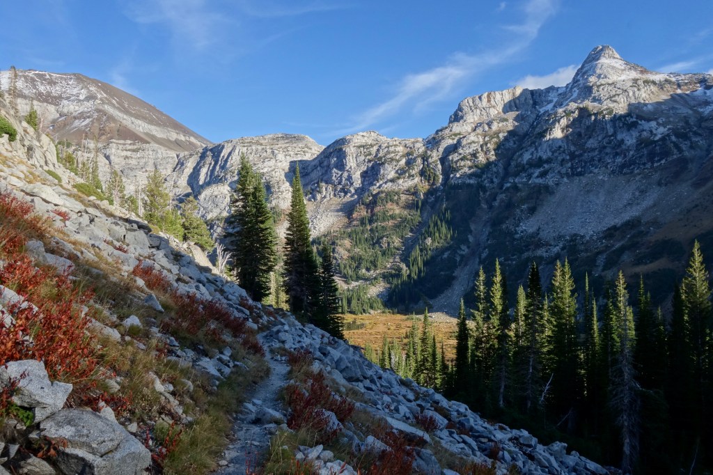
The clear night and deep valley somehow made my second morning colder than the first. Ice flaked from the bottom of my groundsheet as I shook it vigorously with frozen digits. Still, I’ll take 20°F and dry over 22°F and snowing any day. The peaks rimming the west end of the valley gleamed bright against the blue sky in the morning sun as I shouldered my pack and got crunching on the frozen trail. What will the trail to Polaris Pass be like? Is my knee still angry?
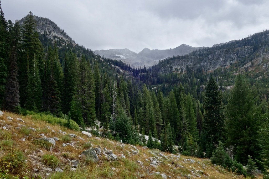
It got colder before it got warmer as I descended along the West Fork of the Wallowa River. Massive cliffs rose from a pile of rubble to my right. The boulders strewn across the trail reminded me of marble and gave me much to consider. I remembered that there was a “Marble Mountain” on my map, and suddenly, it all came together. Oooohhh, marble. I get it. Not since hiking around a different Marble Mountain on the PCT in 2015 had I encountered this rock in its raw, spooky-white form. Like coarse sandpaper to the touch, it didn’t scream “kitchen counter”, but the twisted bands of black made it a believable comparison. So yeah, marble is cool, but enough about rocks.

Soon enough, I was at what looked like my junction (mile 42.4). The signage had been great up until this point, so the inconspicuous pile of rocks and wooden cross didn’t immediately jump out at me. However, a quick check of my GPS confirmed that, yes, it was time to start sweating. So far, my knee was cooperating on the easy downhill, with only a mild unpleasant sensation, while uphill seemed not to bother it at all. I was more than ready to give it a break with the 2,400ft climb to Polaris Pass.
A bajillion switchbacks nested neatly on one another up the precipitous mountainside. The trail was in great shape, and 100% appreciated. Its grade was steady, but not extreme, interrupted only occasionally by a downed tree. My legs felt strong as I focused on a steady coordination of steps and pulls on my trekking poles. I felt grateful for the deep shade and the rapidly improving views.
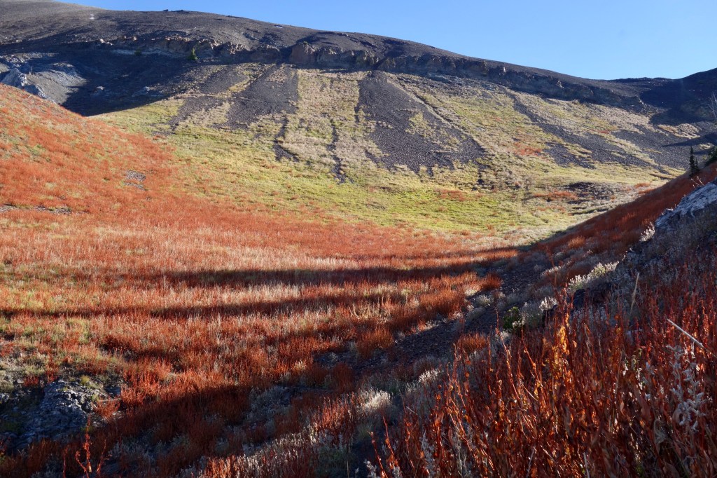
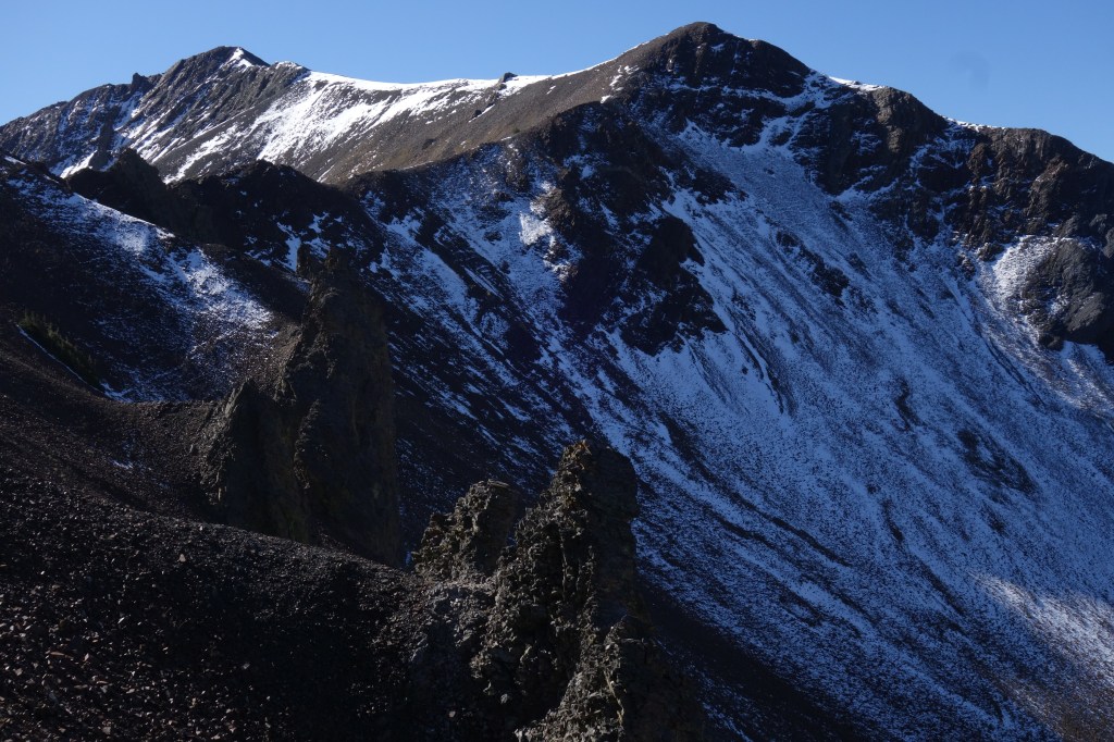
The trees thinned to small islands in a sea of rusty vegetation. Thousands of crickets chirped in the calm air. A few small rockslides forced the final long switchbacks to wobble across a crumbly slope of black scree, but they were nothing to worry about. The steepness of the slope falling away below me and the vastness of the space beyond had me feeling like I was barely connected to the earth at all. Everything came into view as the trail flattened to a humble saddle strung between mighty pyramids of rock. Polaris Pass (8,883ft, mile 47.4).
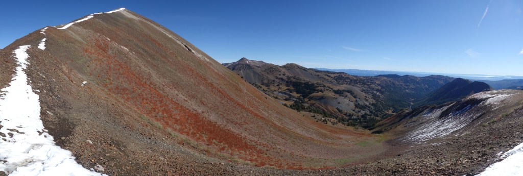
Behind me, the heart of the Eagle Cap Wilderness tickled the sky with granite jags. To my right, the ominous Sentinel Peak reminded me of a pile of crunched up Oreos, the black rock and white snow contrasting intensely. Ahead, browning hills undulated down to Hells Canyon, before rising again on the other side in Idaho. Alone, as I had been all morning, I pulled out my sit pad and food bag. This was the best view yet, and I felt a million miles from anywhere. No roads or towns in the distance. Just a drifting contrail or two.
Forty minutes later, I was moving down the other side with more than my fair share of sun exposure. I chatted briefly with two hikers going the other way, and mostly cruised around wide mountain bowls filled with browning meadows and crickets. The vibe on this side of the pass was completely different. Mellow, almost playful. I tried to imagine what this place would look like with green grass and wildflowers. I struggled to imagine a more perfect place to host a spring color show.

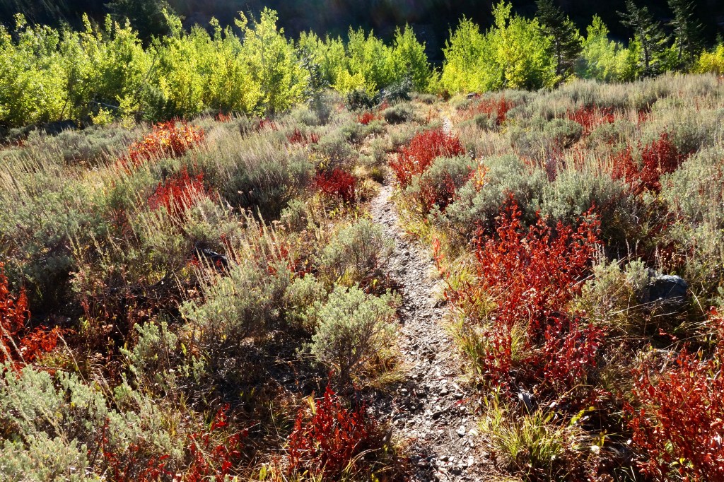
At the next junction (mile 49.9), I purposely took a wrong turn to Tenderfoot Pass, just a quarter mile away. It wasn’t worth it. I retraced my steps then continued down down down to the North Fork of the Imnaha River. Mild dehydration combined with my increasingly aggravated knee to put me in a frustrated mood as grass gave way to sagebrush then forest. I was probably bummed about putting the trip highlights behind me too. The remaining 25 miles back to the car meandered along the bottoms of valleys, and did not promise to be particularly exciting. And my ability to turn it into an engaging physical challenge was hampered by my barking knee. With the rising heat, I prepared my mind for a long grind.
And it was a grind for a little while. My recovery began with a salubrious water-chugging break and a handful of dried mango, then became fully certified when I made the turn up the South Fork of the Imnaha River at the next junction (mile 59.3). With that hard right, I finally began to move in the direction of home. The mental boost that this subtle change granted was both powerful and new to me. Perhaps with so many questions and doubts about my itinerary (route choice, trail conditions, weather, my own fitness) and now my impaired knee, I had to wait until that final turn to release the unconscious doubt buried deep in my primal mind that I might not make it — that I was in too deep. That doubt had kept me sharp and present, but it came with a low-level stress too. Now it was all gone. Just a straight shot to the car.

Towering Ponderosa and the smells of warm forest flooded me with pleasant memories as I sweated out the rest of the day. The blazing sun blasted straight in my face for miles of gradual ascent. With no need to baby my knee on the smooth trail, I pushed as fast as I could until it became clear that there wasn’t enough daylight to make it to my intended camp. At the confluence of Cliff Creek and the Imnaha, I took a wrong turn at a junction (mile 64.2) that I still don’t understand, which added half a mile and a heap of confusion before I got back on track. From there, I managed another mile and a half before calling it a day at potentially the last suitable spot reachable before dark. It was four miles short of Crater Lake, where I’d intended to camp, but it was 6:30pm and I felt good about my 25-mile effort. A sunset stretching session preceded a dinner of yummy Thai noodles and a few handfuls of chocolate chip cookies. Getting horizontal after such a tough day was exquisite.
Day 4
Miles hiked: 9.4
Elevation gain/loss: 1,300 ft / 2,962 ft
With a six-hour drive following a ten-mile hike, I was up and moving before the first rays of orange sunlight tipped Red Mountain, far above. The trail gradually climbed through frozen meadows as light chased me up the valley. A haunting elk bugle cut the morning silence, and with hunting season in full swing, I wondered if it might have been the beast’s last. I gave the sunken Crater Lake (mile 69.2) not much more than a passing glance, noting the wide bathtub ring as a sign of the season. The sun caught me there and I changed into my warm weather gear for the final plunge to the trailhead.
Despite protestations from my knee, I was glad to be going down. This sun-baked slice of trail packed 3,000ft of elevation change into less than six miles. The day warmed up on the downright deserty slope and I sipped my remaining water carefully in order to stretch it to the finish. Sagebrush alternated with stands of shimmering aspen and willow, just beginning to change their coat from green to gold.
The switchbacks lengthened as the slope eased. Sunny turned shady under the cover of tall Douglas fir. I gave one a hug. A last, inconsequential junction, then a quiet stroll to the trailhead (mile 74.1). A small group was shouldering packs to follow my footsteps up East Eagle Creek, and I paid them no mind. Nope, I had a date with 32oz of chocolate almond milk and the rest of my BBQ kettle chips. How they had survived the entire loop, I couldn’t fathom. I switched out my Lone Peaks for crocs, then rumbled down the gravel road to a sunny spot along the river.

I soaked my tired muscles and aching joints in the frigid flow. The surrounding aspen leaves danced in the breeze and I drank in their sound, breathed in the river. Paradise. Sun warmed my bare skin. I took one last moment to exist in a time between coming here and going there. The six-hour drive back home could surely wait one more moment.

The Matterhorn was in Oregon the whole time!? But really, this looks like an incredible trip I know you said Polaris pass was the best view of the trip, but Ivan Carper pass had one of the best videos (I mean photos) of all time!
Did you do any physical preparation or training before setting out on this bad boy? I also love the packing photos, the before and after of what went into the bag (with the slider transition could be cool). Does that sort of thing exist for this trip?
LikeLiked by 1 person
Well, I didn’t have a Toblerone with me to confirm that this Matterhorn was the genuine article. When I return, I’ll be prepared.
No particular physical preparation besides some running and biking. SpiceRack and I backpacked the Timberline Trail at the end of August, as well, but after over a week of staying completely indoors because of wildfire smoke, I was feeling pretty *bleh*. Perhaps more training would have saved my knee. I wasn’t too worried about biting off too much because there were two opportunities to bail if I really wasn’t up to it.
Unfortunately, no packing photos exist, but that slider thing is cool. Didn’t know it existed until I wrote this post. The future is here!
LikeLike
Great photos and writing. You are better with each post.
Thoroughly enjoyed following your trip vicariously.
Thanks so much for sharing.
Jane G
LikeLiked by 1 person
Thanks, Jane! Glad you enjoyed it.
LikeLike
Kia ora Owen,
I loved reading about your challenging ramble and I really enjoyed the photos. You’re a great photographer. An amazing range of terrain, flora and colours. You’re a tough bloke to choose to carry only a tarp knowing the altitudes you would be traversing. Do you also carry a personal locator beacon or do you rely on passersby, also ambitious in such testing conditions, to be on hand if needed? I look forward to your next ramble. Kia kaha, Vicky
LikeLiked by 1 person
Kia ora(?) Vicky!
You know, tarps are far from ideal. They offer just enough protection when it really matters, and I try hard to make sure I don’t need to set mine up. That doesn’t always work, though. On nights like the first of this trip, I was definitely wishing I had brought a tent!
I do usually carry a PLB, especially on solo trips. I used a SPOT from 2015 through 2019. For this trip, I used SpiceRack’s Garmin inReach Mini. They’re not for everyone, but I like using a PLB for tracking and think that is worth it even if I never need to pus the SOS button. *knock on wood*
Hope you’re doing well down in NZ!
LikeLike
Wow I loved this so much. Your writing and your photos really hit me in some inside spot that not many blogs do. Ty for your sharing and your writing and your hiking ❤ hope that knee pain was a 1 time thing!
LikeLiked by 1 person
Thanks! I really appreciate your feedback. Just doing what I can to spread the good vibes 🙂
LikeLike