
In October of last year, I joined my brother in the California desert with the goal of doing something that we’d dreamed about for over a decade. By some fortuitous swing of geology, walking from the lowest point in North America, Death Valley’s Badwater Basin at 282 feet below sea level, to the highest point in the lower 48 states, the summit of Mount Whitney at 14,505 feet above sea level, was not only possible, but also seemed just slightly outrageous. It had been easy to kick this trip down the windy road of life, with moves, jobs, and other hikes getting in the way, but this summer, Arthur had finally taken a stand — L2H was happening this autumn. It didn’t matter that I was bumming around on the East Coast while Spice was flying SOBO on the Appalachian Trail in the middle of our ECT adventure. Once I had an official invite from Arthur, with Spice’s encouragement it was an easy decision. To the desert!
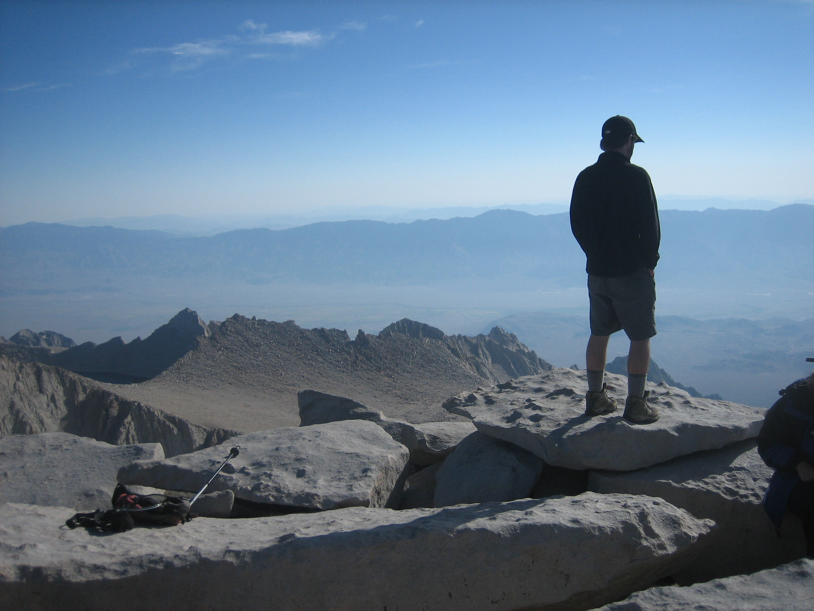
It was 2008 when I first considered the remarkable closeness of the lowest and highest points in the contiguous United States. Standing on the summit of Whitney, I gazed east, wondering if Death Valley was within view. Next, I wondered how far it was. Close enough, right?

When I got home, I mapped out the route, following pavement, thinking that I could bike the road and finish up by hiking the Whitney trail. It seemed possible, but my longest backpacking trip at the time was roughly 35 miles. The 100+ miles of this crazy scheme were out of reach. Besides, I was a bum, just beginning to have outdoor ambitions of my own and terrible at following through. Nope, the L2H, or my quarter-baked version of it, fell off my radar into a frothy swill of homework, cheap beer, and ultimate frisbee when I moved to San Diego to pursue my degree.
It was Arthur who showed me the true Lowest 2 Highest route (L2H) a few years later. Created by thru-hiking’s king desert rat, Brett “Blisterfree” Tucker, a combination of dirt roads, rough trail, and cross-country navigation scratched across the remote desert between Badwater and Whitney. It featured three separate mountain ranges divided by deep desert valleys, and included the 11,000ft ascent from Badwater to Telescope Peak. He’d sniffed out just enough water sources to make this survivable, but setting up a couple water caches was still a good idea. Fortunately for us dreamers, Mr. Blisterfree created a wonderful, single-source website with all the information that an aspiring L2H thru-hiker could need to become hopelessly inspired and scared shitless.
So here we were. 2022 and time to make this thing happen. Arthur did most of the planning, so all I had to do was show up and hike. That simple task turned out to be more difficult than I could have guessed, but this was our time. With much more hiking experience under my hip belt since that lofty day in 2008, I was confident that we could pull it off as long as the weather cooperated. Still, never before had I approached a hike with so little certainty of success. The L2H would surely be next-level in a lot of ways, and there were a myriad of things that could go wrong with pretty sobering consequences if they did. But we Eigenbrots are good planners, if nothing else, so I knew that we were going in as prepared as we could be. Digging deep into the past as we discussed water caches, I hoped that I remembered my PCT calculations accurately. Was it three miles per liter, or was it four? Across 45 miles, that mattered a whole lot.
L2H Summary
Route resource: Blisterfree’s website
Start/End: Badwater, Death Valley to Mount Whitney summit
Mileage: Approximately 135 miles, plus 11-mile return to Whitney Portal Trailhead
Dates: October 13-20
Resupply: Panamint Springs Resort, Lone Pine
Water caches (total for two people): 4 gallons at Wildrose Rd, 2 gallons at Saline Valley Rd x Hwy190, 5 gallons eight miles up Saline Valley Rd
Highlights:
- Crossing the Badwater salt flats before sunrise.
- Dusty sunrises and sunsets.
- Finding water at every expected source and water cache.
- The cool breeze on the ridgeline from Telescope Peak.
- Sunrise on the Panamint Valley playa.
- Walking with a full load of water plus a gallon jug in one hand.
- Caravan of Europeans way off the driving route to Las Vegas.
- Cerro Gordo ghost town and the epic trail beyond.
- Endless jokes and farts.
- Eating 5 lbs of salty fries each at Whitney Portal.
- Getting dizzy at 13,000ft.
- Staying safe and hiking with good style.
- Hanging with Arthur and the family.
Okay, okay, enough of this messing around. Let’s get to the hiking! I’ve been sitting on these posts for way too long now, and I’m thrilled to finally get them out there. I hope that you enjoy the dusty ride.
To Riley, From Riley

Here we go again. Yay!
LikeLike