
10/16/22
L2H Day 4
China Garden Spring to Lee Flat
Chex Mix Camp to Jug Hand Camp
L2H miles: 22.75
L2H total: 80.3
Elevation change: 3547ft gain, 623ft loss
Our fellow L2H hikers were packed up and walking out of camp at 4:30am. As they had explained earlier, their water cache strategy was different from ours, and so they needed to hike 30+ miles to the ghost town of Cerro Gordo by the end of the day. I was grateful, snug, and smug as I blearily watched their bouncing headlamps disappear behind some bushes. That sounded like an excessive amount of hard work. Arthur and I had signed up for a hard enough stretch even without the extra seven miles, and I dimly pushed away the bubbling sense of superiority. Their plan was good for them, our plan was good for us. Hike your own hike, and all that. Still, I wouldn’t have traded theirs for ours.
I’d slept long and well enough by the time their footsteps faded that a nourishing snooze was all I could muster before our alarms sounded at 5:30am. Between the bright moon and the wind that had picked up, the world seemed ready to go as well. There was energy all around us. I could hear it, see it, smell it, and feel its cool touch on my nose and tug on my beard. Arthur sat up first, much revived by his rest, and munched into his breakfast cookie between his first coherent sentences since making camp. I demolished my cookie as well, washing it down with a few handfuls of dry granola. Our appetites were raging now.
The sky was just beginning to lighten when we rejoined the wash to wind deeper and higher. Once out of the breeze in the protected narrows, the still air felt warm, perfect for a comfortable start as we worked our bodies back into the groove. The ground was bumpy, and there were even a few short scrambles to work over, but the hiking was undoubtedly enjoyable. There were no questions about the route, just easy yet satisfying puzzles to dispatch. This was an engaging and gentle way to start our day. The geology was spectacular, varied and twisted, and overall this upper reach of the canyon felt friendly, putting me at ease.
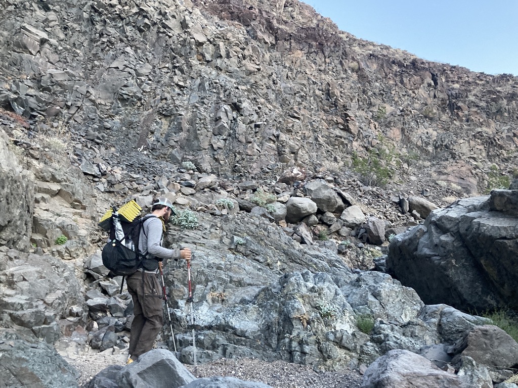


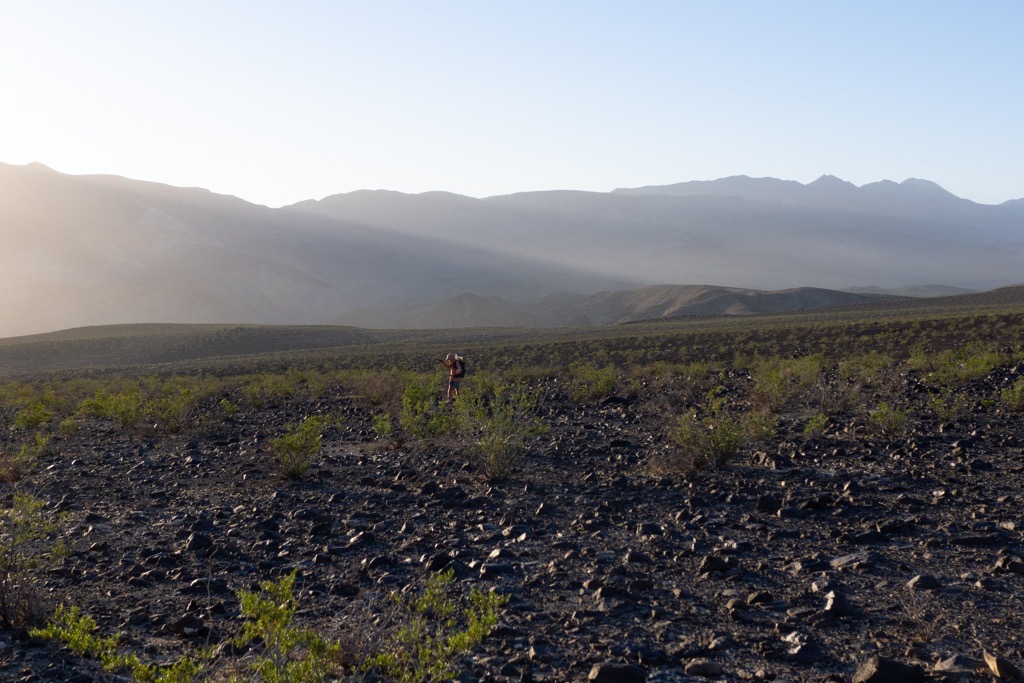
Careful not to miss our turn, we spied a large cairn and confirmed with GPS that we’d reached the right spot. The rim above glowed orange in the sunrise, and now it was time for us to glow as well. It was just a short climb to the land above, and quite dramatically our world expanded from a simple, intimate path to an overwhelming vastness. Much had changed as we meandered through the earth. The mountains were moved, the rocks and plants different, and we were much higher. It was a shock to see how far we had come since leaving Panamint Springs, but not unpleasant. Telescope Peak was no longer perched on our dashboard. Now it marked the second ridgeline, distant and hazy in the artful morning light. We stopped to slather on sunscreen and also appreciate where we stood. Two small creatures in a scene worthy of a painting.
Behind us was an epic desert view like no other, and ahead of us was a long march up to the near horizon. We found our own paths over and around the shiny dark volcanic boulders, placing each step consciously in a moving meditation of mindfulness. The task was simple, yet engaging. Our progress slow, yet undeniable. A steady breeze kept us cool as we climbed, and we labeled it MVB for Most Valuable Breeze. It also bombarded us with a running explosion of crickets. Were they leaping because they sensed our threat, or were there just millions of crickets in the air? We couldn’t tell, and I hiked with my mouth closed.

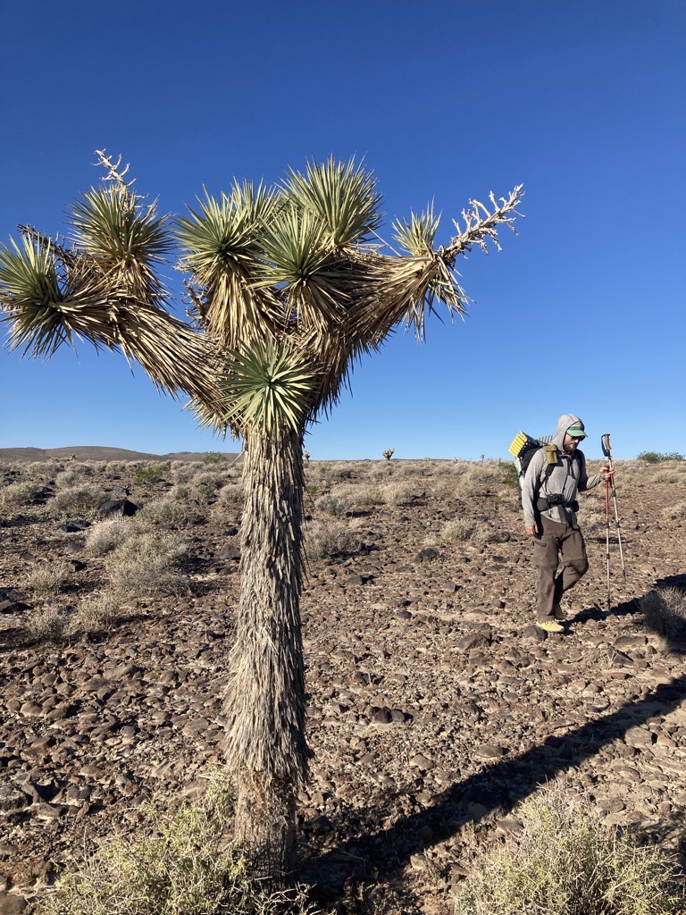
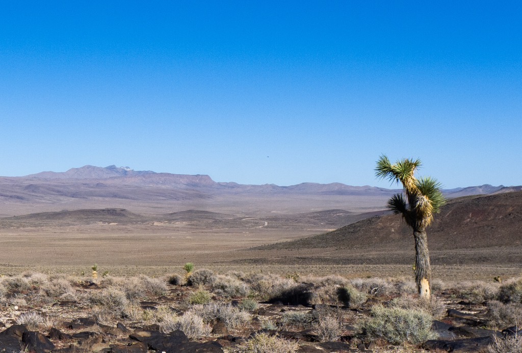
Up one lump, then another. My legs felt tired with the accumulated miles and heavy water carries finally catching up with me. The grade began to ease around 5,000ft, which was also where we met our first Joshua trees. They sparked into the air like wooly dancers, frozen in time, ready to groove when we looked away. Then as we crested the local lump, the High Sierra once again popped into view, appearing much brighter and closer than they had from the flank of Telescope. Just the highest points of the highest mountains scratched above the nearer hills, but I still recognized them and felt their power. Their brilliant gray magnetism pulled me along, and my excitement for the rest of the L2H spiked. With most of the major questions about the route and our worthiness behind us, I granted myself permission to think beyond today, to the next, then to the end. I was so excited to stand on the crest of the Sierra again. I’ve called a lot of places home during my travels, but there is none like the Range of Light. Our relationship spans decades, and with that comes a comfort, even if I am still in awe of their rugged indifference and power. With only a glimpse, I felt rejuvenated.

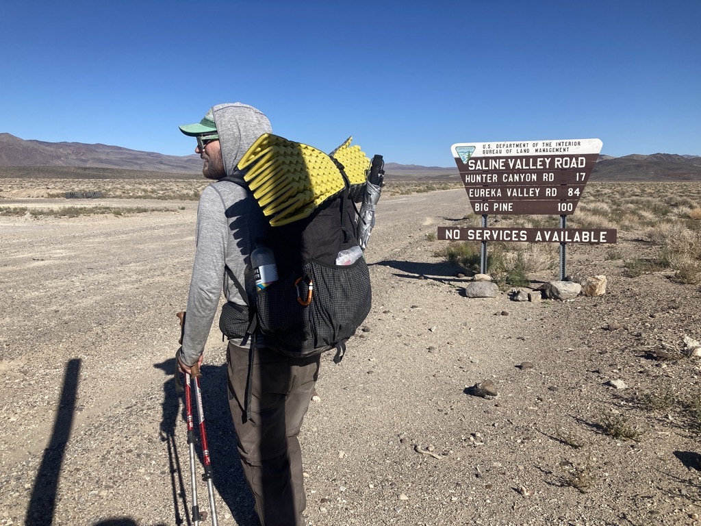
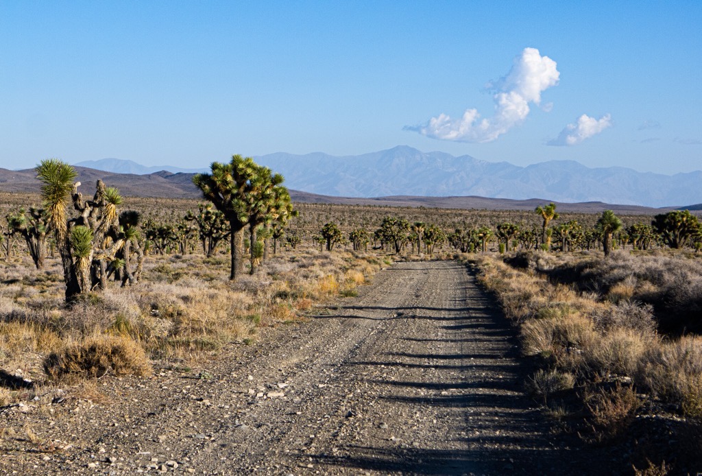
An easy descent to Hwy 190 where it crossed Darwin Flat was marked with ample Jolly Ranchers and a wayward mylar balloon that disintegrated into thousands of shiny plastic flecks when Arthur attempted to pocket it. We aimed for the junction with Saline Valley Road, where hopefully we would find our second water cache. I still had a gallon on my back, but every liter mattered now. After leaving China Garden, we were reliant on only our caches and what we carried from the spring to hydrate us for the next 45 miles to Lone Pine. This stretch included two nights, and was wholly a step above any previous experience for either of us.
When deciding how much water to carry, we used my experience from the desert portion of PCT to inform our best guess, but there were important unknowns at play here. Would providing a liter each for every four miles be enough? To simplify things and reduce risk, we’d settled on a conversion of one gallon of water for both of us every seven miles. That was a lot of water, but the extra weight was worth the peace of mind.
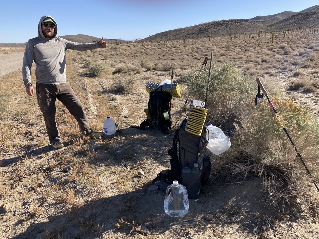
Two jugs were waiting for us, right where we left them and still holding the nights chill. To celebrate, we added our umbrellas’ shade to that of a low bush along the gravel road, and stretched out to enjoy the morning snack break. It was still just 10am and relatively cool, but the sun was brutal. Wherever its light touched me burned and started sweating.
You’d think that finding this specific spot in the vast expanse of the Darwin Plateau might be like digging a needle out of a haystack. It’s actually pretty easy. 
Arthur points to Badwater, where it all began. 
10am. Time for a break at our two-gallon water cache. 
Still nice and cool with the night’s chill. 
The view from our first water cache of the day. Photo credit: aeigenbrot 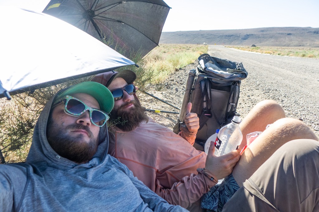
Feelin’ ‘drated. Thumbs up for water. Thumbs up for umbrellas. Photo credit: aeigenbrot
It felt goooood to have an abundance of water, and we both drank with impunity, confident that there was plenty to go around. I wish that I could have said the same for my Chex Mix, which was all I wanted, but felt compelled to conserve until lunchtime at least. I settled for a bar, some dates, and a handful of granola instead. While we reclined, a dude in a pickup towing a long cloud of dust out of the desert stopped to check on us. Satisfied that we were fine and not crazy, he insisted that we visit a canyon up the road that was covered in “bitchin’ Permian fossils.” That phrase would gift us endless chuckles for the rest of the trip.
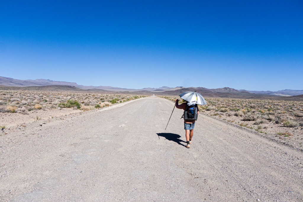
It was gravel road all the way from there, and our bodies learned to hurt in new ways, betrayed by the easy monotony of flat and smooth. We hiked fast, but felt slow. The wide road and huge distances between us and anywhere else swallowed the evidence of our progress unless I forgot to look up for 15 minutes at a time. Then it was noticeable.
We hunkered under our umbrellas, sucking down candies and lightly flavored electrolytes, feeling our heavy loads pound us into the earth. Whether it was the hard ground or repetitive foot strikes, our soles began to suffer from a building ache. Arthur’s pain plateaued after a few miles, and mine built to a stumpy maximum a few after that. But the breeze still blew, keeping the temperature bearable except for the moments of stillness between breaths.
Cerro Gordo Peak barely moved closer on the horizon. This road, which had felt so slow when we drove it days before, was glacial now. We were reminded that eight miles, even at 3mph is a long way. However, above all, was our shared gratitude that our gallant Corolla had made it along Saline Valley Road as far as it had. If not, then we would have been carrying five extra gallons of water between us on this stretch. Yep, it could have been harder. Besides, those extra gallons still waited for us. It would get harder still.

After a hot pass through a few hills, the road once again steadied across Lee Flat, and we were a little disappointed that we could spot our carefully hidden cache from the road. It was intact, but written in sticks was the cryptic, “Hi GL.” That gave us something to consider as we hauled the jugs to the side of the road for another break. Who was GL? While we wondered, we reenacted our last stop at the previous cache, using a bush and our umbrellas to shade us while we reclined on our pads amidst a variety of tiny points and sand. After drinking some water and eating a bar, I tried to catch a nap. All of a sudden, I was sleepy. The darkness behind my eyelids called to me.
Did I snooze? Probably, judging by the snorting snores that shook me awake a few times. Arthur confirmed my suspicions, then it was time to eat some things. We both crammed things in our mouths, lamenting the lack of chips and Chex Mix, while watching a surprising number of cars pass by. It was only five or so, but combined with Fossil Guy, that was five or so more than we expected. One cheerful group of Europeans in a rental gave us something to wonder about when they asked us if this was the way to Vegas. It was unclear if they were joking or not, but they laughed and kept going when Arthur answered with bewilderment, “uhhhhhh, no. It’s actually that way,” pointing back the way that they had come. With the main highway still washed out after the recent flash flooding, it was possible that Google had routed them through the most remote part of Death Valley on the gnarliest of gnarly dirt roads. Could they really be going to Vegas thinking that they were on the right path? With the limitations of Google all too fresh in our minds, we wondered when/if we would hear about these people in the paper.

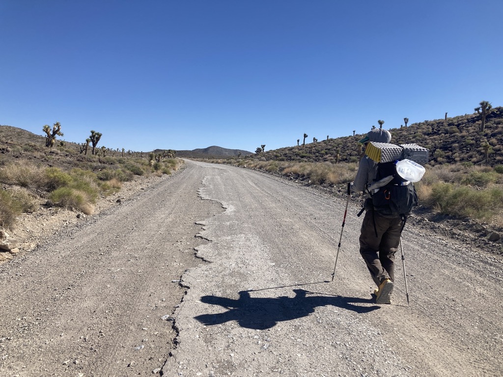
Jokes about a wild rave hosted in the desert by a fictional character, Sven, propelled us along the final stretch of the day. At 3:30pm, under a blazing sun, we’d consolidated the additional five gallons of water and lurched to our feet. I now had a spine-crunching nine liters on my back, while Arthur hefted a grounding 10+. Additionally, we each held a full gallon jug in one hand. From the cache, it was forty miles until our next water. This had to be enough.
Already reduced to using one pole each, we didn’t have the spare hand to hold our umbrellas, so we sweated it out, eagerly awaiting each puddle of shade pooling below the occasional mighty Joshua tree. The tread grew sandier and softer, and our rest had temporarily breathed new life into our feet, but there was no escaping discomfort. Now my focus was on whichever arm was holding the jug. My right arm could carry it for several minutes before feeling stretched and nervey, but my left could only handle it for one or two. What did that say about using thru-hiking as an upper-body workout regimen?


The sun lowered as we ground out the miles. I was proud of Arthur, who was setting new personal records with each passing step, mile, and day. His resilience was worthy of recognition, and his attitude never faltered. For as tired and achy as I was, I knew that he was dealing with worse. Not only did his feet start aching hours before mine did, but he was also nursing a few blisters on one foot. There are few bigger hits to morale on a thru-hike than dealing with blisters during a roadwalk. The repetitive steps leave nowhere to hide from the stinging discomfort, and the monotony provides little to distract one from this sensory onslaught. But he marched on, ready with Simpsons references or quotations from the Road Warrior.

We finally plunged into deep shade as we climbed above the sea of Joshua trees that was Lee Flat. Behind us, Telescope Peak anchored my gaze as I instantaneously scrolled through my memory of every mile between here and there. The long days that began and ended in the dark distorted the passage of time for me. The mountain felt many more days in the past than the true number, but logically it fit into place. Desert days, desert time. The distances were vast and the rock solid, but my mind was fluid, constantly bending and stretching to remember the good times and learn from the trials.

We’d walked until sunset, which was our minimum target for the day. Now that we wouldn’t roast in the sun like a sack of jabronis, we could make camp wherever we wanted to. What a puny plan. However, now the road climbed to the base of the Inyo Mountains and opportunities for flat camping had dried up. So on we pushed for another forty minutes until we crested the hill and reached a level junction in the road. This was our spot. This was home. We set up our groundsheet and collapsed, never to stand again. I peeled off my socks, which had finally become saturated beyond comfort with salt and grit. My feet felt chewed up, finely sanded down by millions of micro-scratches. I taped the few spots that were rubbed raw and called it good. Should’ve washed my socks in the sink at Panamint.

I pulled on my wind pants for warmth while my beans soaked and we watched the sky fill with color then dust into darkness. As Arthur and I spooned our meals and the stars appeared, our conversation turned to his home, and my potential home, in Colorado. It sounded like a good life, and after spending the majority of the year on the East Coast, this taste of the mountain West made me all the more excited to build a home with SpiceRack somewhere with a big sky and the scent of sage on the wind. Sweet thoughts to end a tough day. No doubt this was the toughest physically and mentally of the L2H so far. And we did a good job, and in good style. It was encouraging to acknowledge that our packs would be lighter tomorrow, and that our bodies would be stronger. I was looking forward to the rest, but even more excited to meet the new day.

Thx for the post.
You should carry dehydrated water it is much lighter.
Cheers!
LikeLike