
PCT Day 7 — May 3, 2025
Riverside County to Apache Peak
Big Sandy Camp to Wind in the Bushes Camp
PCT miles: 28.1 miles
Total miles: 170.8 miles
Elevation change: 6385ft gain, 3599ft loss
It was the best night of sleep yet, so it might be safe to say that I have it all figured out now. The night was calm and comfy on my doubled pad, and I even lounged for ten minutes after waking up. I pretended that it wasn’t going to be hot today, and that each minute of the morning cool wasn’t a precious resource to be maximized. I was also reluctant to get started because I was nervous. Up ahead was a stretch of trail that I’d never hiked before, and it looked gnarly on the map. And dry. And hard. And dry. I was excited to see what we detoured around in 2015 because of a fire closure, but it wasn’t going to be easy, and the uncertainties involved brought with them a nervous excitement. I guess this is what the whole trail had felt like in 2015. Almost every step north was into the unknown back then. How did I live this way?
My heels were a little tender to start when I finally got myself moving at 5:45am. Eventually, they would be hooves, resilient and without much feeling, but I was days, if not weeks, away from that joy. So I warmed them up, eating my breakfast cookie while I walked, ignoring the screaming nerves until they gave up and quieted down.

Back in the midst of a manzanita bloom, the predawn buzzed with bee business, a whole universe of life that was completely unknown to me. The bees did their thing, and I did mine, following the nice sandy track over the wrinkled topography, between those mountains behind and the ones ahead. Gradually, the orange sunshine moved from the west across the widely spaced grid of dirt roads toward me. Whoever lived out here were a different breed. This place seemed hot, harsh, and remote. The kind of place that either traps or entrances people. It was both to me, and I was eager to break free, to climb over the rim into the world beyond. I did not want to endure another hot day in the Anza Borrego.
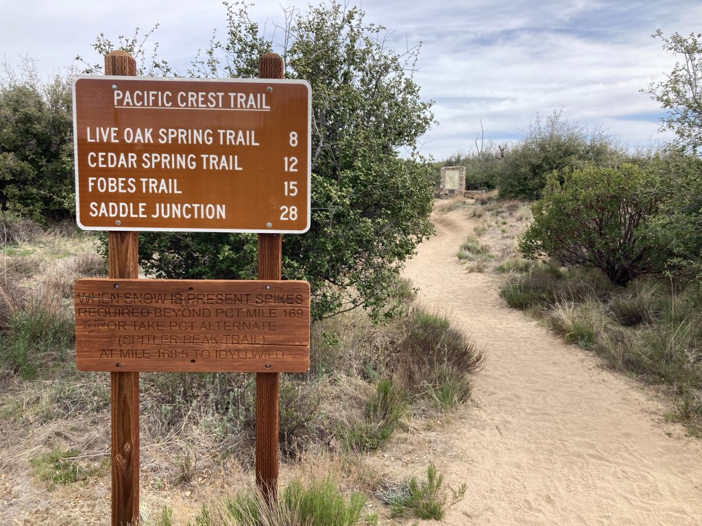
Lushness increased gradually as I climbed, then spiked as I crossed the final desert ridge. Below was a forested valley with the San Jacinto massif rising in granitey splendor on the other side. “We crossed a low saddle and the scenery changed instantly. Not only did San Jacinto come into view, but the change from desert to pine forest was profound.” A highway rushed across the land just down the hill, marking the edge of the unknown. The long ridge rising to the distant summit was sharp and didn’t look too inviting, but supposedly there was a trail up there. I’d gazed at it longingly in 2015, safe in the knowledge that it was off limits. Today, I felt the weight of the question mark hanging over my head.

Across the highway, I found a helpful water cache. Without it, I would have needed to walk or hitch a mile down the road to the Paradise Valley Cafe to fill my bottles. It was sacrilegious to skip this hiker haven in the first place, but I had a big nut to crack and was eager to get started. Besides, being vegan now, I doubted that the restaurant offered a worthy equivalent to the massive burrito I had before. Perhaps I should have given it a shot, but I refused to be disappointed. That the burrito score was now 2-0 in favor of 2015 did not go unnoticed.
After a short sit, I loaded up 6.5 liters of water and headed out. While there were flowing springs up ahead, they were all a significant distance off-trail, always requiring a big descent to access. Instead of adding bonus miles, I would attempt to carry all that I needed to reach the on-trail Tahquitz Creek tomorrow morning, 25 miles ahead. This was maybe a dumb plan. Maybe it was smart. Either way, it wasn’t an obvious choice, at least to me, so I bet on my legs. Without much food left to get me to Idyllwild tomorrow, my pack was light anyway.
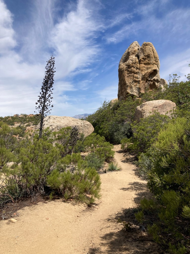
It didn’t take too long before I felt like I’d made the wrong choice. It was still only 10am, but I was already sweating buckets and had serious doubts that even this much water could get me to the creek. Contrary to my expectations, I wasn’t now instantly in a cool mountain forest. The desert was back, and had really never left, only this time it was slanted steeply uphill. It would be a while before this effort paid any dividends in the form of cooler altitudes.
So I sweated and sucked on jelly beans, grinding gradually higher. Slowly, the boulders disappeared and oaks crept into the squinting corners of the hills along with their glorious shade. Then pine. I stopped for a pack-on break to cool down and eat a bar. Boy howdy, this was a good one.
Flipping over the ridge, I was greeted by a breeze and views down into the deep desert where the tendrils of Palm Springs spread like a staph infection across the Coachella Valley. It was like looking at a painting, or a picture. Part of my reality, but just a snapshot. It wasn’t a world that I could interact with. It was too distant and may well have been two-dimensional, something to look at only.
Sweating further along, I made it to the altitude of oaks and stopped for lunch. With a rock for a backrest, I settled in for a long sit, considering that this was the first ‘normal’ lunch that I’d had in a while. It was nice to be free from the town bustle of Julian and Warner Springs, from the water hustle of the days before and after each. I sat and munched, remembering that I could just sit comfortably in the middle of the day for the heck of it. I was tired, so I stopped. Easy as that. Now that was freedom.

The day was much cooler two hours later when I stepped back onto the PCT. I wasn’t sure why, but I wasn’t complaining either. A stiff breeze was blowing above the oak level, which helped my sweat do its thing and gave me hope for my water choices. Reinvigorated, I charged up, feeling pulled forward instead of my previous apprehension.
Riding the spine higher to the north, a touch of danger started to mix with my enthusiasm, which had been growing along with the views. Aware of the wind’s multiplying factor, each chilling gust was physically destabilizing and mentally disquieting. Add moisture to this exposure as the forecast predicted, and this would be an intense place to be. But not yet, and I pushed those thoughts aside for now, in awe of the awesomeness of these SoCal mountains.
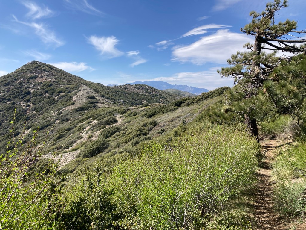
Much discussed is the danger of this section when snow is present. It is deadly, in fact. But I wasn’t worried about snow, which reportedly hadn’t been an issue for weeks. Instead, I was confused why no one was talking about how rugged and steep this trail was. I was working hard and going slow. This was a major jump in difficulty, with grades so steep that they were neither healthy nor fun. It was awesome and spectacular, but I grumbled on, both relishing and hating the challenge.

I burned all the juice in my legs on the first big push and dropped into slow gear for the second. Grimacing, I lurched upward above 7000ft, excited to call it a day at a camp spot on the shoulder of Apache Peak, amused that I was running on empty. I hadn’t known how easy I had it in 2015, roadwalking to Idyllwild through that nice valley far below. Now, ten years later, I was finally getting a clue.
The tempest raged over the stunted bushes where I planned to stop. Damn. It was 7pm and I just wanted to get warm. But knowing that it would be foolish to force the issue here, I threw on my wind jacket and aimed for the next spot in 1.6 miles.
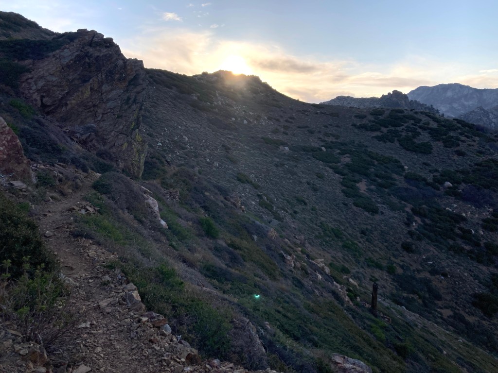
Fortunately, it was mostly down and flat to get there, so I was able to pick up the pace. The ruggedness again surprised me as the trail wiggled down and around the ridge, cutting through cliff bands on narrow tracks. This was no joke, even when dry. I couldn’t imagine hiking through this with snow covering these traverses, so I was grateful now that I could move with haste, reaching camp at 7:30pm.

There was a fart on the breeze when I walked up, and the single resident owned up to it when he noticed me with a big smile shining from a bushy beard. The wind was still relentless here, but it was caught in the bush tops, and I managed to tuck in, finding a mostly sheltered place to unroll camp. I warmed up quickly out of the blow, and ate frantically as it gusted overhead. Lying down, my legs radiated ache, from hips to calves. On paper and perception, this had been the hardest day of this trip by far, and I was feeling it. How would I feel tomorrow? Did I have enough of my water left to avoid a headache? Would it rain tomorrow? I’d answered some questions by hiking up this previously mysterious trail, but there were more on my mind now. One thing was certain, however, I was ready for a rest in town. The desert yesterday. Mountains today. Town tomorrow. All I needed to do was survive the night, and that rest would be mine.
