
10/13/22
L2H Day 1
Badwater to Hanaupah Canyon
Lowest to Sunset Ridge Camp
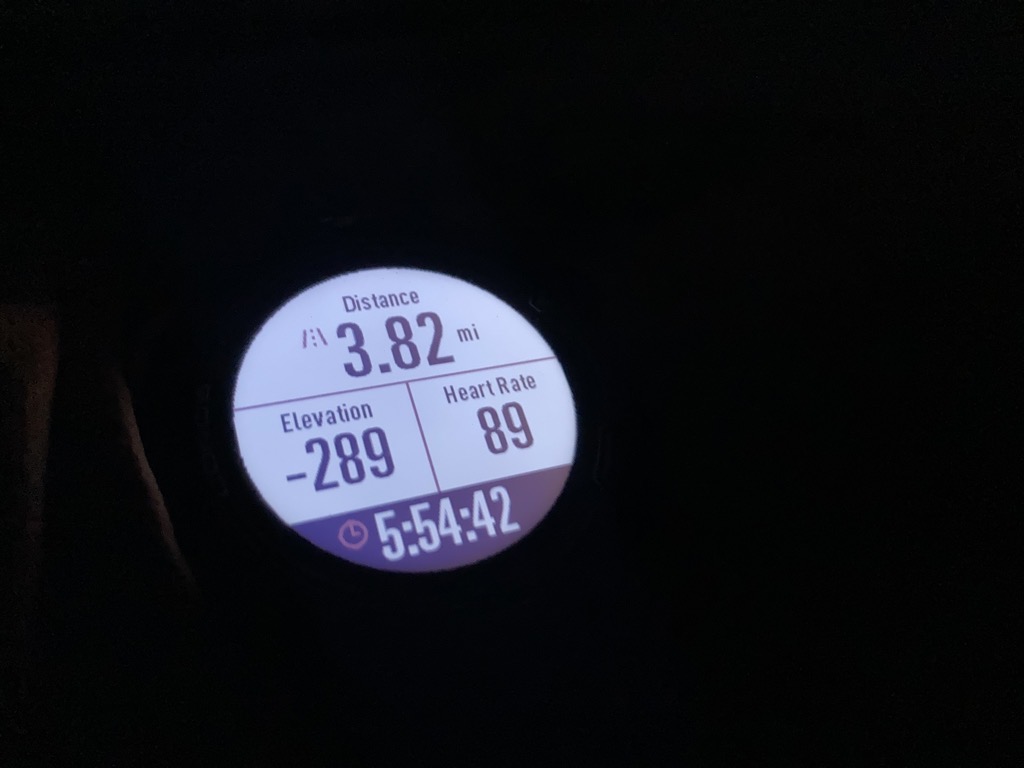
L2H miles: 17.18
Elevation change: 5325ft gain, 75ft loss
So little had changed. Could a mere three hours really serve as the delineator between one day and the next? Could I really call this darkness ‘tomorrow’, or was it still ‘tonight’? The good news was that it didn’t matter. I’d slept a little bit, pretty well, in fact. I felt rested, excited, and even alert, as if while I slept my body had dosed out occasional drips of adrenalin. Arthur theorized that he hadn’t slept at all, and I almost believed him. I was amazed that I had maybe slept, and was grateful for even my paltry three hours. It would have to be enough. There was a long, hot day ahead of us. The goal was simple: survive. If we pulled that off, then it was virtually guaranteed that we’d make it to Hanaupah Spring and find it flowing. Everything beyond that was bonus.
By the warm red of our headlamps and the cool white moon, we packed up our sleeping gear and loaded it into the trunk. I crunched across the gravel and filled up our bottles one final time from the campground spigot. The high-pressure spray sounded like a jet taking off, rapidly filling the bottles with warm froth and spraying my knees. I took a swig of the tepid water. Actually, it was a step warmer than tepid, and certainly warmer than the balmy night air. This is a strange strange place. What are we doing here?
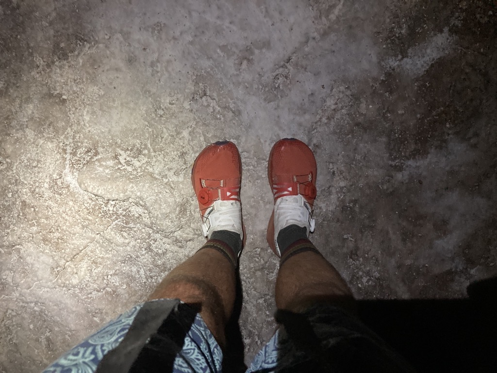
I braided my hair for the first time since touching Cap Gaspé in Quebec in July as Arthur navigated our rental steed along the deserted Badwater Road. As I tugged a comb through my knots, I let the ritual resurrect the hiker within me. The one with a sharpened focus on food, water, miles, navigation, and blisters. My fingers were out of practice, fumbling to keep the bundles of hair even, and I hoped that my feet remembered their dexterity better than my hands. The car radio remarkably still pumped quiet rock n roll, and blank desert sped by in our limited beam of headlights.
The 30-minute drive gave us just enough time to review our plan and convince ourselves that we were not crazy, and that everything was going to go great. We both really did feel like we were doing it right, but it was also true that neither of us really knew what to expect. Reading blogs and trip reports is one thing. Doing it ourselves, quite another.
There was one other car parked at the Badwater trailhead when we pulled in. Someone else doing L2H? Other than that, Arthur and I were utterly alone. At 282ft below sea level, Badwater is the lowest point of dry land in the Western Hemisphere, or at least it was until they found some place in Argentina. Still, it was the lowest point in North America. As one might expect, it is a weird place. Gritty with salt and dust. Expansive and open with heavy air. The wide basin was empty, but it was also full, pregnant with darkness and the unknown.
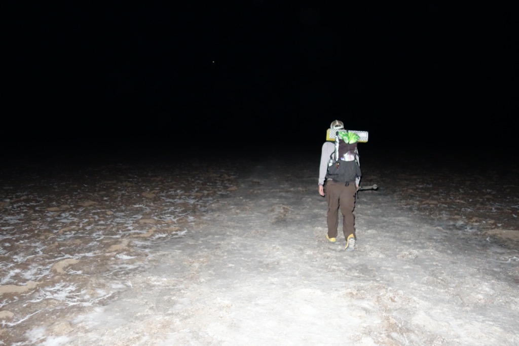
Juiced and ready to go, we sprang into action, putting the finishing touches on our packs and tightening our shoes. Full of bubbling nerves, I pretended to stretch while scarfing down the two burritos that the warm desert air had thawed in the night. It had taken a lot of stress and effort to get to this point, perched on the edge of a cliff, but standing here was the worst feeling yet. The anticipation burned in my belly, ready to evaporate once we took our first confident steps. At a quarter past four, we hoisted our packs, patted the corolla goodbye, and crunched down the salty steps to the boardwalk below. We took the obligatory photos in front of the Badwater sign, then pointed west and began walking to face whatever doom awaited us.

The million steps of previous visitors had pounded the sharp crusts of salt into a smooth sidewalk of white dust that crunched quietly with each footfall. It gleamed in the moonlight, which was so bright that Arthur and I hiked by the white glow alone. The air was cooler here than it had been at camp, but it was still warm enough that my brow soon dampened despite the easy pace. I stopped to swipe a finger on a slick patch of salt. It was moist and dry at the same time. It tasted like salt when I touched it to my tongue. No surprises there.
After about a mile, the smooth surface terminated, marking where the spirit of adventure of those thousands of visitors often dried up, soaked in by the thirsty earth, or evaporated into a sweltering sky. I’d been to this point before and understood the pull to turn around here. Even in the relatively cool darkness, it was clear that humans weren’t supposed to linger in this place or stray too much further from the safety of the road. The dim silhouette of the mountains ahead looked no closer, but the cliffs behind us looked much further away. The scale of this land was beyond comprehension, and it was going to be a long time before it felt like we were any closer to our destination.
We powered ahead, cognizant of the need to keep moving with reasonable quickness if we wanted a hope of making it across the salt playa before sunrise. Automatically, my feet, ankles, and legs rotated and bent to smooth out the rough ground. The salt was no longer smooth and white. It was a jagged mess of sharp ridges and peeling plates painted a sinister brown-gray, wickedly irregular and rock-solid. There was no path anymore, just a distinct dip in the dark ridge on the horizon to aim for. Arthur and I hiked side-by-side, focused intently on each step, sometimes stepping on the raised edges, other times hopping to the crusty flats nestled between. It was engaging work, enhanced by the thrill of danger. A trip here, and the ground would slice us up while simultaneously rubbing salt in the wound. Careful speed.
The ground smoothed, then recrusted as the miles ticked by. It was so damn interesting and otherworldly, and both of us struggled to process that we were actually out here, doing it. This trip was over a decade in the making, and it was hard to pry it free from ‘dream’ to place it in ‘reality’. The nerves were gone. Now I was just excited and grateful to be out here.
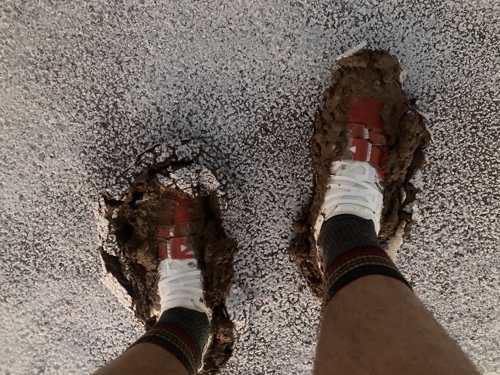
Still, the distant mountains came no closer. Ahead, I was relieved to see a sliver of bright white, indicating that we were approaching a friendly flat patch amidst this sea of tortured ground. It was also comforting to see two pairs of footprints tracking across the pristine canvas. However, as we came to find, the footprints were only there because of the mud. Somehow, in a place so hot and so dry, there was ooey gooey sticky mud. It sucked at our shoes as we broke through the thin crust of crystals. With each sucking step, the white surface bulged and cracked, revealing the dark brown mud below. It reminded me of molasses cookies, dusted in powdered sugar, and almost looked good enough to eat. But there was danger in stopping to consider it. This was the stickiest of muds, and gobbled up Arthur’s shoe after he stopped for a moment too long. We fished it out, careful not to fall to our hands for fear that it might be difficult to return to our feet.
It wasn’t long before we wished for the razor jags of the crusty salt. Pumping through this sticky stuff was hard and treacherous work. Our shoes were heavy with goop and our balance precarious as we squelched forward, always searching for the firmest patch. The footprints that we followed were helpful in indicating how deep we should expect to sink, but ultimately, we diverged from them to hop between small dark islands of hard salt, constantly amazed by the strangeness of it all.
Around 6am, the sky began to brighten, sprinkling the approaching sunlight onto the mountains ahead. With a little more definition and texture, they looked pleasingly close, though still quite far away. A look at the GPS indicated that we had pulled a little left of the straightest route, but that we were right where we expected to be mileage-wise. Ahead we could see maybe one more pristine flat of salt-covered glop, but then it was all crust to a line of green bushes that marked the edge of the basin. We were almost across.
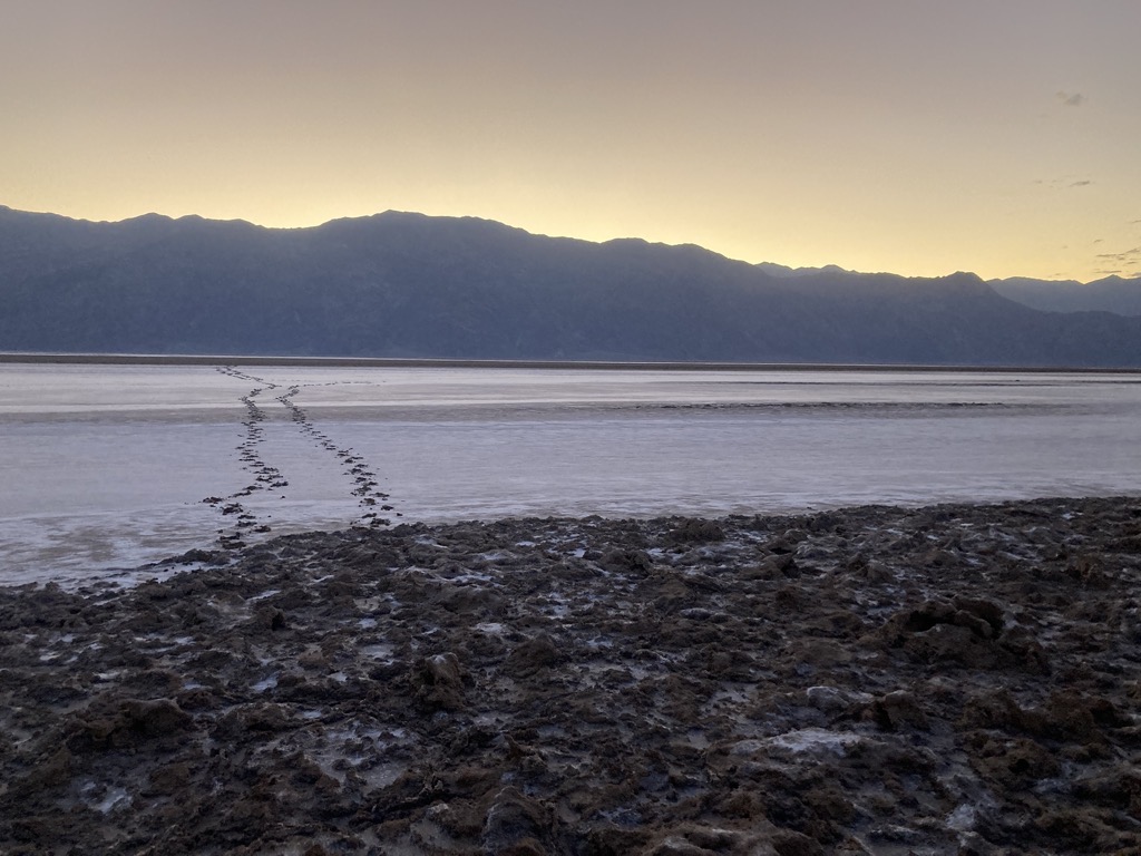
With a glowing horizon behind us and enough light for our cameras, we were finally able to see the context that we had so far mostly felt. No doubt, the mountains where we had started looked very far away now, and our fresh tracks looked epic and surreal emerging from the emptiness in between. The dark splotches were hardly LNT, Arthur joked, which made me wonder how long they might last. A week at least, but a month? Who knows?
The mood was jovial as we drank deep from our heavy loads of water. Even though I’d started with an exorbitant 6.5 liters, my survival instincts were reluctant to consume with impunity, and I needed to force myself to catch up. I was taking hydration very seriously on this trip, and that meant drinking before I got thirsty. I guzzled some gulps from my bottle of cola electrolytes. It was a weird flavor at this time of the day, but not a bad one and I was relying on the steady microdosing of caffeine to get me to bedtime.

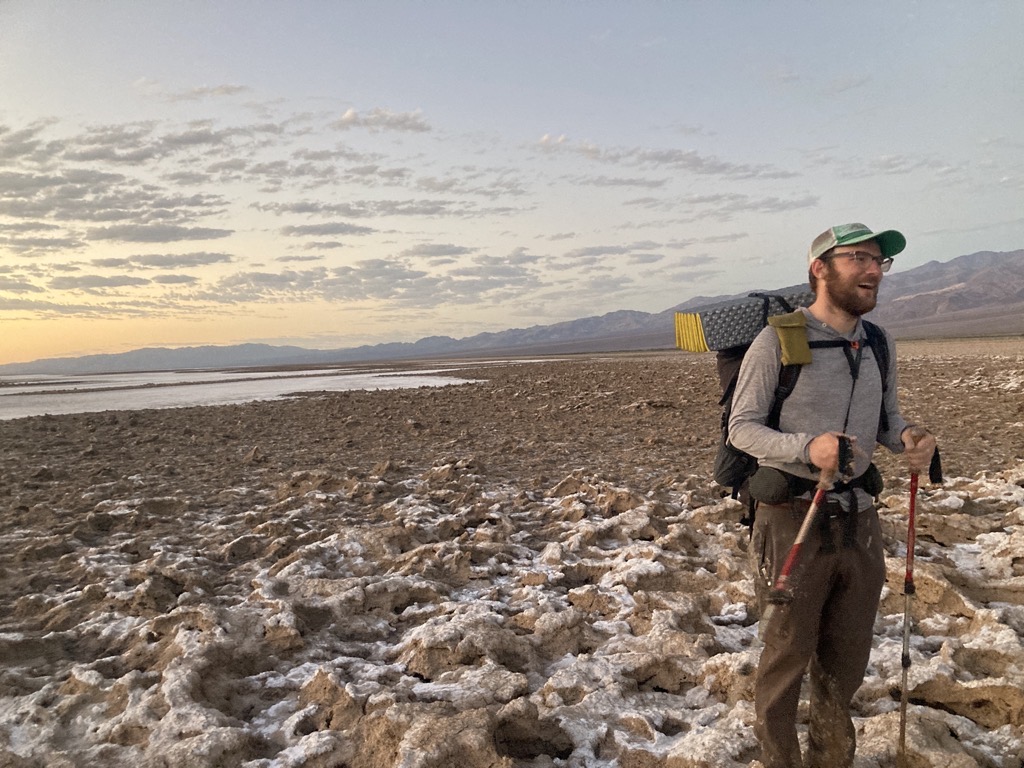
We finally stepped onto solid ground for the final time just as Telescope Peak caught the first pink rays of alpenglow. I stomped my feet and clacked my poles to shake loose some mud, but most of it clung tight. This was the good stuff. Gradually the bubbling blisters of salt crust gave way to brown-green shrubs, then to large, gum-drop-like bushes. Then there was no more salt at all, just gravel and sand, washed here from the mountains by eons of rain and wind. I stopped to dig a cat hole in the soft ground, my lowest poop of all time, then caught up with Arthur who waited at the gravel West End Road, which officially marked the end of phase one. We were across Badwater Basin before sunrise. So far so good.
Finally off the muddy, salty playa and onto crusty shrubs. Hard to understand how anything green exists here. 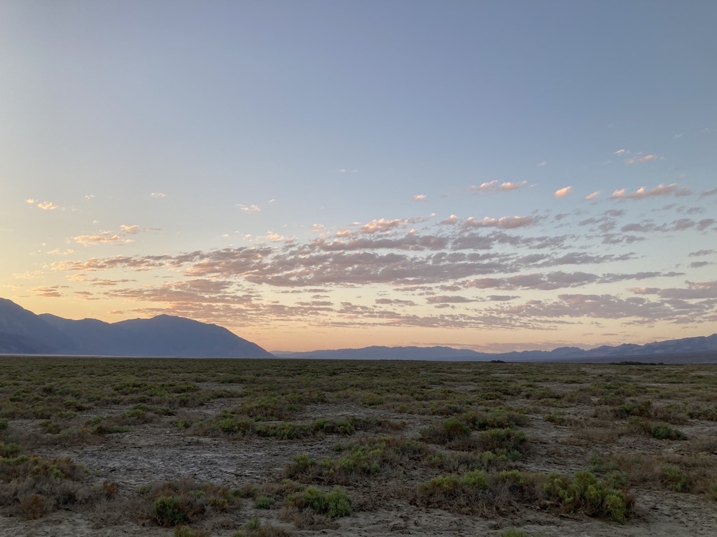
Sunrise and shrubs. 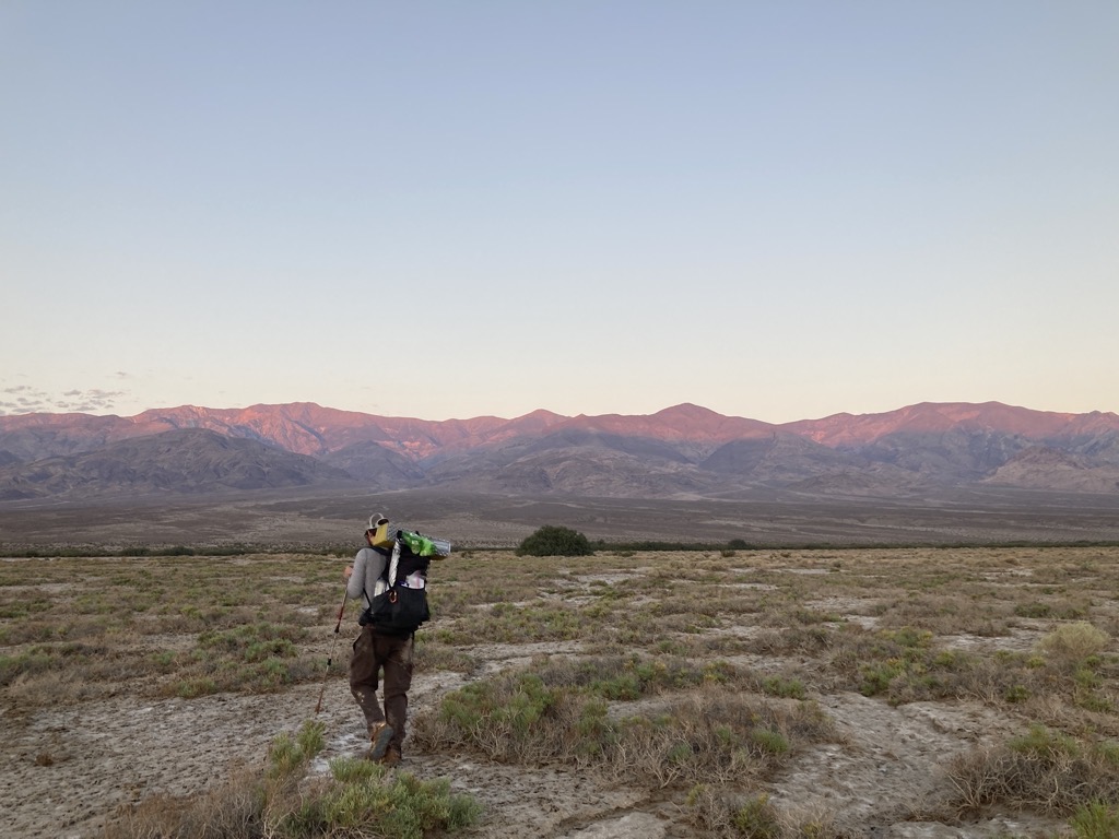
Alpenglow on Telescope Peak. Hot stuff coming our way. 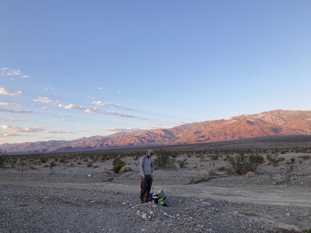
Pack off at West End Road for maybe our last shady break for a very long time. We’re pleased with our progress. Right on schedule. 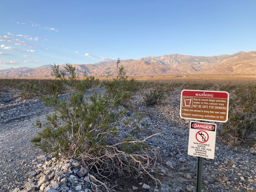
A bunch of marijuana grows hidden in the hills have maybe left the groundwater laced with nasty stuff. Unfortunately, we don’t have a choice. Poisonous or not, we’re drinking it.
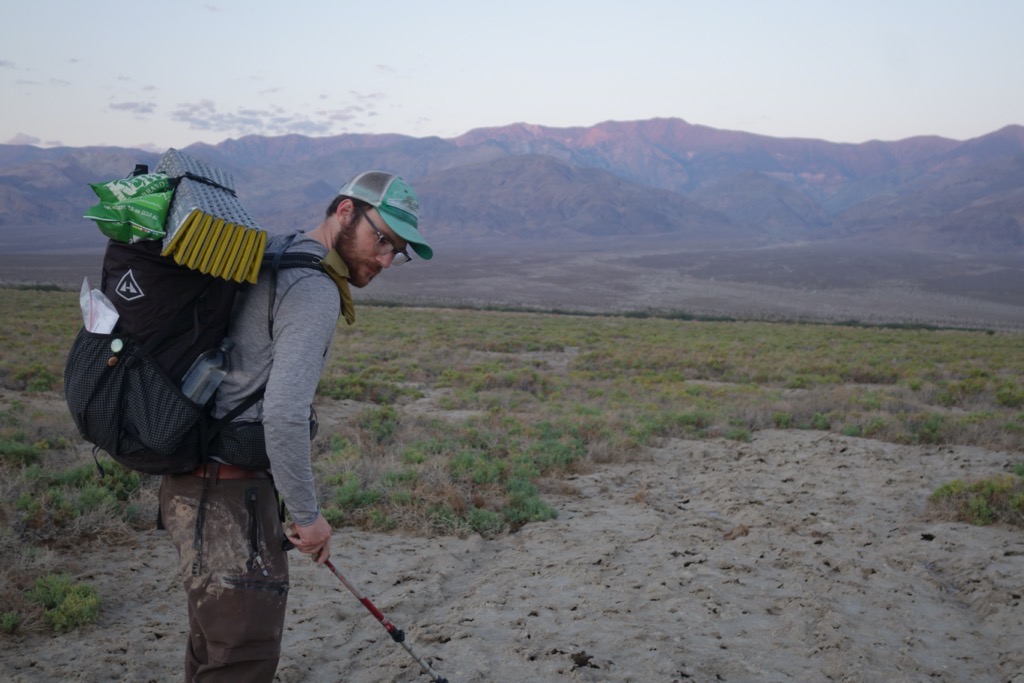
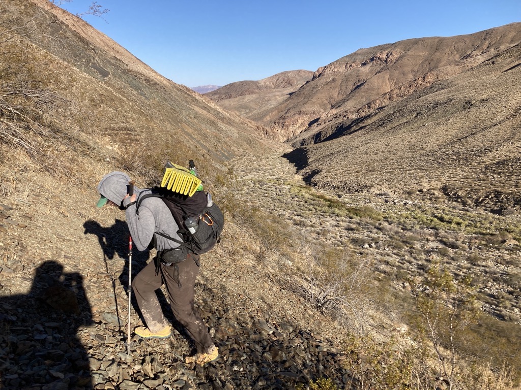
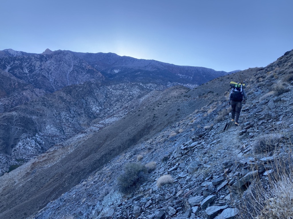
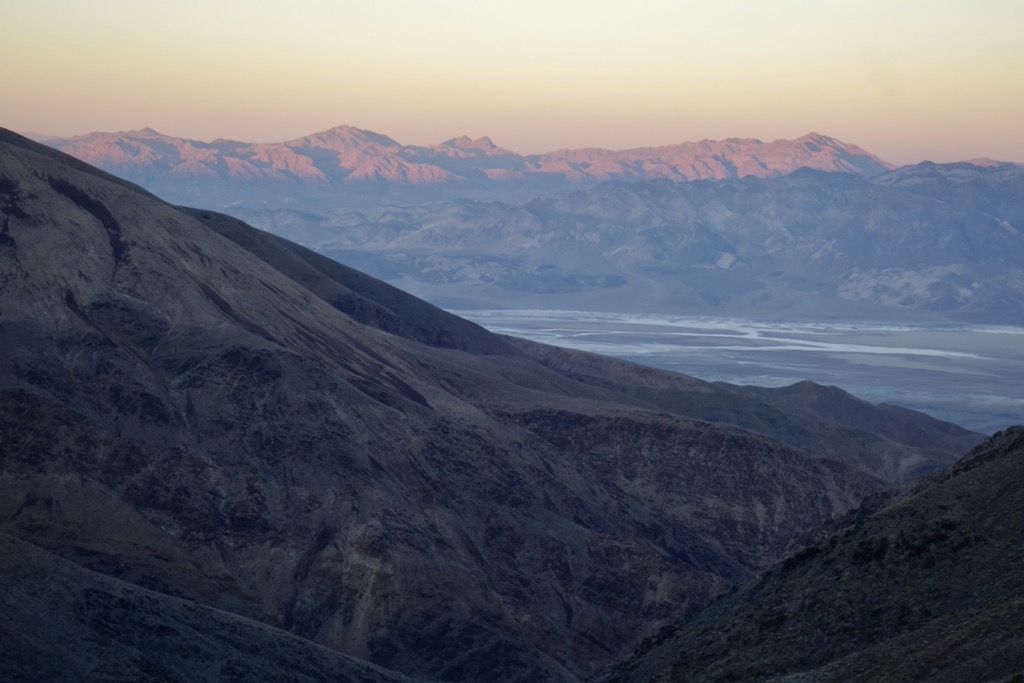
The sunlight poured down the peaks ahead as we crunched along West End, then turned left onto Hanaupah Canyon Road. It was almost impossible to believe that it was eight miles from here to the base of the Panamint Mountains, where we might finally find some shade, but there was nothing to provide a sense of scale out here to indicate otherwise. It didn’t matter anyway. We needed to walk there no matter how far it was. It was also humbling to acknowledge that it was literally all uphill from here for the rest of the day and half of tomorrow. What’s more, it was steep uphill, over 10,000ft of gain in 15 miles. Time to sweat.
The road would have been hell to drive, but it was good for walking. We made great time along the meandering path as it wiggled up the tremendous alluvial fan, rising deceptively high above Badwater below. When we hit the sun, we stopped to smear on sunscreen and ready our supply of Jolly Ranchers. The rays burned hot. Even though we’d been churning uphill, we were only just above sea level now. It was going to be very hot here very soon. Heck, it was already very hot here. We needed to gain some altitude.

Eventually, we had the good sense to pull out our reflective umbrellas. The relief was immediate and immense. Though the air would eventually heat up, it was really the intense sun that scorched us, and the self-created shade was a game-changer. That said, I was soon dripping sweat and purposefully regulating my pace to keep my heart rate down. I felt it flutter higher a few times — nothing a water break couldn’t set straight.
Hours later, we dropped into a wide wash where it exited Hanaupah Canyon. After crossing it, we found something glorious, dropping our packs to hunker in the shade of a tall cliff of crumbly conglomerate. It was still just 10:20am, so the air was cool at this elevation, and a light breeze quickly chilled my damp back. With no plan other than to relax and cool down, we threw down our foam pads and popped off our shoes.

Hours later again, we were still there. With just five miles left to go on the day, there was no rush, so we had successfully transitioned our snack break into a lunch break, then tacked on another snack break for good measure. The temperature was perfect, and we watched the world roast in comfort. Eventually, questions about Hanaupah Spring got the better of us. Even though there was no need time-wise, curiosity got the better of us, and we packed up to get moving.
Unsurprisingly, it was hotter now, but the narrowing canyon threw us some patches of shade from time to time where we could stand around for a few minutes to cool down. Stepping into the dark coolness, I’d flip my umbrella upside down and toss my hat onto a bush, half-expecting Arthur to say that there was steam billowing from my crown. The relief was instant and lasting, along with the superb tang of Jolly Ranchers and electrolytes. Setting out again, the heat would rise with the steepening slopes around us.

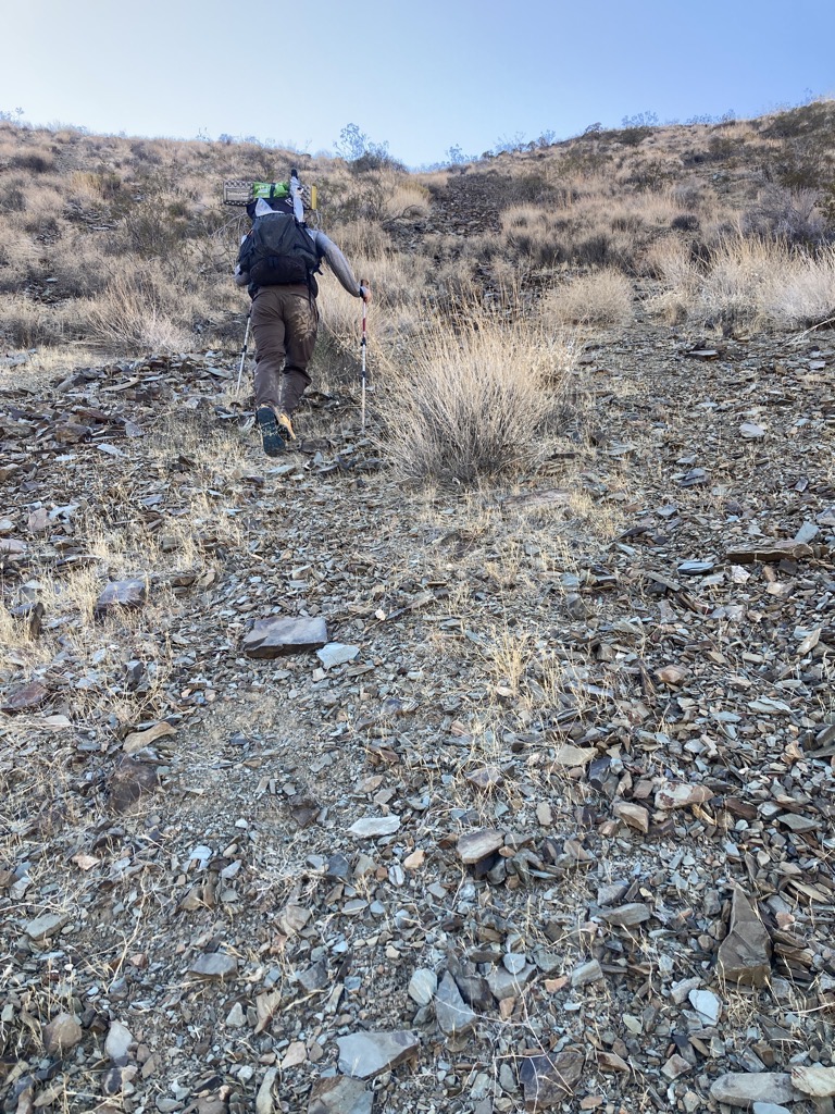
The road eventually petered out, but navigating up the wash remained easy, and soon we were kicking through a lush clutch of tall reeds and mesquite in search of Hanaupah Spring. We heard the water, and then Arthur found it. It flowed strong and clear, a sight to behold in this environment. We dropped our packs in a thin sliver of shade next to the water and settled in for yet another break. With dunked hat and shirt, there was nothing else I wanted. We’d made it. Survival was assured.
Two hours later, at 4pm, we’d washed the mud from our shoes and filtered several gallons of water. It was hard to leave this oasis, the yellow flowers and buzzing bees, but it seemed imperative that we cut into the remaining 6,000ft of climbing that lay ahead in order to make tomorrow’s miles a less intimidating proposition. In just half a mile, we’d be up 1,500ft in cooler air, with better views. Now that we knew that we wouldn’t die of dehydration in Death Valley, it was time to worry about tomorrow.

Arthur and I had been in agreement on everything so far, so we shouldered our heavy loads for the final push of the day. I carried close to nine liters of water, he had ten. Hopefully, this was enough to get us to our first cache by tomorrow evening.
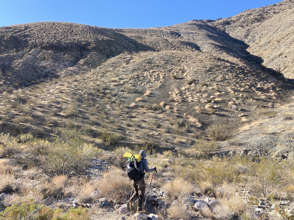
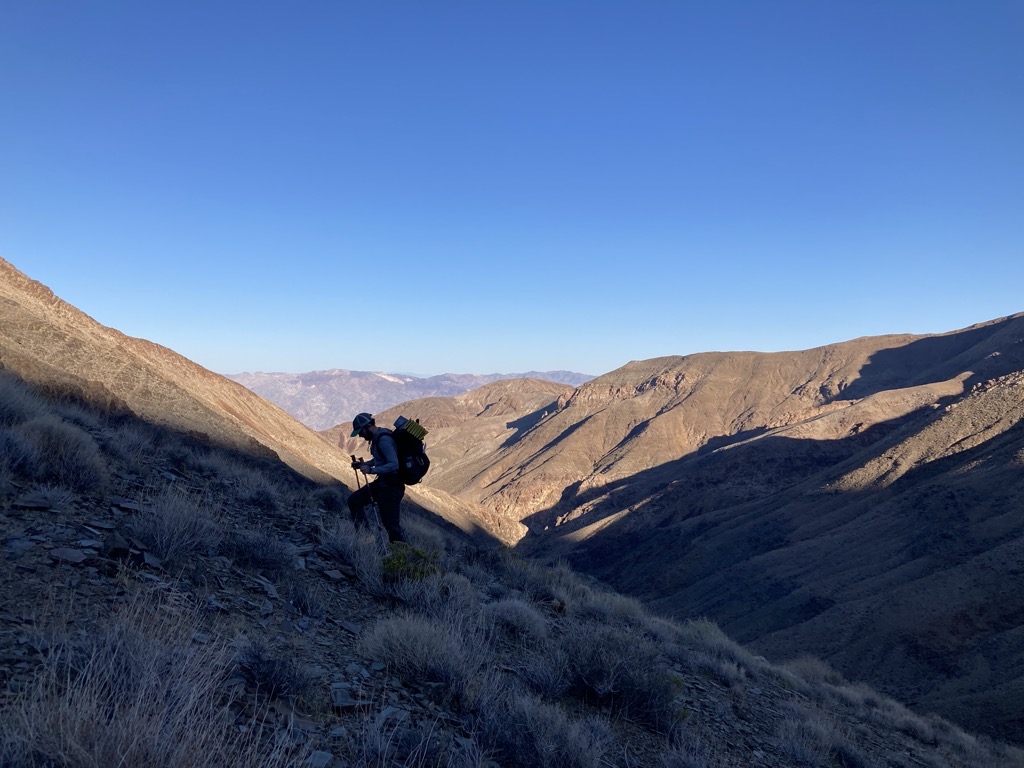
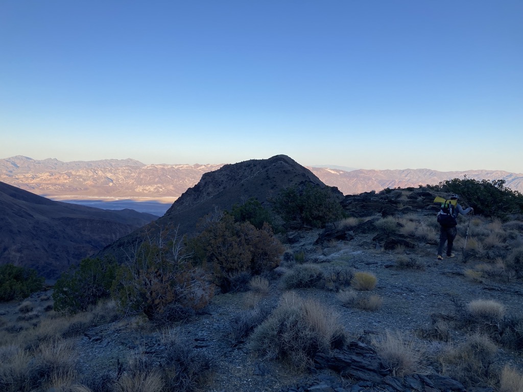
Up we went, turning right up the canyon wall. Without a track to follow, we made our own way up the crumbly slope, weaving around bushes in search of the most gradual grade. With heavy loads and nothing but time, we took it easy, and I stopped frequently to watch Arthur’s progress and to appreciate our progress as the views expanded in width and depth. The steepness was truly horrendous, but we didn’t have far to go, and the world was so beautiful. And that we were finally hiking the L2H had yet to get old. I think that both of us were still in blissful awe that we were out here doing this crazy thing, and that it was going well.
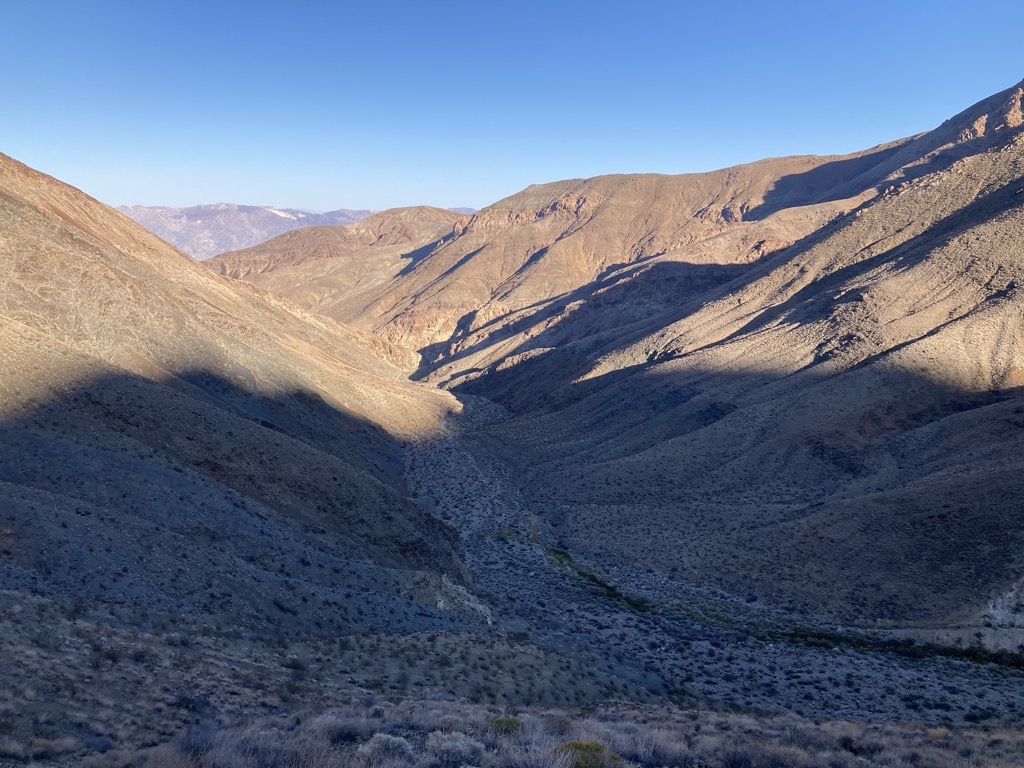
The sun dipped behind the ridge, gifting us shade as the shadows hunkered in other folds of the earth began to lunge and stretch across the land. There was always something to ogle when I needed an excuse to catch my breath. The distant ridges still bathed in baking sunshine, the outrageous colors of the varied rock across Hanaupah, the soaring Telescope Peak high above dotted with pine stubble, the purple shale and dusty cacti at my feet.
Finding our own light tracks on the rounding shoulder of the mountain, Arthur and I came together where they merged below an unnamed prominence on the ridge above. From there, I followed him on the narrow trail as it traversed a steep crumble to the next saddle. There, the hard work was done and we were both ready to call it a day. On little to no sleep, we’d crushed it and were very much deserving of a long rest.

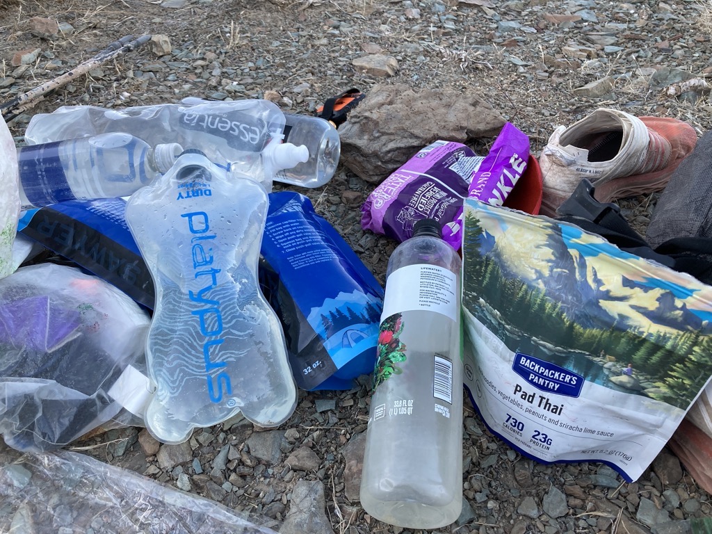
We stumbled around searching for a place to camp, confused by the abundance of almost-flat spots, our minds finally giving into the fatigue just a few minutes too early. Finally, Arthur checked behind a bushy piñon pine and found what we were looking for. We crinkled out the groundsheet and flopped to the dirt. Thirty minutes later, our beans were soaking and the last pink of daylight was lifting from the ridge on the other side of Badwater.
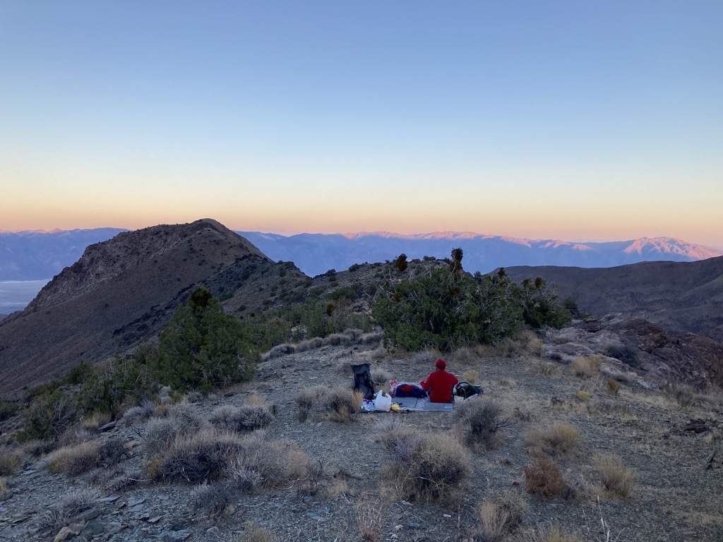
Our ridge blocked the view of our car, but we could almost see it, and it was far away. Satisfyingly distant. It was hard to believe that we were here, but here we were. The calm air hummed with silence. I felt a chill on my cheek. How strange to be wearing my puffy within sight of the hottest place on earth. Then, once I let it, sleep took me instantly after one last amused glance at my bounty of water. Good night, dude.

Nice post. I hate Jolly Ranchers (the candy).
LikeLike
Kia Ora, Owen, Thank you for such a lyrical description of your first day on the L2H. I am in awe of your resilience and determination. Loved the pictures and description of the scenery and especially the gloop. I look forward to following you on this trail. Kia Kaha, Vicky
LikeLike