
10/14/22
L2H Day 2
Hanapau Canyon to Panamint Valley
Sunset Ridge Camp to Second Valley Camp
L2H miles: 19.37
L2H total: 36.6
Elevation change: 5194ft gain, 7730ft loss
Finally, no alarm to prod me awake. After two abrupt nights and two tough days, I needed all the rest that I could get. Arthur and I both did. And we got it. Perched above 4,500ft, poised to climb higher, there was no need for an early start to beat the heat, so we let our bodies decide when to get moving. It was almost 7am by the time we rustled to life, and the sky was already bright with dawn’s glow, a dusty ombré that only exists in the dry warmth of a distant desert horizon. Orange to purple to gray to cerulean to black. Even when the burning sun crested the distant ridgeline, I could imagine the night sky above me, almost see the stars. For a few moments, night and day existed as one, a changing of the guard with a solid fist bump from one to the other. Then the glow still glowed, but less so, and the night was gone. The day had begun.
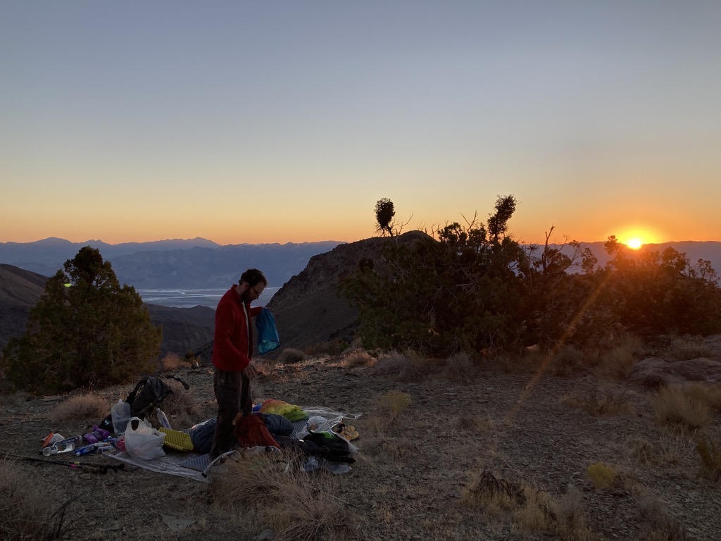

I’d drunk a liter of water and peed twice in the night, but had still been gifted a ripping headache to overshadow any and all other physical discomforts that might arise during the day. Lucky me. I didn’t get it, but accepted my fate. Perhaps I shouldn’t have ended the day with electrolytes? Too much salt in my system? Well, I’d flush it out today. I had a lot of water to carry, and so a lot of water to drink. Arthur and I ate our breakfast cookies and gulped some water. My stomach felt a little weird too, but that was no surprise, and it would work itself out. Time to get going.
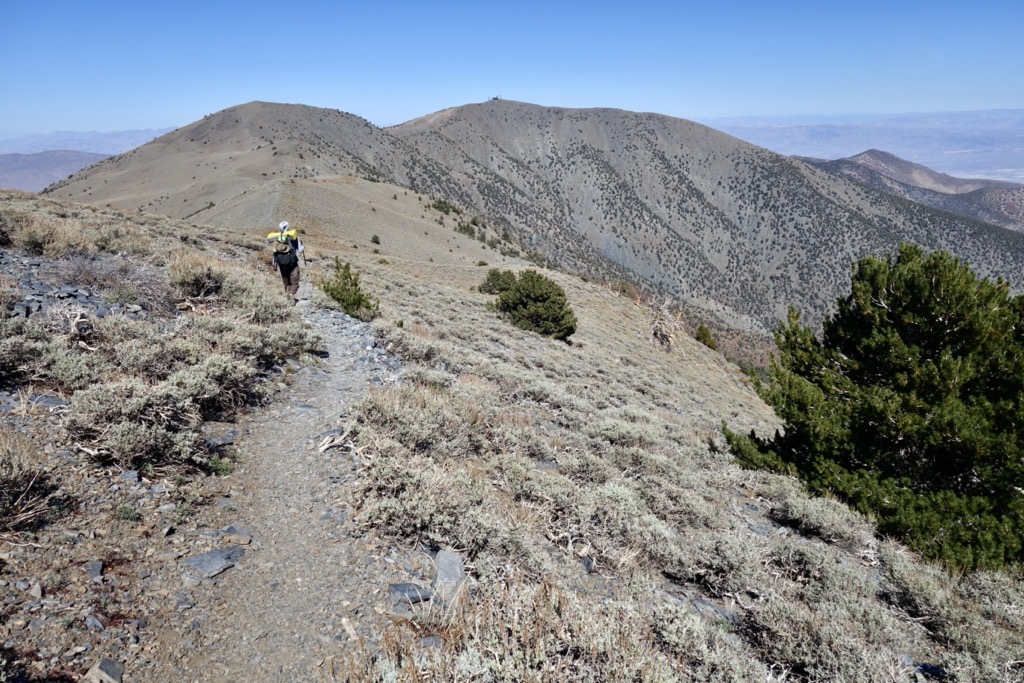
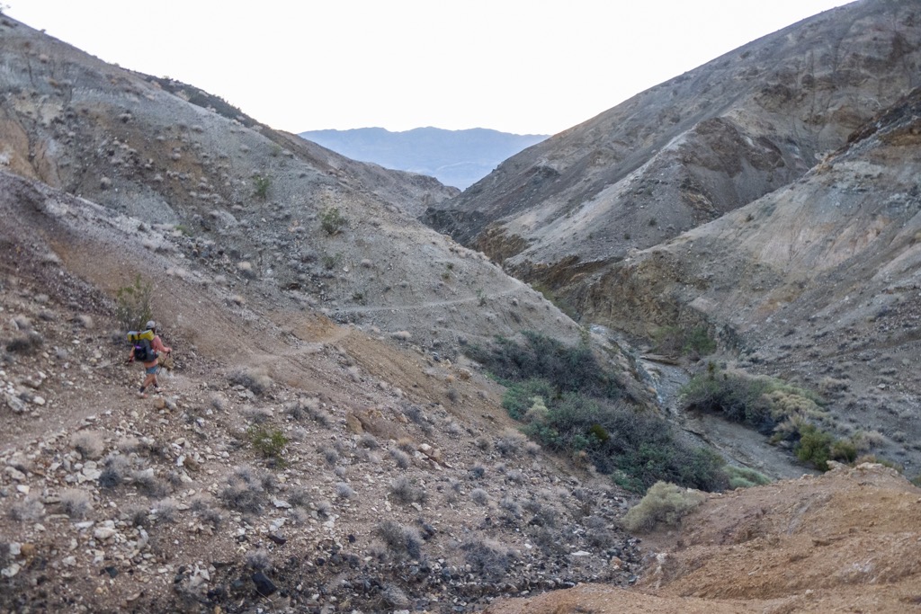
At 7:40am, the brothers rolled out to answer the next big question of the L2H: could we handle this climb? Aside from merely staying alive yesterday, pre-hike I’d been most concerned with the off-trail grind from Hanaupah Spring to the crest of the Panamint Range. The numbers were eye-popping, 6,500ft up in 4.5 miles with some ridiculous amount of water on our backs. We’d managed a good chunk of it yesterday evening, but were still looking at 5,000ft in 4 miles. The six liters of water in my pack weighed me down, but would it be enough to get me to our first water cache 19 miles further? It had to be. There was no other option.

Off-trail or not, our route was obvious. All we needed to do was follow this ridge up (and up) until we reached a trail. It looked like a lot from where we were, but at least our task was simple. The dotted piñon on Telescope Peak were the only clue of the true distance to the top, but if we’d learned anything yesterday, it was that we were ill-equipped to estimate anything out here. Trying was a sure way to be humbled.
Almost immediately, we rediscovered the use-trail that we’d followed yesterday, and began side-hilling around the next lump on the ridge. Hanaupah Canyon to our left held an immense volume of air, and each look across it at the folded mosaic of earth tones four miles distant was a reminder of how small we were. Each glance at our goal in front of us, remaining stubbornly distant, reminded me of how slow we were. Yet on we hiked, making steady progress, not pushing too hard. It was reassuring to know that we’d expected to crawl up this mountain. Speed didn’t matter this morning, only that we made it in good health. My headache was still present, but a steady drip of caffeine had dulled its edge, and I could confidently say that I was on the mend.

Not exactly super speed, but hey, look how far we’ve come. 
We remembered seeing a picture of this old L2H ‘sign’ on a different blog about this route. Surreal to see it in person. 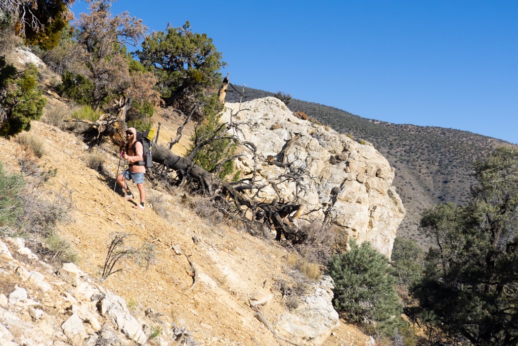
Steep happens. Photo cred: aeigenbrot 
A long way up and a long way to go. 
Arthur checks our progress on the GPS during a break among the piñon.
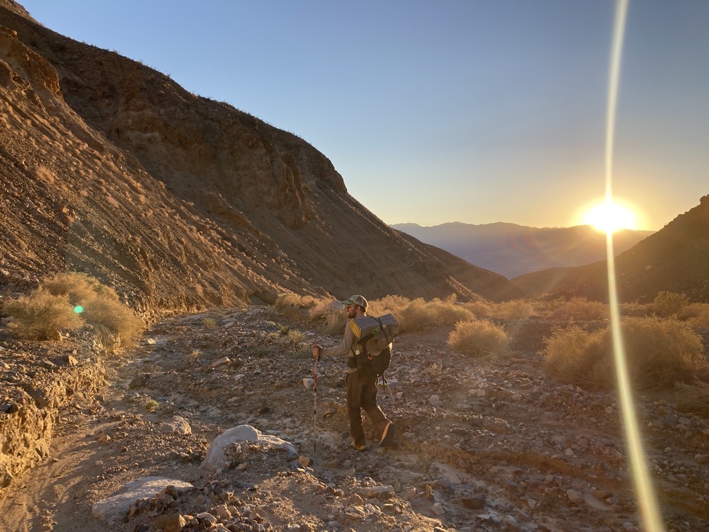
The air was still cool-ish, and soon we had the shade of a loose piñon forest to cut the intense sunshine. Grateful for the light track to follow through the trees, we climbed higher, frequently stopping to cool the jets and admire the ever-expanding views. Badwater was now visible, looking far away, but not as far as we knew it to be. Additional layers of horizon extended much farther still, deep into Nevada, perhaps even beyond. I panted as we climbed higher into thinning air, and my hat became soaked with sweat, but I was happy. The ‘doing of the thing’ was proving easier than ‘the thinking of the thing’. Instead of focusing on what could go wrong, all I thought about now was what was going right and all the beauty that made the effort worth it. The hiking was hard, but these were good moments.
A few hours and miles into the day, we finally reached what we had called from below the ‘Triangle Face’. It was the last obstacle before the top, and judging by the topo map, it was the steepest stretch of the entire L2H. We danced around the base, pushing through a dense thicket of shattered trees and sharp bushes, setting up for the best route to the top. The comforting scent of sage filled my nose, overflowing in my brain to wash out my other senses for an instant. The smell was my favorite — singular and comforting. The smell was home, and represented everything that I’d missed this year while wandering through the Appalachian Mountains. It was cleansing and potent, like a cough drop for the mind, leaving a cool sense of clarity gifted by the dry air of western sage-land. This route is freaking awesome. I was so glad to be where I was.
The final scramble took us well over an hour to travel less than a mile. Arthur and I each took our own paths up, around, and through a mixture of steep scree and unstable talus. I tried to stay close to the bushes that held firm the ground, but inevitably found myself sliding backwards when soil and stone broke loose under the weight of my lunges. When this happened, I relied on my poles to keep me attached to the earth, resting heavily on their points, driving them deeper to feel safer. Yet slowly and surely, we made it to the top. Unexpectedly, after a slow-motion sprint up a patch of loose gravel, I was on a smooth trail next to Arthur. I’d thought we needed to make it all the way to the ridge, but I wasn’t complaining. This was far enough for me. We high-fived. This felt good. 10,000ft below us, there was Badwater, where it all began. After a day and a half, it was time for some downhill. We’d earned it.

Kicking through shrubs at the base of what we dubbed the Triangle Face. 
Arthur fights gravity up the loose talus/scree near the top of the Triangle Face. 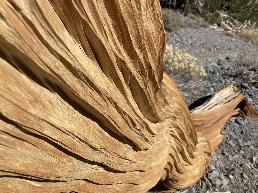
Hey, sometimes it’s nice to take pictures of wood when I need to catch my breath. 
Niiiice, made it to the trail. Arthur surveys the entire route so far.
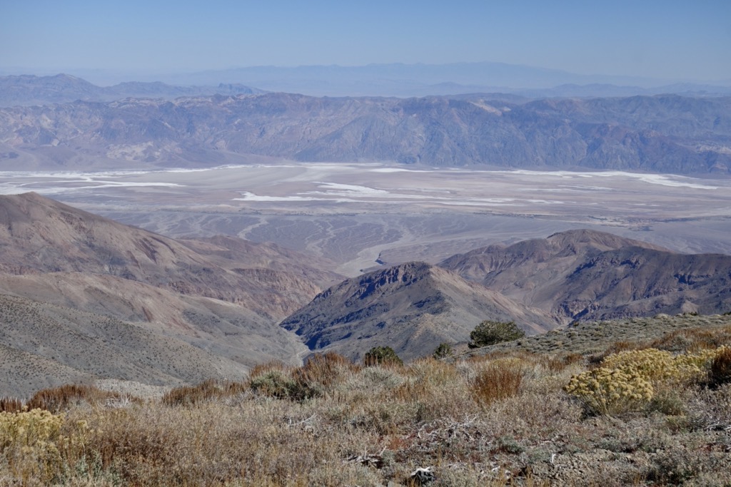
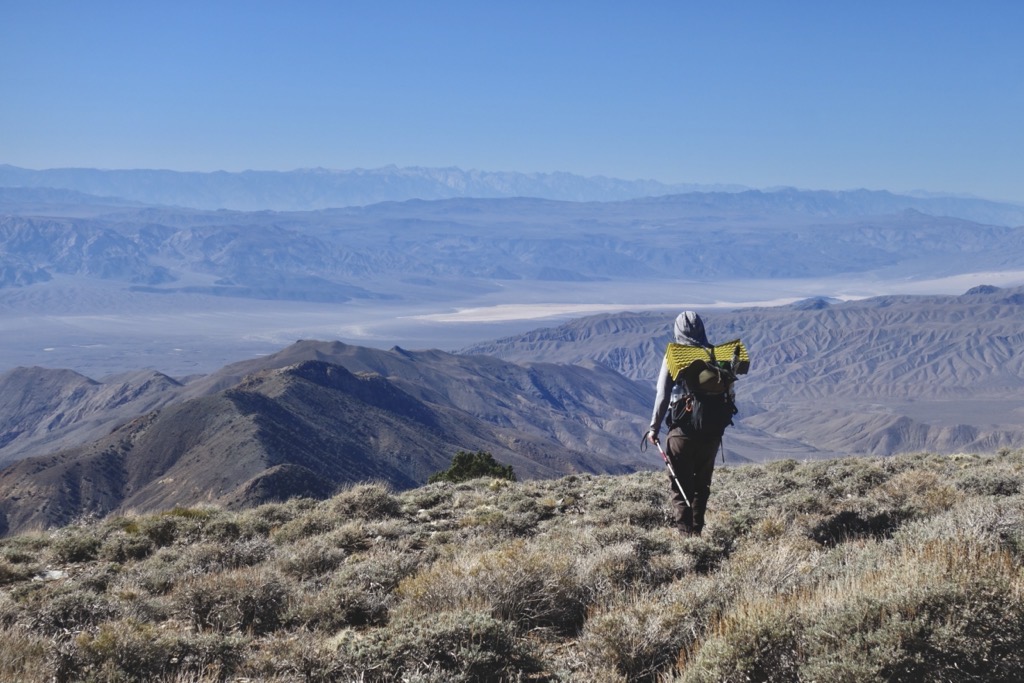
We left Caleb, another hiker who’d surprised us near the top, to wait for his partner, and flew down the buffed trail. The air was thin, but it was easy cruising, mimicking the best elements of ridgewalking from the CDT. The trail emerged on the crest of a wide, shrubby ridge, absolutely surrounded by air. Views in all directions were superb. Epic trail ahead, the intimidating summit of Telescope Peak behind, Death Valley to the right, and best of all, the highest of the High Sierra scratching the sky from across the Panamint and Owens Valley. The bright granite gleamed in the sunshine and I couldn’t wait to walk among it. Lowest and highest, both visible with just a turn of the head.


Arthur found a place to hunker out of the breeze next to a gnarled juniper tree where we celebrated our good fortune and honored our stoke with a satisfying lunch break. Noming down and crunching numbers revealed that my appetite was back, and that it took us five hours to move four miles. No wonder I was hungry. We hadn’t set any speed records, but we were here, right where we hoped to be, more or less when we expected to be. The plan was, amazingly, still chugging along.


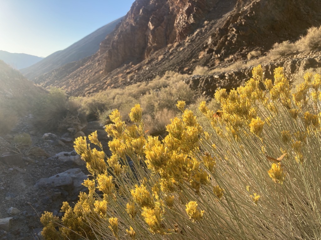
The blissful ridge riding continued for almost two more miles to the saddle below Rodgers Peak. Here we dove left off the trail to drop into the trackless Tuber Canyon, leaving it and the other pair of L2H hikers to the alternate route through Wildrose Campground. I was a bit envious of their roadwalk as we crunched over shrubs and gravel, but I knew that Tuber Canyon was the right choice. It was unknown, and so scared me, which was the whole point. I was glad that Arthur and I were on the same page in this regard. Both nervous, both in for whatever would come.

Bushes were pushed out by piñons as we descended along the ridge. The dense trees then urged us left into the steep canyon before it was time, and we were constantly redirecting back to the ridge crest. But then, with GPS confirmation, it was time to find the bottom. I spun the dials to tighten my fancy new shoes, and followed Arthur down the steepest of slopes.
The orange rock crumbled and slid, and it looked like the floor would never come, but in less than an hour we were nestled in the tight crease of Tuber Canyon. I’d slipped and slammed the muscled base of my thumb into a pointed rock, but that swollen bruise and oozing nick was a discomfort that I could handle. Besides, the buzzing nerve wiped away what was left of my headache. And now that we were at the bottom, I didn’t really need to grip my poles anymore anyway.

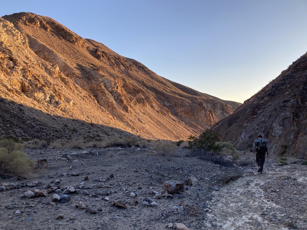
We briefly attempted to locate Tuber Spring out of pure curiosity, and finding nothing except for a few lengths of ancient rusty pipe, turned downhill to follow the wash out of the mountains into Panamint Valley. The flat gravel made for some easy cruising, and the trees soon disappeared as the canyon widened into an expansive floodplain of rounded stones, gravel, and dry brush. We made great time, gradually yet significantly dropping in elevation back into the warm embrace of the desert. It felt amazing to move freely again on a smooth decline with just a reasonable amount of water on my back. Arthur and I fell into easy conversation about nothing in particular, replete with snippets from our shared childhood and they myriad of inside jokes that now guided each journey down memory lane. Quotes from The Simpsons flew, punctuated by an endless stream of farts.

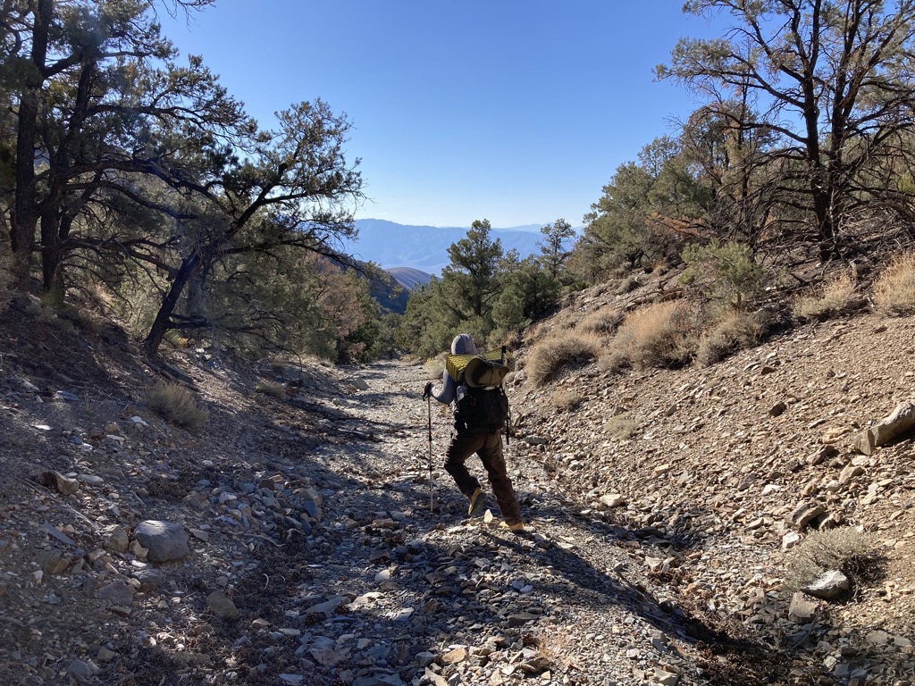

However, despite our quick and tooty-frooty pace, the mouth of Tuber Canyon barely seemed to creep any closer. Once again, our sense of scale severely underestimated these desert distances. Checking the GPS showed minimal change, and eventually we reconciled that yeah, eight miles is a long way. It sure hadn’t looked like eight miles from the ridge, but the map didn’t lie. At least the cruising was smooth.
Evidence of wild burros increased as we approached a lower wallow of Tuber Spring. Worn trails crisscrossed the dense, green brush, and stacks of manure sprinkled the earth. When we spied the stagnant pool of water, we were both glad that we’d carried the extra water we needed to make it to our cache. This water would sustain life, and there was probably better water around, but drinking this or looking for better would have sucked. We pushed through, and pushed on.

Fortunately, every time we encountered difficult geology or brush all we needed to do was follow a burro trail. 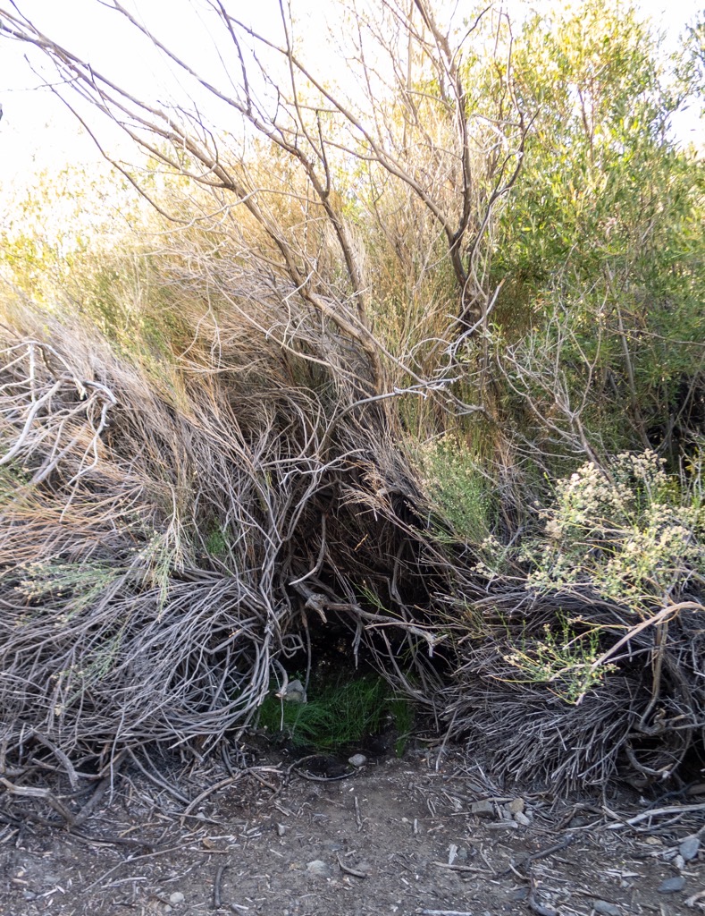
The second spring in Tuber Canyon. Plenty of water here, but it was stagnant and nasty with lots of burro crap nearby. We’re glad we weren’t relying on this to survive. Photo cred: aeigenbrot 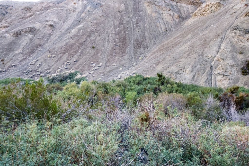
View of the lowest ‘spring’ in Tuber Canyon. There’s probably water here, but it would be a pain in the butt to find. Photo cred: aeigenbrot
After hours in Tuber, we were finally getting somewhere. The narrowing walls now blocked the lowering sun, casting glorious shade across our path, and we could practically smell the end. With a tremendous warm glow on the hills above, the sun ducked below the distant range, leaving us what we hoped was just enough time to navigate the final turns before dark.
And we were just in time indeed. Countless burros had carved contouring tracks along the canyon walls where the wash cliffed out at a narrow gorge. This eroded trail was just enough to inspire confidence by daylight, but would have been downright freaky in the dark. In a blink, we were high above the canyon floor, which lay at the bottom of a cliffy tumble, trusting that these wild burros shared our desire to get back down. Sure enough, as gently as we had been unknowingly lifted, our guides floated us back down once the wash became flat again. My heart dropped back out of my throat as well. Thank you, burro friends. Thirty minutes later, we found our turn onto an old dirt road, and bid farewell to the great Tuber, longest of canyons. Shortly thereafter, we strapped on our headlamps for the final few miles of the day.
Burros are maybe the best trail builders, which is awesome because the bottom of Tuber gets kind of cliffy. Without the burros, this stretch would be damn near impossible to navigate. Photo cred: aeigenbrot 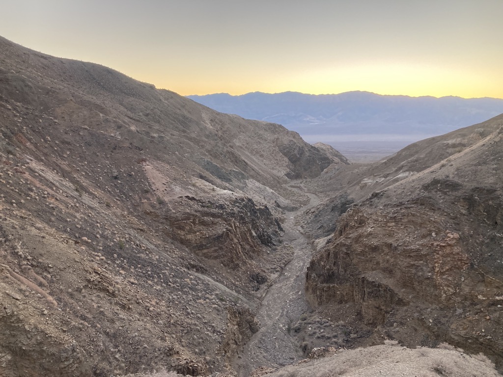
How did we get way up here? Gulp. Bring us down now, please. 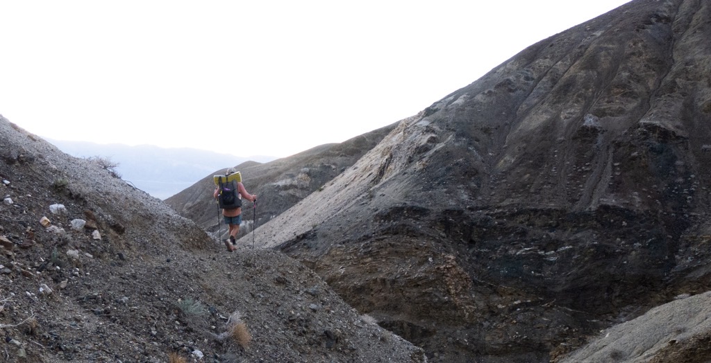
Airy walking on some burro trails. Photo cred: aeigenbrot
The road carried us north, past hulks of rusted mining relics, into the ever-increasing openness of the Panamint Valley. There wasn’t much to see anymore, but it was easy to sense the increasing space surrounding us as we left the mountains behind. A mysterious orange light burned across the valley, and a few distant cars streaked like fireflies, but we were alone. Just us and the warm desert air. And it was warm down here below 3,000ft. We wouldn’t have wanted to be here while the sun was up. I was running low on water as it was.
Following the GPS when it became impossible to distinguish road from not-road, Arthur practically stepped on our water cache. Nailed it. It was a greater relief than I expected to find our precious jugs intact. I was down to the dregs of what I’d hauled from Hanaupah, and didn’t know what to do if we’d found otherwise. And it wasn’t worth worrying about anymore. We had four gallons, more than we needed. I chugged a few glugs, then we sat in the dirt and filled our bottles. The weight felt good, reassuring, when we hefted our packs again. It was less than the weight of the stress that had lifted from my shoulders.

A mile or so further, after a quick jig-jag onto and off pavement, we found our home for the evening along our empty gravel road. It was 8:30pm — time to eat and rest. The day had been a tough one, and I was pooped. However, it had gone off without a hitch, and just like yesterday, this amazed me. The L2H scared and made me nervous in so many ways that I couldn’t help but expect something to go awry, especially during these first two days. That we’d made it here, according to plan, healthy and hydrated was remarkable to the point of disbelief. But it wasn’t just luck. We worked hard for this, and it was paying off. That felt great. And my beans tasted great too.
There were so many stars above when I lay down to sleep that the sky looked dusty. I struggled to pick out all but the brightest individuals as a warm breeze rustled my loose quilt. With an early alarm impending, it was going to be a short night, and I was tired enough to make the most of it. Good day, good night.

Owen’s latest post
LikeLike
Great writing Owen. You get better with each pot.
I look forward to these blogs and following your journey.
LikeLike
Great writing. Thanks!
LikeLike
Enjoying this unusual trail. Obviously meant a lot to hike it after so many years and with your brother. Look forward to the next post.
LikeLike