
10/17/22
L2H Day 5
Lee Flat to Long John Canyon
Jug Hand Camp to Bug Saddle Camp
L2H miles: 21.79
L2H total: 102.1
Elevation change: 5253ft gain, 3858ft loss
My well-used quilt was just not cutting it anymore. After 70 nights on the AT and IAT, the accumulation of my filth had rendered the synthetic insulation clumpy and impossible to distribute evenly. The night had been our coldest so far by a significant margin, but it was still significantly warmer than my quilt’s 30°F rating. I’d slept through most of the night, mostly comfortable, but the dead spots absent of insulation left the door open for a chill to take over my feet and thighs. The desert gets cold at night, especially above 5,000ft. Arthur and I slept at 6,100ft, and would be higher still tonight. No more messing around. I’d learned my lesson and would put on all of my bonus layers before lying down again.
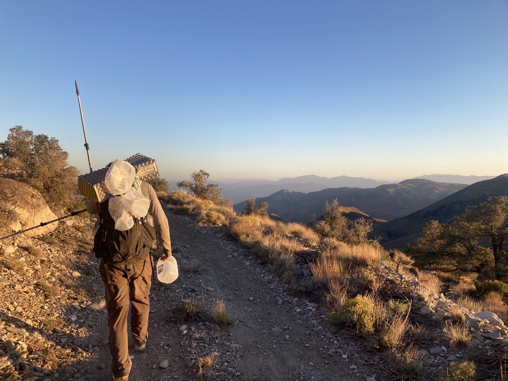
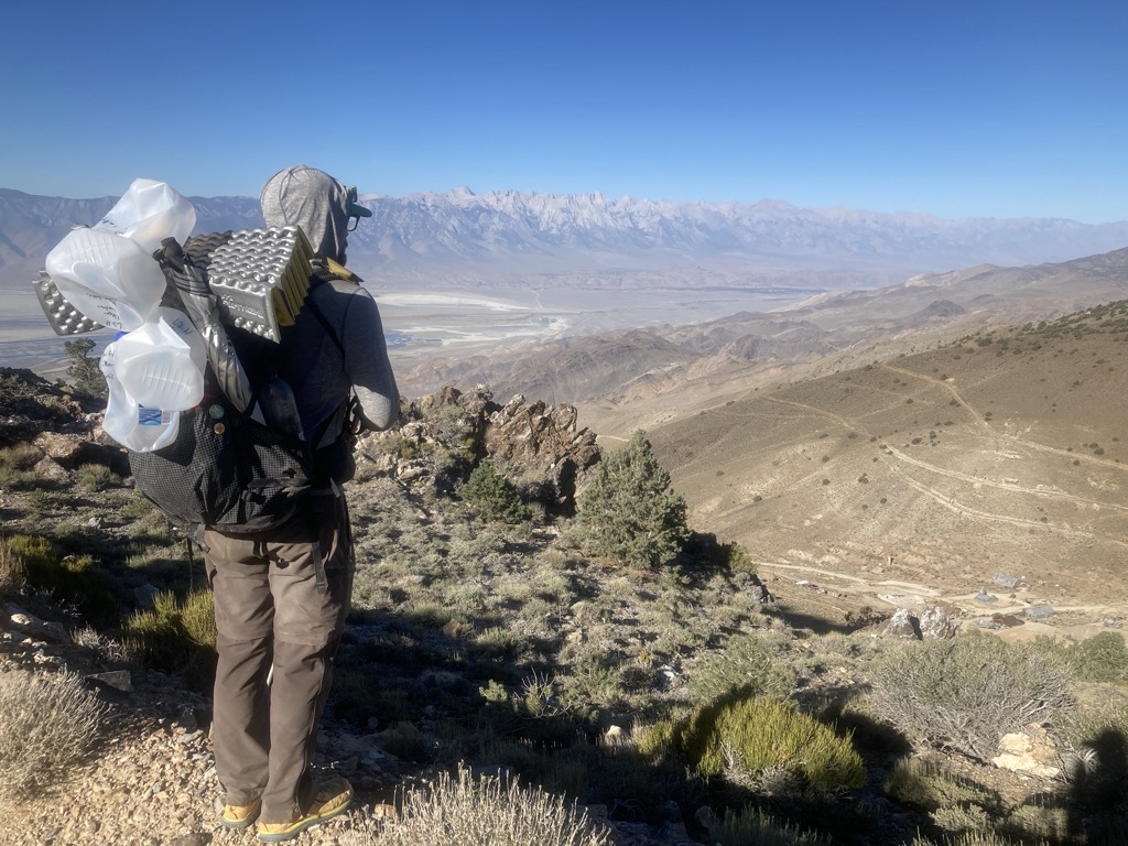
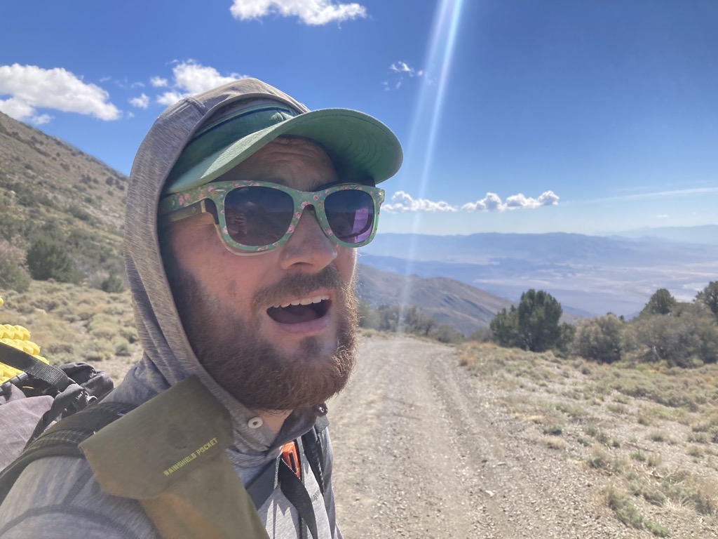
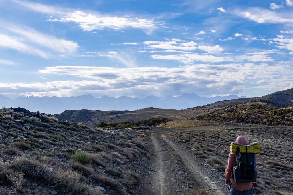
I was ready to get moving when the 5am alarm buzzed, but in the dark coldness of predawn, it took a significant mental wind-up to venture from the inadequate warmth of my quilt. Arthur and I ate our breakfasts in bed, then did the delightless dance of removing our warm layers for packing. By 5:45am we were hiking up the west-pointing dirt road, officially on the Cerro Gordo Alternate route now, pumping our legs quickly to stoke internal fires from smoldering coals to raging jets. The darkness was cold and breezy, and I noticed how my fingers chilled while gripping my gallon jug. It was easier to carry today with only one liter left, and I committed to finishing that before the big climb of the day began in a few miles.
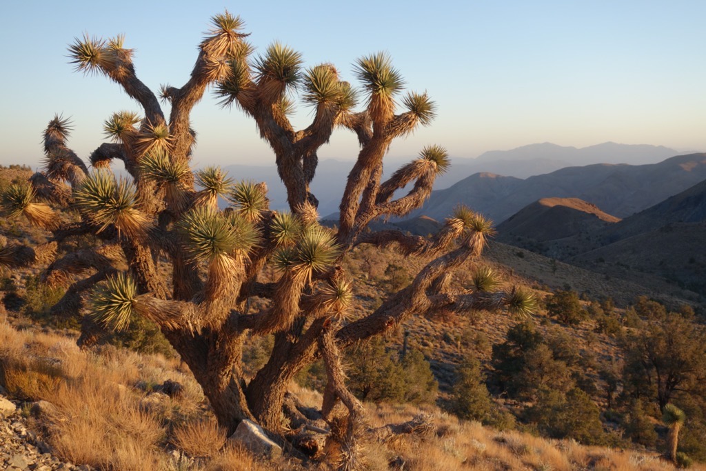
We hiked by moonlight into the gradual embrace of the Inyo Mountains. Joshua trees were replaced with sagebrush, which was soon followed by piñon pine. The breeze stilled as the mountain folds constricted around us, and the only sound came from our crunching steps, clicking poles, and quiet conversation. The sky lightened and I warmed up, feeling the chill of my sweat every time I arched my back to expose my damp shirt. We passed the turnoff to the bitchin’ Permian fossils in a forested canyon, then clambered out of the wash to follow the road over and out of this particular fold of fuzzy hills.
In no time as we shot skyward, the smooth tread transformed into a scarred mess of tilted dirt and deep gullies. It looked impossible to drive to my eyes, but the fresh tire tracks were proof of my wrongness. “Blackbird could do it,” joked Arthur. I found it difficult enough to walk, but my shoes held firm as my ankles swiveled to accommodate the angled terrain. Forget a 4×4, the human body is the best off-road machine.
Cresting an unassuming saddle, we dropped down an equally jacked-up and steep slope into an intimate meadow of sage rimmed with piñon. The coldest air had pooled in this basin, renewing my chill as the sky continued to brighten. This place was like so many along the continental divide, and I appreciated my brain for returning me to the CDT, connecting me to my past, and providing comfort in the present. Rounding the edge of the meadow, we found the source of the tire tracks and shared a few words with the early riser of the group (there’s always one) who was standing alone and looking content with his hands in his pockets. Two of their rigs looked the part, heavily modified squirrel-squashers with knobbly tires and Mad Max-esque extraction accessories, but the third was essentially a minivan. Now getting that thing in here was a major flex.

Exiting the cold basin, we could see the road contour for the next mile ahead before disappearing around a distant ripple of brown and green stubble. A rocky summit loomed above, and I prepared mentally for the impending climb up and over. Even with the jug water almost gone, our pack weights hadn’t dropped appreciably since lunch yesterday, and still pressed us into the earth. They worked against us as we pushed to the sky. Without this water, we could fly, but without this water, we would die.
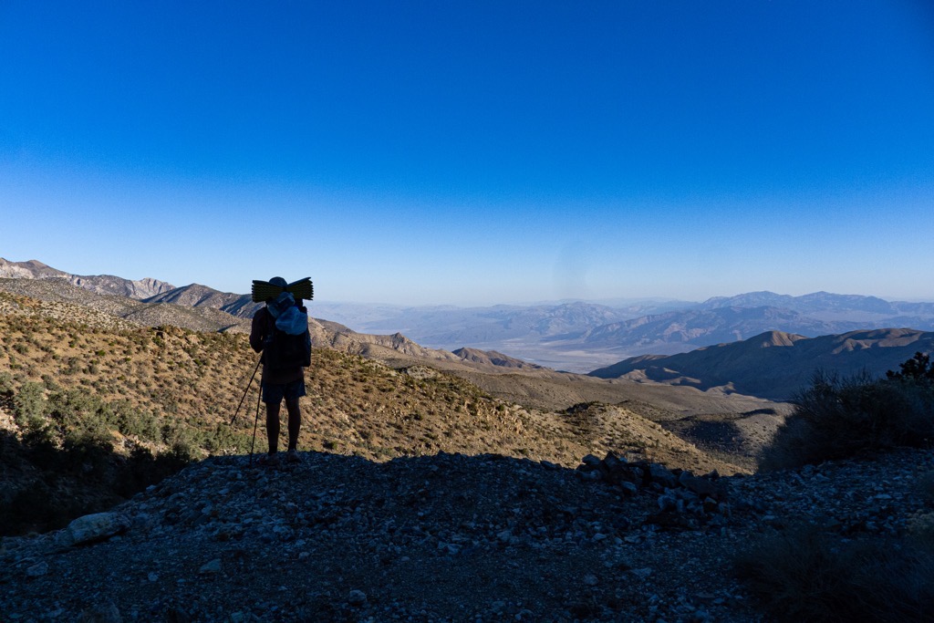
The vibrant warmth of sunrise cascaded from the peaks, flooding across the road. In the deepest of the deep valleys, it was temporarily rebuffed, but the shadowy haze wouldn’t last long out here. We stopped to apply sunscreen amidst a few red paintbrushes, and then immediately turned back into the shade. The road told us it was time to stop fooling around. Empty those jugs, grab your other pole, time to climb. I chugged and looked back across the layers of mountains and deep valleys to the endless horizon.

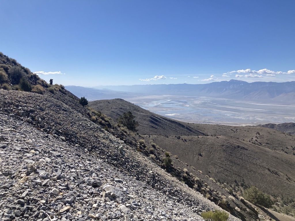
We stuck to the shaded north slope of the mountainside and the road launched us skyward. The going was steep and rugged, but efficient. Soon I was panting, looking way down to the first ‘switchback’. Letting gravity tug my gaze further, it tumbled and bumbled down an incomprehensible distance to a shy corner of Saline Valley, home of hot springs-loving, naked hippies. Arthur and I tried to guess its elevation, settling on roughly 1,000ft above sea level, but for all I knew I wouldn’t have been surprised to find out that it was below sea level. It was a looooong way down, and looked scorching now that the sun had breached the mountain walls.
Finding ourselves on a massive slag heap, I marveled at the tenacity of the miners who literally scratched their living from solid rock in this unforgiving environment. How could it possibly be worthwhile to collect rocks in the middle of nowhere? Though I couldn’t understand, it must have been worth it. Can you imagine a life where you dig into a mountain overlooking Death Valley, perhaps alone, then haul that stone miles over a huge ridge to sell it in some smear of a town? In what world does someone choose to do that for a living? But hey, here I was, in the same spot, toiling away, without the potential for financial gain. Maybe these miners just loved being out here like I do. Maybe they were thrilled that mining paid the bills. Maybe they would call me crazy for walking around out here for pleasure. Who knows? What was certain, however, was that the handful of rocks with a turquoisey patina were gorgeous. Arthur thought that their beauty might be linked with a certain concentration of arsenic. Whatever, still awesome.

The road above Belmont Mine had degraded to a single track across a steep slope of talus. But did that stop us humans from having a good time out here? Nope. While steep, it was still smooth hiking. I chugged along behind Arthur, settling into a strenuous yet sustainable pace as we finished the final twists to the top. There, we broke into the sunshine at a small and airy saddle with tremendous views across the tapering tail of the Inyo, Darwin Flat, and Panamint Valley, all the way to Telescope Peak. It floated dark on the horizon on a cushion of haze that matched the sky and was a satisfying reward for our efforts. It also offered another moment for reflection. This is awesome. The L2H rules.


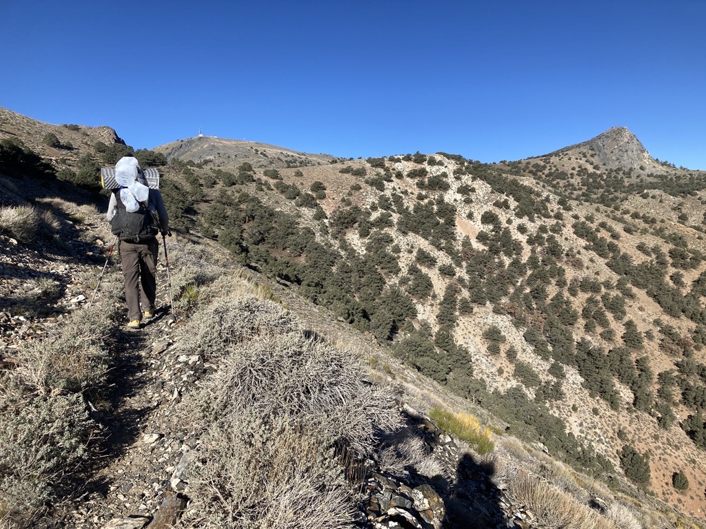
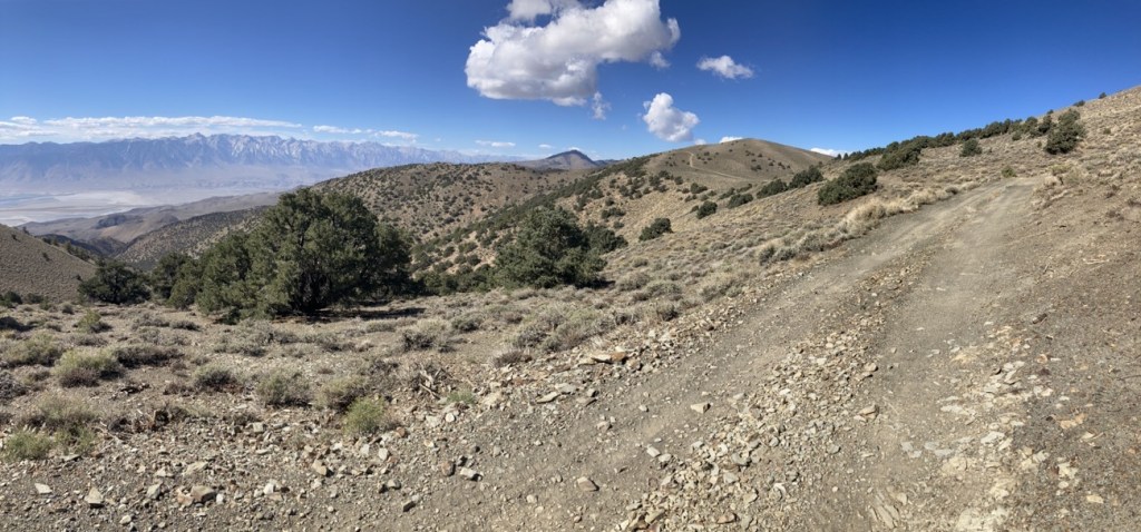
The major climb of the day was pretty much done. Now it was time to enjoy the ride along the crest of the Inyo Mountains. The old road contoured past a point of striking gray stone, then into a high confluence of two saddles, a secret kingdom of sage hidden from the world. After one more little ramp, we were looking way way down to the next, and final valley of our journey.

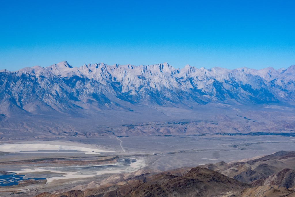
The Owens Valley is my favorite place in the world for many reasons, but this view would have won me over even if I had never seen it before. It was arresting. I stopped and could not walk, I had to look. For it was not just the valley, but also the escarpment of pure Sierra granite rising to a serrated edge on the far side. The points and jagged cuts were known to me, bringing back a flood of memories as I traced the horizon from Olancha to Cirque, over Langley, Mallory, Irvine, and Muir, rising up the Needles to the big one, Whitney (Tumanguya), and beyond to Russell and Williamson. This was the best view of the best mountains, and I was so grateful to be here.

Stopping many times to take pictures along the way, I followed Arthur down a much-improved road to the ghost town of Cerro Gordo, home of one of the largest silver mines in the United States, while it was operating at least. For being a town of ghosts, it had a lot going for it. There were a lot of cool buildings, a few llamas (living), a couch, garbage cans, wifi, and a most gracious host, Trevor. He showed us around the museum and told us a lot of history about the town. Most surprising was that the place was once been home to between 3,000-4,000 residents. It took three saloons and three brothels to keep this rough-and-tumble community running. Slightly more interesting were the plans to rejuvenate and refurbish the town into a destination with lodging, dining, and a small movie theater. In a few years’ time, this stop might be a completely different experience for L2H hikers. We sat, ate, dumped our empty jugs in the trash, and laughed about the water cache left by other hikers. To: Riley, From: Riley. After a most pleasant visit, it was time to go, and we vowed to return in a few days once we had wheels again.

We really were not sure what to expect in Cerro Gordo. It turned out to be awesome. 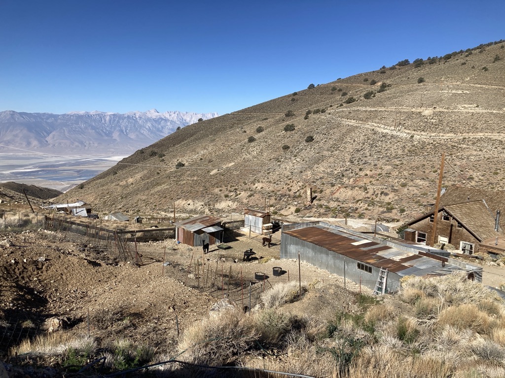
Downtown Cerro Gordo. See the old ’streets’ on the opposite slope. That’s where the thousands of residents built their homes and shacks. 
Hey, this deck is niiiice. 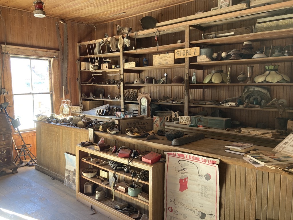
Artifacts for days. 
Only in a mining town. Photo credit: aeigenbrot 
Well, I might as well sit in it. Photo credit: aeigenbrot
Arthur led the way out of Cerro Gordo on one of the old roads that spiderwebbed across the adjacent hillside where once thousands of miners made their home. The plots were now overgrown and eroded, but the stories of those who had lived and died here still echoed in the cirque where Cerro Gordo had thrived. I couldn’t interpret their experiences, but I could imagine that all aspects of human existence had transpired here, good and bad.
Rounding the wide shoulder, cruising on the excellent road, we walked into a dream. The view of the High Sierra was uninhibited by anything except for miles of crystal clear air. I was enamored, ogling the endless summits for steps at a time. This was literally the best trail ever and it promised to be this awesome for the rest of the afternoon. When Arthur stopped to dig a hole, I had no qualms about finding a place to sit so that I could settle into my contentedness without worrying about tripping down the mountainside.

The road dimmed to a slanted scratch across a slope of steep shale, which suddenly required all of our attention to navigate safely. Still, we both remarked about how such a minor track could make the impossible easy. And again I considered how incredibly capable the human body is. The trail barely existed here, but it was plenty. Oh, the wild places we go. Often, I’d looked into these Inyo Mountains, from Sierra summits or the Owens Valley, wondering what they were all about. Well, now we were finding out, and I couldn’t have been more stoked.


Our light contour joined another road for a horrendously steep climb to the next saddle. I pumped my legs and pulled hard on my poles, giving everything I had for the fast burn to the top. Utterly gassed from the effort and altitude, I crested the ridge, gulping the thin air and wiping the sweat from my nose. In desperation, I cocked my hat sideways to release some steam and block the brutal sun, and swigged some electrolytes. Arthur shared my shock.

However, we quickly let the indignity disperse as the road turned gradual for a long flight along the endless crest of the Inyo. Riding the mild undulations and flip-flopping across the sage-covered ridgeline was hiking of the highest quality. The air was cool and the sun hot. The views in all directions were epic. Our road was visible for miles ahead, the Saline Valley baked 8,000ft below to the east, and the Sierra did their thing to the west. No time to complain about the heavy water on our backs. We couldn’t be here without it.


The deceptively challenging rollercoaster had wiped us out by the time we reached the ruins of the old Saline Valley Salt Tram. Great, it was 2pm and time for lunch. We settled on the wooden relic, and I admired the vibrant colors in the weathered beams, tracing the knots with my fingers and rubbing across the coarse wood grain. Once again, it was challenging to imagine the life of the hardy souls who called this place home and kept the salt flowing. Even more difficult was comprehending the effort required to build this darn thing. The timbers were too large to have been sourced locally and so must have come from far away. So much hard labor, and for what? Salt? How spoiled and disconnected I was to take salt for granted.

The skeleton of the old salt tram appears on the next lump. 
This is one way to get salt from the Saline Valley to the plates of refined folk all over the country. You can see the intermediate tower on the next, forested ridge. 
What was once a booming salt business is now a hoppin’ hippy hot springs. 
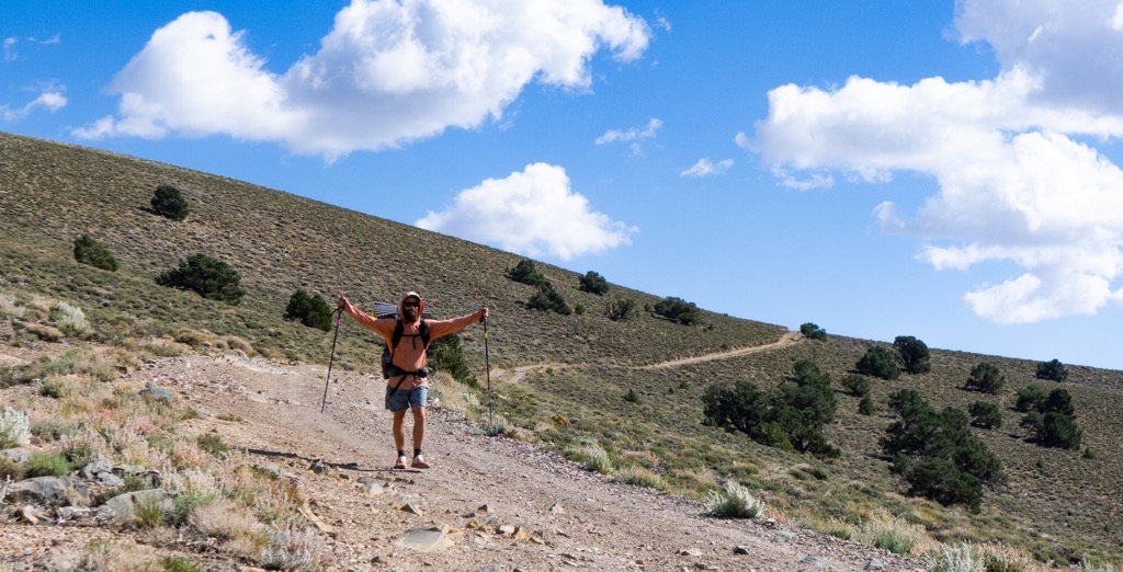
Loading up again to finish off the day after a restful lunch.
Speaking of salt, my sweat turned crusty while we sat in the sun and filled our ravenous bellies. My shirt was nasty, but my socks were the worst. They were now part sandpaper, part cardboard, and my feet would have to endure until Lone Pine where I could wash my stinkables in a sink somewhere. The tape I’d applied to my sore spots last night was doing its job of keeping irritation to a minimum, and my grit-polished toenails did look pretty fly. It wasn’t all bad.
Unexpected and exhausting climbs defined the final miles along the best ridge in the world. By the time we reached our junction, Arthur and I were both at the end of endurance and tolerance for this nonsense. We’d said, “last climb until Lone Pine” enough times seriously that it was now a joke. But then we finally turned off the interminable rollercoaster, heading straight into the low sun. It silhouetted the Sierra and blinded us with an intense glare. It was awful, it was great.


Perched on the edge of the steep drop to the Owens Valley, we finally left the road for good to find our way cross-country into and through Long John Canyon. We’d originally planned to camp right here at this airy point, but had since decided that descending as much as practicably made sense so that we might rest more comfortably in the boosted warmth of lower elevation. After my cold night at 6,000ft, I wasn’t eager to give sleeping above 9,000ft a shot.

This was a great plan. We had daylight and desire. Arthur did a great job navigating between the tiny cairns that guided us down and down across scree and around piñon. Eventually, we joined a light trail that threw these weary hikers a couple of switchbacks to finish the day. However, the steeps had gotten to me, and now my right knee twinged with each flex. A tight quad? That was my guess. A little scary, but probably nothing that some focused stretching couldn’t clear up. Fortunately, we were just a few minutes from camp at this point, so the scare was short-lived.

We found a mostly flat saddle right where the topo map promised one might be. It was perfect. Protected from wind, peaceful, and empty. We dropped our packs after circling for the flattest spot, then spent the first few minutes after sunset stretching our worked muscles. My body felt thrashed and my brain was beat. The day had given us so much and pushed us to the limit. Worth it in every way.

With nothing left but a burning desire to lie down and eat, we unfurled camp and got in bed. I dragged on all of my layers while the beans soaked, then we talked about nerd stuff and stars while spooning our tepid gloop. The color flowed from the world, followed by most of the light. A tumbling meteor then turned the night to day before disintegrating into the horizon, and that was enough for me. It wasn’t getting any better than that. Today was the best.

I would miss trees.
Great post. Thx.
LikeLike
Larry
LikeLike
Owen. I have followed you through the AT. IAT with spice, her few posts. And now L2♡H. I am hooked. I live vicariously through your eyes. I wonder, when do you find the time to write your very eloquent and poetic, and writings? They evoke all my senses as if I was there with you. I always want to send a response, but am always left with an inability to express myself, appreciation of your sharing, that I am left without ability totights into words. Do you have a voice dictating program? I love the fotos. I will always remember the funny albeit funny story of your brother getting sick in the mud @ Katahdin!!! I love that mountain!
Your soliloquy touched every emotion and every sense. Had this bike been your biggest challenge? I am going to go into withdrawals when this trip is over.
I understand your studies and jobs. Where did you learn how to write these fanciful recounts of your experiences? After a long day I can’t imagine you sit and write or speak, but you Remember everything with such detail!
W what is spice rack up to,? What are you doing without her burritos??? Grin
Give your brother and spice my regards. I finally wrote, yay! I had hoped to cross paths with you when you got to Lincoln, nh, after moosilauke, but missed you. Sadly.
Your on the home stretch….. sending energy, passion, and strength your way.
Cheerio
Susan. Christenson
LikeLike
So No day 6 L2H update this week?
Hope all is well.
LikeLike
All good here, Fred. Just very busy. I hate to miss this, but unfortunately, I have less to prove to my HFD boss (me) than my other bosses!
LikeLike
Understood. My day job keeps me sitting on my butt for the past 37yrs.
I had my adventure in 1981 biking cross country. now live vicariously thru your posts.
LikeLike