
10/19/22
L2H Day 7
Lone Pine, CA to Whitney Portal
Movie Star Camp to Carbo Load Camp
L2H miles: 11.73
L2H total: 123.7
Elevation change: 4619ft gain, 164ft loss
There might be nothing riskier during a thru-hike than sleeping indoors. This website should really be called “Headache For Days” for all the times that I’ve woken up in a motel with a nauseating thump ripping my skull apart. The rooms are stuffy, beds too warm, and fresh water plentiful to the point of being forgotten. I’m bad at towning. Always have been, always will be.
Fortunately, proper hydration has been at the forefront of my mind during the L2H, a focus that carried over into our room at the Dow Villa. I slept great despite the stuffy, still air that rather quickly became saturated with farts, and drank so much water that I even peed a few times in the night. However, it was still a close call. When I woke up, I told Arthur that I felt like a baked raisin, because that’s how I felt — double dry. It was validating when he said that he could relate. Welcome to my world.
It was early and there was no rush, but we were up so we got moving. I ate bites of my burrito, cookie, and apple between spurts of packing up and braiding my hair. Slowly the explosion of ragged scraps and dirty gear reformed into the awesomely capable collection of essentials that allowed us to survive in the harsh outside. A little before 8am, we bid farewell to our folks and reentered the outside.

The morning air in Lone Pine held a perfect coolness, invigorating yet subdued like the peaceful energy of the early risers who spoke in hushed tones as they made their pilgrimage to the nearest coffee pot. The day was full of promise, not just for us, but for everyone it seemed. This was such a beautiful spot and such a gorgeous day. It felt impossible that anyone could be having a bad time. I was probably wrong about that, but hey, maybe not.
We soon turned left off of Hwy 395 onto Whitney Portal Road, pointing out of town and straight at the mountains. I let their joyful presence wash over me and kept my gaze raised to ogle as I followed Arthur along the gravel shoulder.

We hiked fast on the gradual uphill — it’s all uphill from here — but as is always the case, even the fastest stride felt slow relative to even the slowest vehicles. Lots of vans and cars passed us going in the other direction, and a hooning Hyundai stole the show when it careened onto a dirt road for a drifting lap of a small loop. Somehow, the morning was still peaceful though. All this motion was nothing when surrounded by so much empty, quiet space.
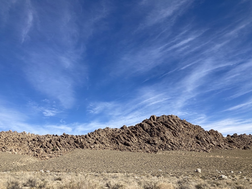
We left the pavement to parallel it for a mile along the recently-minted Alabama Hills Trail. It meandered a little, and so added some distance, but we had distance to spare. The tread was smooth, and we made great time as it guided us up and around a few of the orange granite lumps before depositing us back on the road. A stranded Honda that was stuck on a rock not 20 yards from the pavement helped me once again appreciate the amazing capabilities of the human body. The transition between road surfaces was nothing to us. We were slow, but we always made it there.

Arthur and I jammed along, steadily gaining elevation without thinking about it too much. The mountains crept closer, and every time we turned around we were higher than the hills that had towered over us just minutes before. Even though the ground we traversed was flat, it was tilted, and some complex mechanism inside my ear wasn’t fooled. Neither were my legs, which definitely felt the added effort of gathering elevation. Even so, the mellow grade helped us keep it casual, and there were good vibes all around.
A covering of thin cloud drew feathered wisps across the sky. A warm breeze rustled the yellow flowers of roadside tufts. A trio of cyclists churned past us, slowly enough that we could hear their conversation for the next five minutes.


We turned off the Whitney Portal Road at Lone Pine Campground and found a shady picnic bench to host our first break of the day. Our spot looked like it had been flooded by a recent cataclysm, but the fresh sand and branches didn’t bother us. The concrete picnic bench was all we needed, and we gratefully popped off our shoes and dug into our fresh bags of chips.

With nothing but time and abundant water, the L2H had taken on a completely different character since reaching Lone Pine. Gone was the urgency of climbing high before the sun broiled us dry. No more did we need to ration our water or grind under the weight of gallons. The weather forecast, which had toyed with our emotions for the past 10 days, fluctuating between summit blizzard and bluebird sunfest, could finally be trusted now that we were within 24 hours of our summit attempt. The dry, though cold, prediction was the final piece of the puzzle that allowed us to proceed, unconcerned and at ease.
But the real final puzzle piece (for real this time) dropped into place at noon when recreation.gov released the “walk-in” permits for the following day. As the highest point in the lower 48 states, Whitney (Tumanguaya, in native Paiute) is understandably a busy peak with a notoriously exclusionary, and 10,000% necessary, permitting system. Fortunately for us, demand is almost nonexistent as October rolls towards November, so we were able to snag two of 30+ day-use permits with ease. Now we were really at ease.
From the campground, our route joined the Whitney Portal National Recreation Trail for the final four miles to, you guessed it, Whitney Portal. We followed the sandy tread up a narrow ridge, out of the wash, and across the last mile of alluvial fan before reaching the foot of the mighty Sierra Nevada.
Blackened trees dotted the hillside as we began switchbacking among them, and I remembered the days when I anxiously tracked any and all fires in this region, reworking weekend itineraries to dodge closures and smoke. This one was fresh, from June 2021, a bad year for fires in the West, but these charred snags didn’t sadden me for some reason. I mourned the loss of life, yet reveled in the cyclic power of nature. To grow and die is something that all living things share in common. I’m more about the growing personally, but death is important too.

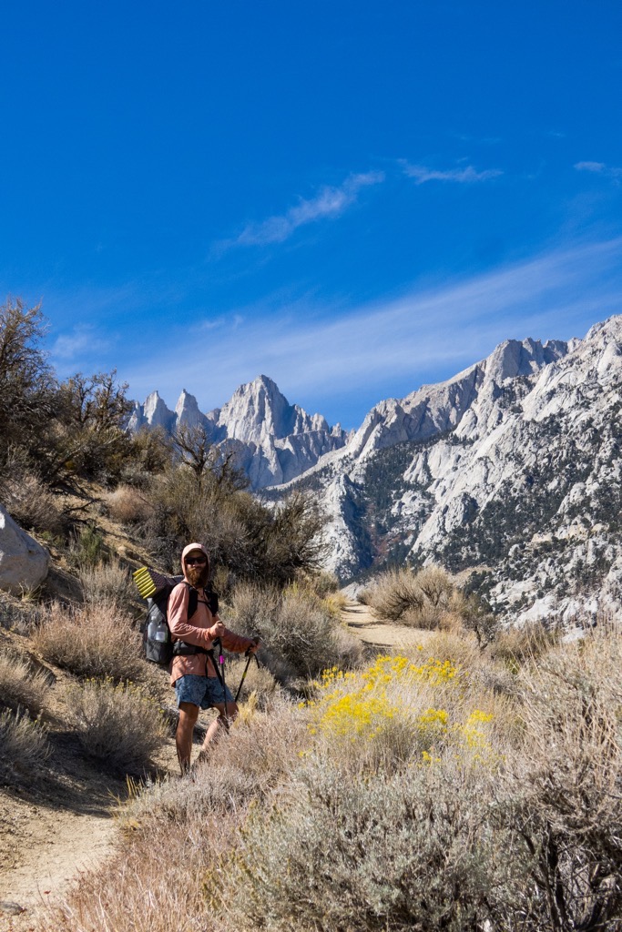
Break over and summit permits acquired, Arthur crunches up the Whitney Portal National Recreation Trail. 
How did these trees even burn? They’re so far apart. 
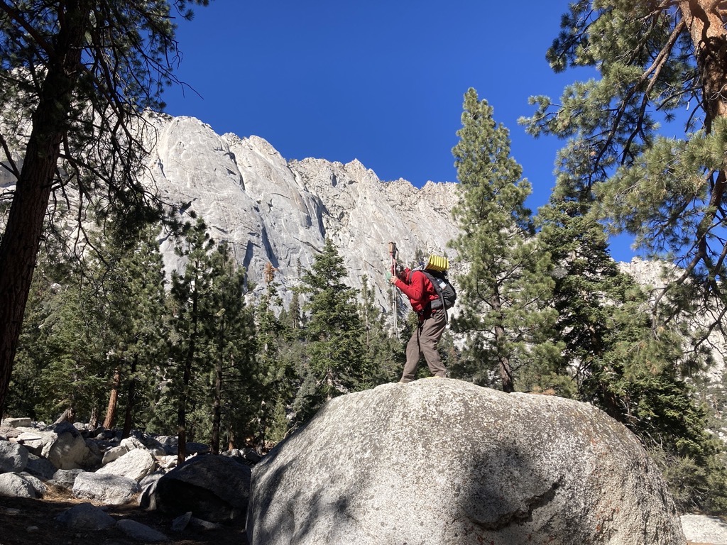
Getting wacky. Photo cred: aeigenbrot 
Saying goodbye to the desert and the Owens Valley before rounding a shoulder and sinking into the mountains.
I wasn’t totally sold on the Mango Chili electrolyte mix that soured my water during an exposed push through the shadless burn, but it did the trick and quenched my thirst. After a final switchback, Arthur and I rounded a shoulder and followed the good trail into the drainage that emptied the Whitney Zone. With each step, the mountains constricted around us, rising higher and squeezing us tighter between lofty walls of pure, bright granite.

Our goal defined the horizon ahead, looming large in terrifying detail, finally looking as high as its ranking suggested. The trees grew in size as well as we hiked deeper, eventually eclipsing the largest I had seen in years. I recognized my favorite, the ponderosa pine, but there were other old giants that had called this place home for hundreds of years, if not longer. Their earthy aroma mixed with that of the hot granite and frothing creek — a familiar smell, and so comforting. This was home, these were my mountains.
An insulting amount of water cascaded down Lone Pine Creek, thus ending the desert portion of the L2H. And if there was still any doubt that we were in the mountains now, the sheer volume of solid rock left no doubt. Arthur had wondered out loud for days if unbroken stone was at the core of all mountains, and here it was obvious. No more speculation required. The scale was impossible to comprehend. Just. so. much. granite. Even with shooting cracks and bending layers, the walls looked invincible, as permanent as anything else in the world. However, the boulders that had settled near our path told a different story. Many were the size of small houses, and I shuddered to imagine the terror of watching something that large tumble from the heights. The noise, the shaking. Ahhhhhh, I felt so small.

Neat and narrow switchbacks hastened our ascent between the biggest boulders and trees. As we climbed, we passed into autumn, marked by yellow-leafed willows and the smell of winter. As we neared the campground and the end of our day, we found the trail obliterated in not one, but two sobering displays of natural indifference. A wide jumble of boulders and snapped trunks were all that was left of a small creek crossing, then a pile of rough granite blocked our path where it had avalanched from the cliff above. It all looked recent, perhaps caused during the same event that wiped out so many roads in Death Valley. Not that I needed any more convincing, but yeah, I felt small. I watched Arthur work his way through. He looked small too.


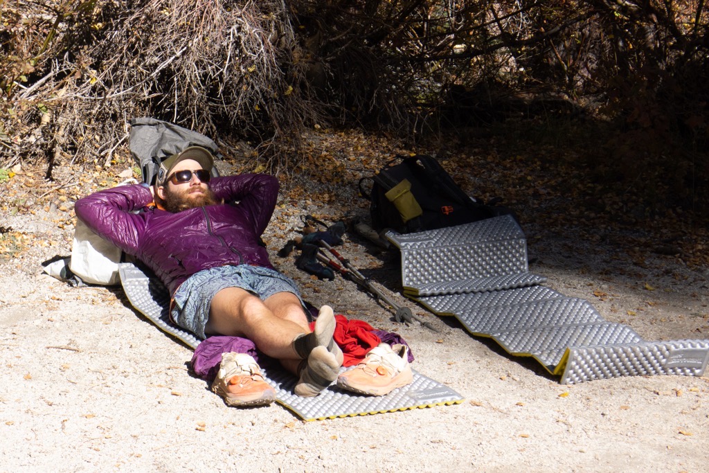
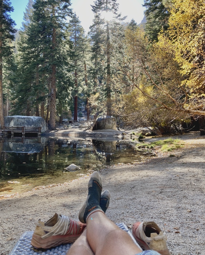
The smell of campfire welcomed us to Whitney Portal at 8,200ft. It was chilly in the shade, so we found a bench in the sun outside the portal store to soak it in while we could. The surrounding peaks would very soon plunge this place into a cold gloom. We ate some things, then followed the sun to the sandy shore of a nearby pond to lounge away the afternoon. I roasted in my puffy, languishing in the warmth that I would soon covet. Now this was living.

The sun sank behind Thor Peak at 4pm. Too soon, if you ask me. I worked on all of my warm layers, then we dragged our relaxed butts back to the benches for some hot food. Two enormous plates of french fries filled us up, leaving my tongue and lips burning from the generously distributed salt. Then it was all about people watching, as hikers of all sorts staggered down the Whitney Trail. They were hard to read. All looked relieved and defeated, whether they had summited or not.

Our final entertainment for the evening began when a crew of five, all wearing the shortest shorts legally allowed, sprang from two cars and dove into an organizing frenzy. They were up to something, maybe something big. We found out when a curly-haired character asked us where he could fill his water bottles. Almost instantly, I guessed that this was none other than Riley, of To: Riley, From: Riley fame. This joke had been on loop since Cerro Gordo, and it was beyond our wildest dreams to meet the real Riley. The crew was dropping off a car at the portal and starting from Badwater tomorrow. We answered a few questions and wished them well, but I was unimpressed that they had cached Four Lokos at Saline Valley Road. Maybe I was just too old and crusty for that kind of thing now. Kids these days…

Finally, even though it was barely past 7pm, it was time for bed. We set up camp at the backpacker campsite and pulled our quilts tightly around us. It was already the coldest night of the trip, and I hoped that all my clothes could help my bedding get me comfortably through it. Fortunately, we would be up and hiking before the temperature bottomed out. Our alarm was set for 3am. I couldn’t ever remember being excited for such an early wake-up call, but I was excited now. Tomorrow was going to rule.

Thx.
Cheers!
LikeLike
Where is day 8? How does your story end? How did you get back to the rental car?!?!
LikeLike