The idea to explore McGee Creek came from a friendly ranger in Bishop who wouldn’t stop singing its praises. I added it to the list. A look at the map got me excited about linking McGee Pass with the Convict Creek drainage to the north, which looked to be the perfect length for a weekend point-to-point. Hitching from one trailhead to the other was going to be easy enough, and a cross-country pass linking the two trails had me itching to go by the time my weekend rolled around.
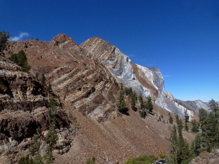
I left my car at the McGee Pass trailhead then started walking down the dusty road back to the highway. A friendly local picked me up before long, dropping me near the boat ramp at Convict Lake. Easy peasy. After arcing around the northern shore, the trail continued up Convict Creek in various states of disrepair. A mystery pile of pristine peanuts provided welcome calories. I moved on after shelling a few, preferring not to ask the tough questions. This late in the season, the missing bridge was not missed as the water levels were quite low, but the trail below Mildred Lake is a bit of an adventure and not recommended for stock travel (as of 2016). A final crumbly push revealed the lake, big and beautiful (mile 5, 9,730ft). Turning in place, the variety of rock was truly stunning. The gunmetal gray kidney of Mt. Morrison to the east, red and white layers twisted together to the north, and Red Slate Mt., dusted with snow, at the southern end of the lake. And none of the typical speckled Sierra granite. The much bigger Lake Dorothy was 600ft higher, and ripe with prime campsites.
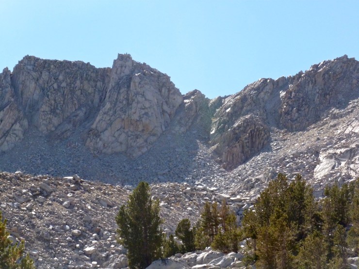
A touch more climbing on diminishing trail put me in sight of Cloverleaf Lake. Thirty minutes of awful sidehilling found me on its tranquil shores, ready to dump the gravel from my shoes and eat a Clif Bar (mile 7.75, 10,300ft). While I rested, I picked out which notch I thought was Ram Pass in the ridge above. Fun boulderhopping over car-sized rocks turned into classic Sierra class-3 scrambling as the slope steepened below the pass. The fun bit of climbing put me on the narrow ridge with a full face of fresh wind (mile 9, 11,330ft). Franklin and Ram Lakes glittered deep sapphire in the breeze far below.
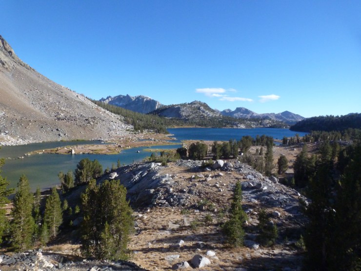
A collection of cairns delivered me safely to this beautiful basin where the walking was easy and views sublime. A final bit of trailless travel through a small canyon deposited me on the mighty PCT at Lake Virginia (mile 11.85, 10,320ft). With the sun getting ready to set behind a ridge, I quickly found small spot protected from the wind, which was blowing with renewed effort as the shadows lengthened. I set up to cowboy camp and ate my cold beans for dinner as I considered John Muir’s hobby of climbing trees in wind storms for a good time.
The morning was bright and calm as I finished my walk around Lake Virginia then switchbacked steeply down to Tully Hole with the incredible Silver Divide spread across my southern panorama. Upon reaching the meadow (mile 14.2, 9,550ft), I hung a left, leaving the PCT to follow a lightly used single track up Fish Creek. The trail climbed gradually through forest, then terraced meadows, views improving with every step. Shortly, I found myself crossing a wide, idyllic meadow complete with meandering stream, heading for the large pile of red slate rising steeply ahead.

Yep, I was on the other side of Red Slate Mt. today. Many switchbacks of red talus later, I crested McGee Pass, a high shoulder of Red Slate and about as barren as they come (mile 20.1, 11,920ft). The views southwest were utterly fantastic, revealing endless potential for future adventures that would be bounded only by the limits of human imagination. I cowered from the wind behind a rock to consider these limits and eat the last of my sundried tomato and asiago loaf.

After copping out of a summit bid, I saddled up for the final tumble to the car. The small valley immediately below the pass maintained the otherworldly feeling, barren and rusty. Little McGee Lake broke the monotony, burning blue and protecting a small iceberg. The landscape returned to normal before reaching Big McGee Lake, where I had no choice, but to take advantage of the warm afternoon and stop for a swim (mile 22.4, 10,530ft).

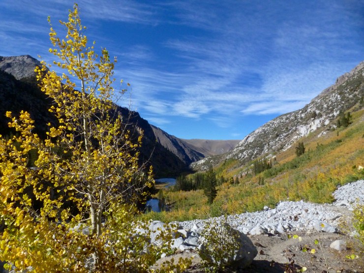
Damp clothes cooled me as good tread allowed me to cruise along McGee Creek for the last six or so miles to the trailhead. Quiet. I didn’t see another soul and was allowed to enjoy the aspen beginning their transition to fall colors in complete solitude. I made the final eastern turn out of the canyon long after the sun dipped behind the ridge, yet bright rays shot between craggy teeth to illuminate still more twisted contortions of colorful rock high above. A twirl followed by a jaunt put me at the trailhead, car waiting (mile 29.6, 7,870ft). Convict to McGee. Awesome.