
SHR Day 20 – July 22
Bubbs Creek to Wright Lakes Basin
Better Not Be Bears Camp to Montana Camp
Miles: 15.20
Gain: 4731ft
Loss: 3829ft
Passes: Junction Pass, Shepherd Pass (trail), Wright Lakes Pass
When we lay down at the end of the day at our camp at the bottom of Wright Lakes Basin, SpiceRack and I agreed that this had been our favorite day on the High Route in a while. That has less to do with the crumby moments of the past few days and more to do with how truly enjoyable we discovered this pocket of the Southern Sierra High Route to be. I had lofty expectations for this section and, so far, we are off to a great start.
Something had us up and moving an hour earlier than usual this morning. The restful night of sleep eventually lost out to my excitement for seeing Junction Pass. I was awake at 6am, ready to hike 30 minutes later. I’m not sure what got Spice moving early, but she was with me, relishing the cool quiet of the earlier start.
After about one mile we started looking for an inconspicuous junction where we would leave the JMT for good. Our GPS helped us find the spot without issue and a small cairn to our left guided us towards the obvious trail. Although it was rough in comparison with the JMT, it was plenty obvious for anyone looking for it. Before we could hike more than a few yards up the trail, our buddy, Akshat hailed us from his camp. We exchanged pleasantries, surprised and happy to see each other again, then left him to grind up the JMT to Forester Pass while we ground our way up the old JMT to Junction Pass.

The out-of-commission trail was easy to follow, or should I say that it was easy to follow Spice as she found the old trail. I rode in her wake up a grueling 1,000ft climb. The tree cover made it difficult to gauge progress, and I was pleasantly surprised to learn from my watch that we had come so far. Leveling out, we found ourselves at the beginning of a wide basin that held alternating lakes and meadows at its bottom for a few miles. An amazingly serrated ridgeline appeared ahead of us, silhouetted by the low morning sun. A super calm lake barely rippled as we followed the soft grass trail around its shores.
Checking the map during a water break at the next lake told us that we were at Golden Bear Lake, in the middle of Center Basin. The name rang a bell for me, but I must have written it off as a boring place for having such a boring name. Let me assure you, dear reader, that Center Basin is poorly named. Something like “Super Big Awesome Basin with Sweet Lakes” is more appropriate. And it kept getting better the higher we climbed. Swinging further around Center Peak, nestling closer to the headwaters of the mighty Bubbs, the views grew larger and the lakes grew, hmmm, also larger. They didn’t even have names, as far as I could tell, but they were pretty darn sweet looking. I found it remarkable that this place was so amazing, so close to the JMT (so close that it had even been the JMT before trail crews blasted the trail over Forester Pass), yet so quiet. No complaints here. I soaked it in like a sponge as I followed Spice up the faint trail, wind twirling my pinwheel noisily.

This lake doesn’t have a name. That’s crazy, right? Mount Keith above, Junction Pass is the easiest-looking saddle on the right. 
Just enough of the old JMT to follow on the way up to Junction Pass. It’s the wide, flat-ish saddle on the middle horizon. 
Hanging out on the ridge halfway up to Junction Pass. Watching hikers on the JMT move like ants up the trail to Forester Pass (out of sight to the left). 
About to give a JMT hiker the ride of a lifetime.
High on the rounded ridge to our right we watched small ant-people mill around aimlessly. By the time we reached the same spot, not without some effort, the ants were working their way up the high saddle ahead. This looked like Junction Pass to me, and we were relieved to see it in good shape. A hiker we’d met the day before said that it was just an unclimbable cliff now. However, with our own eyes to back up our intuition, it was obvious that he had been mistaken. But before pushing on to the top we turned our attention west across a valley to the procession of different ants marching along the JMT going up to or coming down from Forester Pass. They marched with unmistakable purpose, and the distance diminished each personal struggle to the simple distinction between moving or not moving. Spice and I hollered and hooted, trying to elicit any tiny ant reaction, but the vast gulf between us and them gobbled up all vibrations. Eventually we tired of making fools of ourselves and turned to follow our own ant trail to Junction.

Surprisingly good switchbacks near the top of Junction Pass. Beautiful Center Basin below. 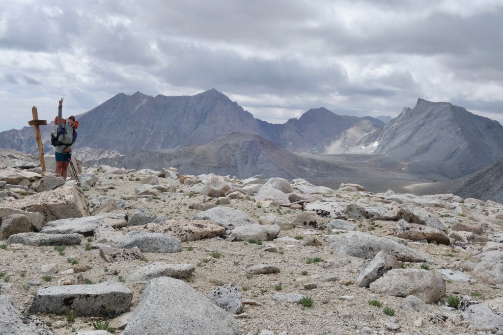
Peace on Junction Pass! Mount Williamson and Tyndall are the big ones behind SpiceRack. 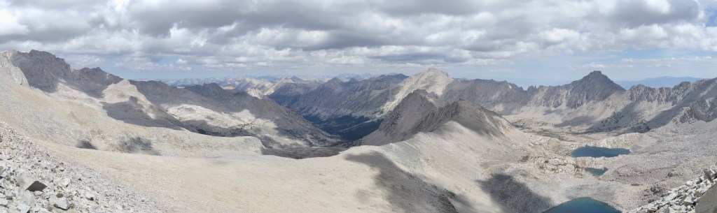
The view north from Junction Pass. Our route followed Center Basin(right) to the middle ridge. The new JMT and Forester Pass are on the left of the ridge.
Those old trail builders did a good job. We had no trouble following the wide switchbacks across and up the final steep, rocky slope. The only markers of contemporary disuse were the yellow flowers sprouting from the tread, and they actually enhanced our experience. The view from the top ruled, of course. Center Basin looked even better from here, and the terrain ahead was awesomely intimidating. A flatish mesa of sand looked easy enough to deal with, but then it dropped over what appeared to be a cliff. Uncaring granite fins and walls soared above from the other side of the pit that would surely spell our demise. The familiar peaks of Mount Williamson and Mount Tyndall bounded the southern horizon. To the east, we could peer all the way down to the Owens Valley. Sitting to contemplate these things, our route ahead, and the yumminess of my snacks, a sip of cell service allowed me to check the weather forecast for Whitney. I sighed with the relief with the positive prognosis.


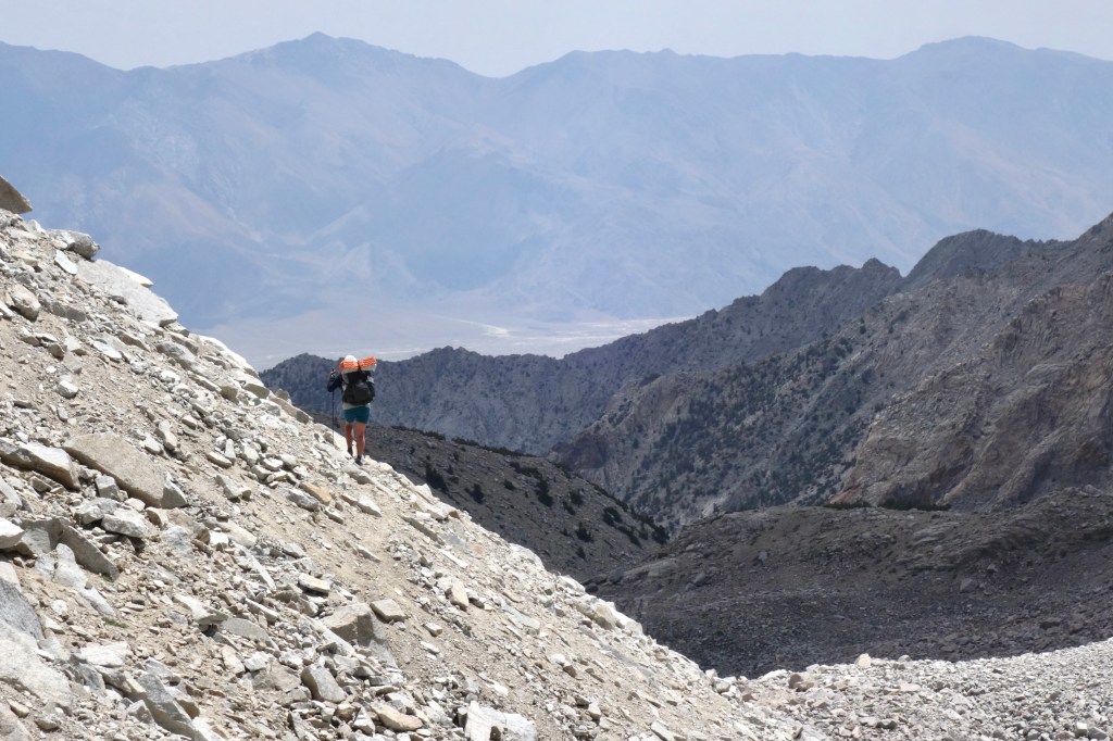

We jogged down the sandy mesa to the edge of the cliff, using GPS to put us in the right spot. What we found below wasn’t bad at all. Not a cliff, but a steep slope of loose sand and talus. We needed to be careful not to kick rocks on top of each other, but otherwise the descent was fun, more like skiing than hiking on the sand. We were happy to be going downhill for sure. Near the bottom we picked up what remained of the old JMT on this side after decades of neglect and landslides. It wasn’t much, but made all the difference as it allowed us to stay 150ft above the boulder-filled gully floor on a sidehilling traverse of the same loose crud which we had descended. After about a mile, the gully spit us out near the trail to Shepherd Pass. There we took shelter from the sun and had lunch under a short pine tree, pleased with our quick progress so far.
A couple of drops from the building clouds did just enough to get us moving, but that’s all that would come of them. At the risk of minimizing the effort of hiking with a full stomach, once we found the trail among waves of talus, it took us five songs from Spice’s playlist to climb the sandy switchbacks to Shepherd Pass. My guts were busting near the top, but the reward was one of my favorite views in the Sierra. Tyndall to the left, Junction Peak to the right, and the steep rampart of the Great Western Divide guarding the distant horizon directly ahead.


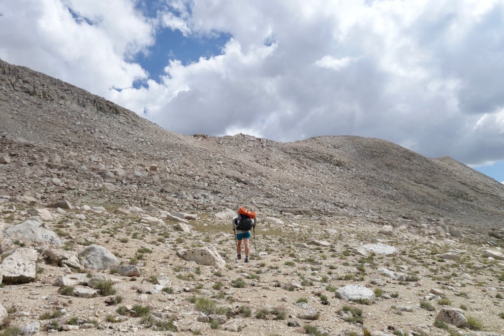
The west side of Shepherd Pass was a slope as gradual as they come. We flew with our arms spread wide, finally understanding what makes the SoSHR so special. The scale, the feeling of touching the sky, the ease of travel, and the freedom to gaze further than a days walk knowing that with just a little time, we could get there. We left the trail to hop over a short saddle on the shoulder of a familiar peak that I remembered from the PCT. We roasted in the sun on top, before descending, sun drunk, into Wright Lakes Basin. It was huge, and we ambled without much thought of our route across the easiest cross-country terrain imaginable. I’ve hiked many trails with tougher tread than this. And just when we thought we were moving fast, we spooked a coyote that sprinted a mile in what felt like 30 seconds.


Blissful miles flowed by casually before camp. We found a spot along Wright Creek, that reminded Spice of our time in Montana while hiking the CDT. I agree that a herd of elk or a grizzly bear would not be out of place. Trees, meadow, meandering creek, big sky. Montana in the Sierra. I gathered water, then we watched the sun set below Bighorn Plateau, turning the sparse clouds orange and pink over the mighty Kaweah Range, while we spooned our dinners of cold beans. A lone coyote howled at the silence, and we howled right back. After today, it felt like the right thing to do. We’re part of the landscape now. Visiting, sure, but not insulated from the land or animals. Tomorrow we move forward and will be gone from here, but for tonight this is home.

So enjoying your new blog. I was in awe of your CDT trip but cannot believe you could actually walk some of the places you picture. Huge respect to you both. The landscape and your achievements are stunning.
I’m interested to know – probably really stupid question, but the other day you said you had some snow melt. Why do you filter lake water but not snow melt? (Or did I misunderstand?).
LikeLiked by 2 people
Thanks, Annie!
Hmmmm, about the snow, I think you are referring to Day 11 when we ate some snow on the way up to Feather Pass. It’s a valid question: why do we filter water, but eat snow unfiltered?
I don’t think I have a great answer to that. I’ve always filtered liquid water, but never considered that I might get sick from eating snow. Thinking about it now, I’m pretty sure that eating clean snow is alright. And even though I’d filter the water that came from that same snow melting, that’s probably overkill. Unless maybe the water is flowing over marmot poop or something.
Did I answer your question? If your question was really stupid, then my answer was equally, if not more stupid!
LikeLiked by 1 person
Good enough…!
LikeLiked by 2 people
Kia Ora Owen and SpiceRack, Your writing style is almost poetic and I love it. The images, both real and imagined, transport me to your trail! The geography and terrain is so wild and challenging yet you walk it like it’s another day at the office – awe-inspiring. Kia kaha, Vicky
LikeLiked by 2 people
Your kind words are too kind, Vicky. At this point in the trip, getting up and hiking through this stuff really did feel like just another day. I thought that was pretty incredible when the thought struck me on the way up Puppet Pass on Day 12.
LikeLiked by 1 person