
SHR Day 21 – July 23
Wright Lakes Basin to Iceberg Lake
Montana Camp to Shoot for the Lumpy Potato Camp
Miles: 9.27
Gain: 3976ft
Loss: 2326ft
Passes: Russell-Carillon Col
The morning sun was bright on the distant Kaweahs when I peaked from my quilt. Wright Lakes Basin and our camp were still caught in the dewy dampness of dawn, so I snuggled deeper to await the morning thaw. By the time SpiceRack and I had dried our gear and packed up, it was a little past 8am, a little later than usual, but there was no rush today. With Mount Whitney waiting for us like an insurmountable wall at the end of our day, the distance we could cover was capped at under 10 miles. Granted, even such a relatively short distance could easily take all day, but I found comfort in the upper boundary. I knew what I had to do. Nothing less, nothing more.

We finished off the easy meadow strolling out of Wright Lakes Basin before a wide left turn jumped us through a rocky forest to Wallace Creek. The trail drawn on our GPS map never did appear, so we bushwhacked, searching in vain for a defined track. We spotted a few cairns, but nothing ever came of them. No matter, we had a simple task, follow Wallace Creek up to Wallace Lake. Spice led the way as dense pine duff gave way to flakes of granite as we climbed steadily along the rushing water.
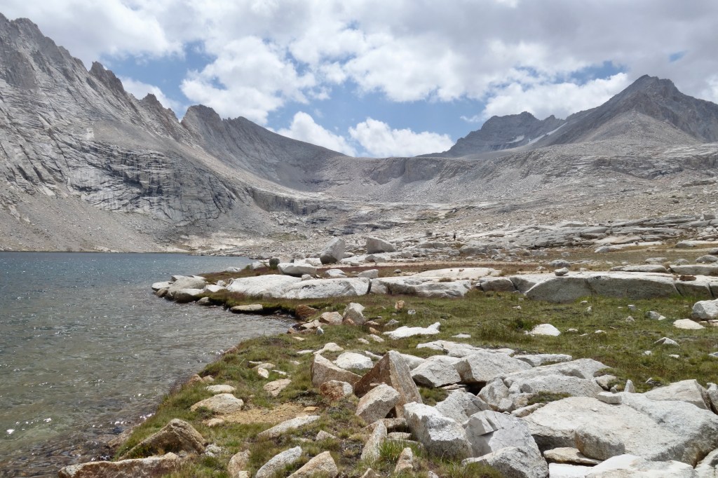
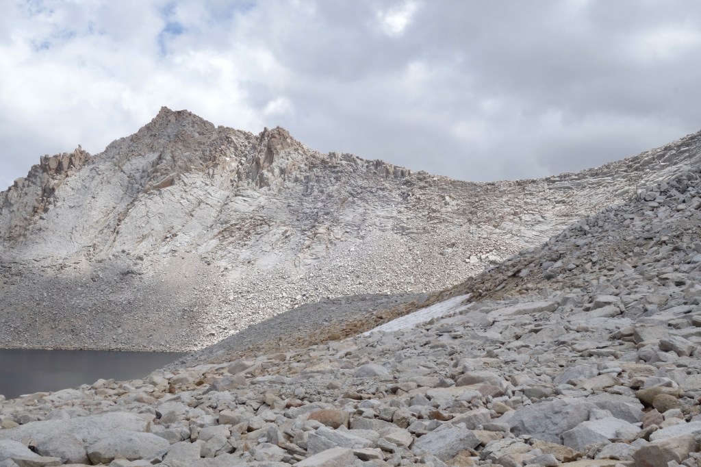
The thinning trees gradually started to reveal the character of this drainage. Huge cliffs falling away from bigger mountains drew my gaze south. Straight ahead, it was clear that the next few benches would hold space on an unprecedented scale. Wallace Lake looked big on the map, and the place that held it hidden needed to be sized to match. Out of the trees, we stumbled onto a descent looking trail. I guess we missed it by hiking on the north side of Wallace Creek. It was easy to follow the final mile out of the trees and through a flat moonscape to the shores of Wallace Lake.

I don’t really have words to do this place justice. Huge. Titanic. Mega. Those are what come to mind. The lake itself was all of those things, and so were the mountains around it. We’d been scampering around the base of Mount Barnard for half a day now. It rose to the north, shooting a ridge southeast to form a high rim rising steeply from Wallace’s deep blue waters. This swung around to a wide and high saddle that cradled the small glaciers hanging below the imposing towers of Mount Russell and Mount Morgenson.

The lake was big and the peaks lofty. I felt small, and I loved the feeling. Before the steady breeze could cool me down, I stripped and dived into the clear water. My swim lasted less than 10 seconds and it was just what I needed. The sun did little to warm me against the blustery wind as we ate first lunch, sitting on Spice’s foam pad across tufts of lumpy grass. I ate everything I could in anticipation of the big climbs ahead.
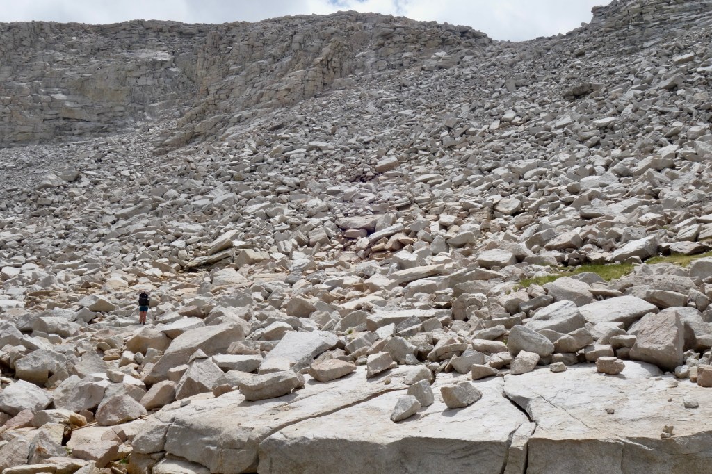
A steep wall of refrigerator-sized talus was the first major obstacle of the day. It was solid rock, and I enjoyed the climb, not just for the motions, but also for the place. Our proximity to Whitney, in a massive basin surrounded by other 14ers made this portion feel epic. I hate using that word, but it was epic. I felt like I was doing epic things, and doing epic things feels good.
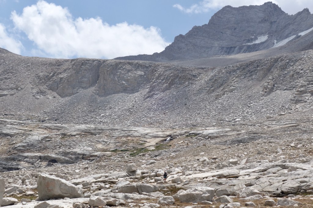
An unexpectedly lush meadow, kept green by the melting glaciers above, greeted us at the top of the climb and carried us like a magic carpet up to meet the highest named lake in the Lower 48, Tulainyo Lake. I’d flirted with this special place on previous trips, having seen it from high above on Mount Russell and Whitney. It had always struck me as about as sacred as a lake can get, and so now I approached it with reverence. Spice felt it too, and shushed me when I approached her sitting silently. The air was inexplicably calm for the first time today. For almost a whole minute, no human nor animal made a peep. I had been excited to drink from Tulainyo’s waters, but now I wasn’t so sure if I wanted to. To disturb it with my filthy hands seemed offensive and rude. With no inlet or outlet, it sat cupped in a bowl of crumbling gray boulders that rose to a serrated rim merely a few hundred feet above the lake’s surface. On the other side, the eastern slope fell away steeply so that it felt to me like this bowl was being held on an outstretched arm of the mountains, raised high to the sky. Almost like it held the sky itself. In a way it did.

I snapped out of it when a cloud of gnats went for my nostrils as I approached the water. Oooooooo, watch out, dude. They’re guarding it. I chuckled to myself as Spice and I scrambled around the talus shore as quickly as we could. After risking the bugs to chat with a pair of NOBO SoSHR hikers, the only others we’ve met so far, I filled up a 2-liter Platypus with the sacred water, gnats be damned, then joined Spice high and in the breeze for another round of lunch.

We ate, filtered, and scrutinized our next obstacle, Russell-Carillon Col. Kind of like Stanton Pass, way back on Day 1, it looked like an impassible cliff. At least our guide acknowledged this, validating our trepidation. And if the author could be trusted further, the route to the top was not only straight forward, but it was also fun and safe. Fortunately for us, all those things were true. It wasn’t as steep as it looked and cliffs always have their cracks. We made it to the top in good style, Spice leading the way over the final few hundred feet of scrambly obstacles.
Russell-Carillon Col. That’s next for us. 
Hmmm, looks like a cliff. One must learn to have faith on the SHR and SoSHR. 
Leaving the Tulainyo Bowl behind. 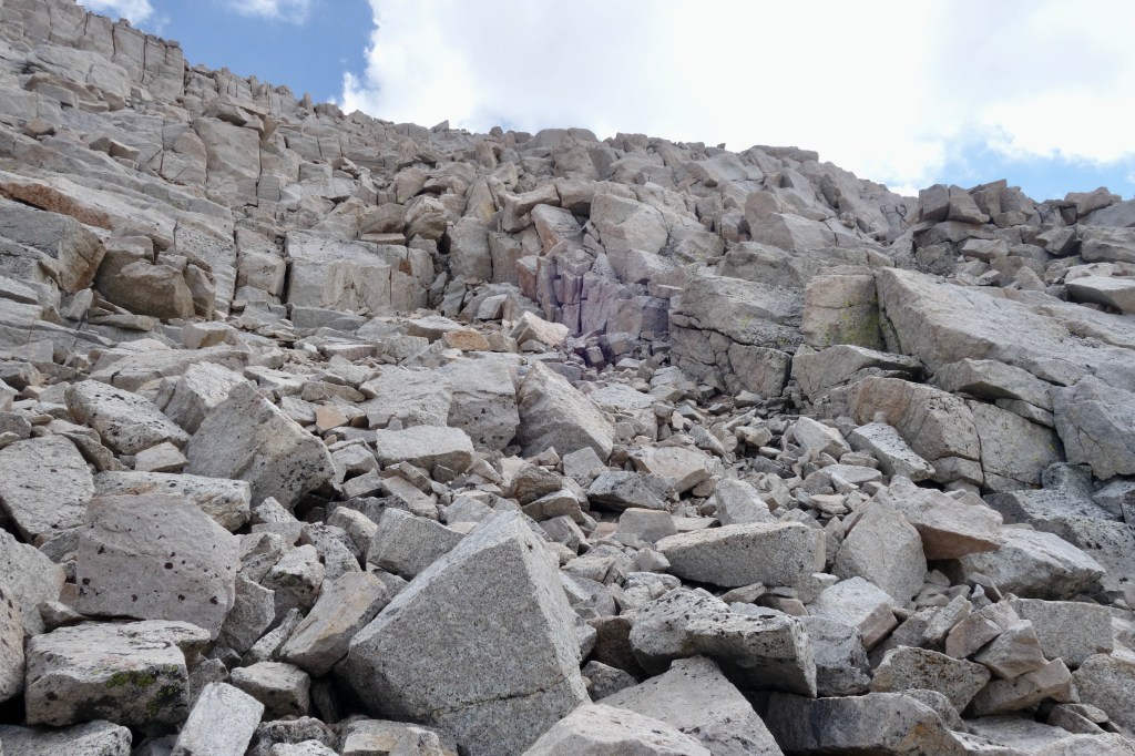
See, the cliffs aren’t so cliffy after all. 
Mount Russell, SpiceRack, snow, and a cool lake. 
Not a bad view at all as we near the top of Russell-Carillon Col.
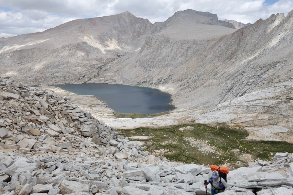
*Sigh* The view from the top was just the best. Mount Whitney and all the jagged spires, pointy points, and sharp needles of the Whitney Zone sat on our dashboard. The terrible and terrifying east ridge of Mount Russell gave me a subtle vomity, butterflies-in-my-stomach nausea as I remembered the dizzying exposure of that climb. This view from Russell-Carillon Col held everything that I’d imagined as a climax for the SHR/SoSHR. This was the crux, the jewel, of my dream trip through my favorite range. What could I do, but gaze and smile like a fool.


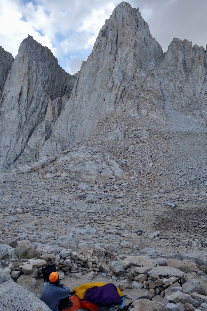
A sandy flat transitioned to a steep ramp of sand, which we followed, skiing and stumbling well-over 1,500ft down to Upper Boy Scout Lake. After a brief rest to empty our shoes and filter water, we began the final climb of the day up towards home at Iceberg Lake. A good use trail was easy to follow up to the last barren flat at the base of the sheer east face of Mount Whitney. The lake was busy with climbing parties resting for another day of climbing tomorrow, but Spice and I found undoubtedly the best campsite there, above the lake with a view of everything. A low rock wall bounded a flat patch of sand. A large boulder formed the perfect backrest. We cooked up a double portion of beans and mac n cheese, then reclined to scrutinize our route for tomorrow, the Mountaineers Route.

It looked darn near vertical, almost impossible. If I hadn’t climbed in before, I wouldn’t have believed that we could do it without a rope. Even with my past experience, I wasn’t confident that I remembered the route properly. Which chute was it again? Right or left? It took solace in the fact that I had no traumatic memories from the climb. Without fail, I always remember beings scared in the mountains, even if I forget everything else, and I was drawing a blank with Whitney. I can’t say if this was also reassuring to Spice. She seemed stoic, resolute.
Tomorrow would hold the answers we were seeking. Whitney was our final major obstacle. It almost seemed too perfect. I couldn’t have written it any better myself.

1 thought on “SHR Day 21”