
SHR Day 22 – July 24
Iceberg Lake to Upper Soldier Lake
Shoot for the Lumpy Potato Camp to Foxy Foxtail Pine Camp
Miles: 9.10
Gain: 3222ft
Loss: 4514ft
Passes: Mount Whitney, Crabtree Pass
SpiceRack’s alarm chimed. She snoozed it, yet I saw no evidence that she was awake. A minute later my watch began to buzz. I pressed the snooze button too and lifted my head so that I could see above the short windbreak at my feet. I couldn’t see too much, just a world of shadow, though Whitney’s hulking mass was obvious. It was just 3:30am, probably too early to make any moves anyway. Last night we had discussed the possibility of making it to the top for sunrise. I wasn’t too stoked about route finding by headlamp, but we had the full moon on our side and sunrise summits are almost always worth it. We decided to make our final determination at 3:30am. When Spice’s alarm rang again, she woke up just enough to say that it was still too dark before rolling back over. That was good enough for me. I snuggled deep in my quilt to wait for the light.
At 4:30am I roused Spice. It was still dark, but the horizon would begin blushing any minute now. We packed up in silence, conscious of how all our plastic bags and fabrics exploded with cacophonous crackling in the calm quiet. By 5:10am we were past Iceberg Lake and the rest of the sleeping climbers, moving uphill on the scree slope below the true start of the Mountaineers Route. The lumpy potato rock was easy to find and right above it was the chute we were looking for. We stopped at its base to put away our headlamps and stow our trekking poles. It looked like hand work above.

The ground was loose and shifty, the walls of the chute provided solid handholds. Careful not to dislodge any dangerous rocks, we scrambled up the first few hundred feet. We were making good time and climbing well. Once we made it over a cliffy obstruction, my nerves began to unwind a little bit. That had been the big question mark yesterday as we examined the route from below. Now the rest lined up with my tattered memory. There was a lot of hard work left, but I had no doubt that we’d make it.
A narrow shelf cut into the lower cliff of Whitney’s East Buttress brought us to the main chute, which rose 1,000ft to a prominent notch in the Whitney silhouette. We pulled out our poles for this lower angle section. The loose sand and talus demanded four-wheel drive. I focused on not killing Spice with a rock as we scrabbled in tandem. At this point in the trip, our communication was mostly non-verbal and we made good time despite the crumbly garbage we were walking on. A cold wind whipped at our backs and froze our hands.
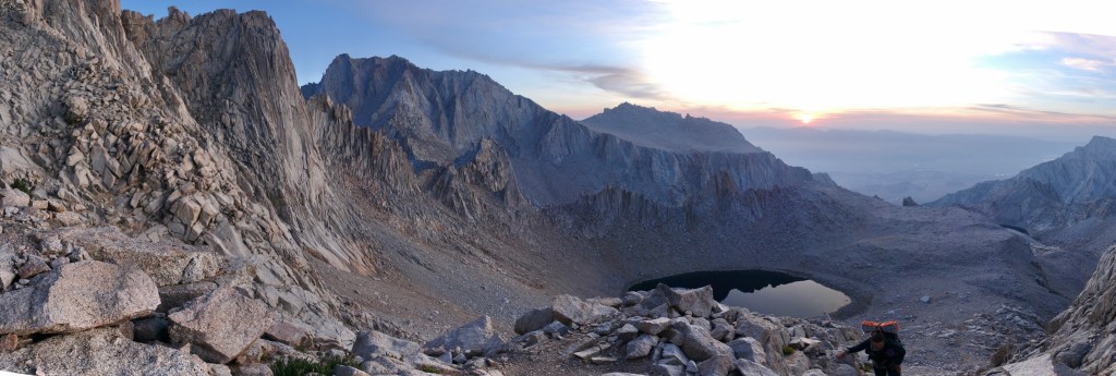


The sun clambered above the horizon behind us. A thin veil of cloud and smoke colored it bright red and sapped its warming rays of all power. My form cast a weak excuse for a shadow, diluted and transparent like using a bag of Earl Gray for its fifth cup of tea. I was chilled, but my pits were still sweaty. Nervous? Probably. Tiny ant people milled about way down at Iceberg Lake.
At around 14,000ft we pulled up into the notch. The tough slog was done. Just the fun climbing left now. Spice led the way up the upper chute – a big move to start, then classic class 3 scrambling to the top. The rock was mostly solid, and though our hands froze in the windy shade, I felt the safest I had all morning. The huge north face plunged thousands of feet below us. Rising beyond was Mount Russell and Morgenson, but beyond them there was a lot of space as the land dipped down to Wallace Creek, then Wright Lakes Basin. This part of the climb felt airy and wild, like a bird’s view of the mountains. The moves were the same, but this climbing, so high and so spacious, felt like a distant cousin to the rest of the high route.


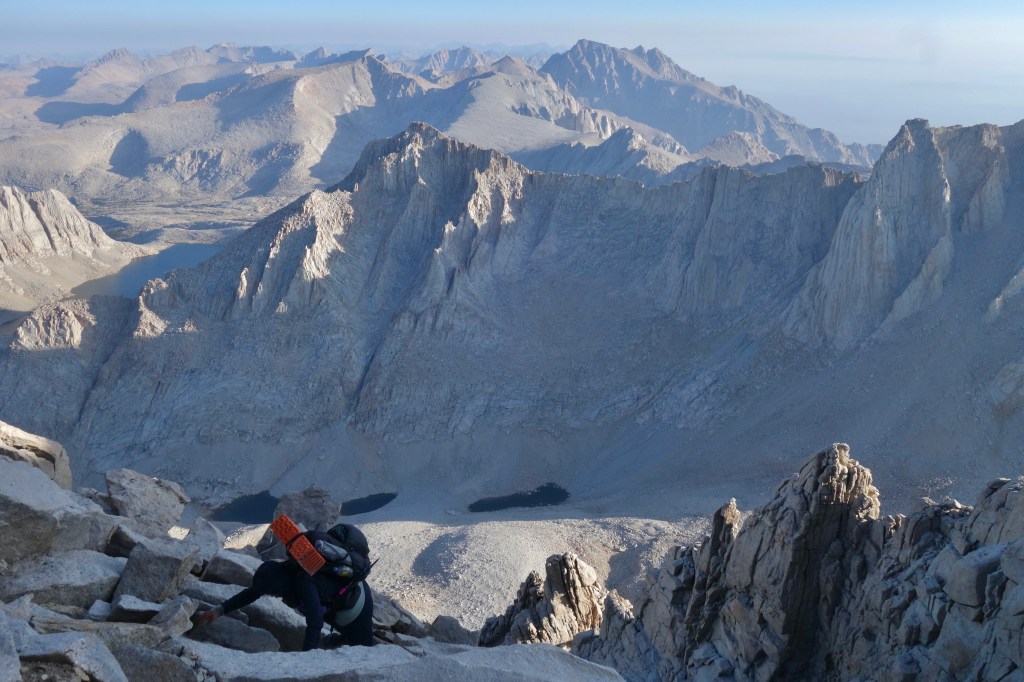
There was the sun on the rocks just above. We pulled ourselves over the edge onto the shockingly flat summit plateau of Mount Whitney. The summit hut was just a few hundred feet away, among a mob of hikers celebrating their achievement. Spice and I joined them, spinning in place on the scalloped granite boulders, taking in the endless panorama.
Hot tea, warm beans, and hanging out occupied two hours as the morning matured into the beginnings of a hot day. As hard as I tried, I couldn’t resist the daily urge until we exited the Whitney Zone, and so had to poop in a wag bag. At least I only have to carry it for one more day. We boogied on down the ridge trail passing a steady stream of hikers coming the other way, and even reunited with a few familiar faces from our JMT miles.

SpiceRack on top of the Lower 48. 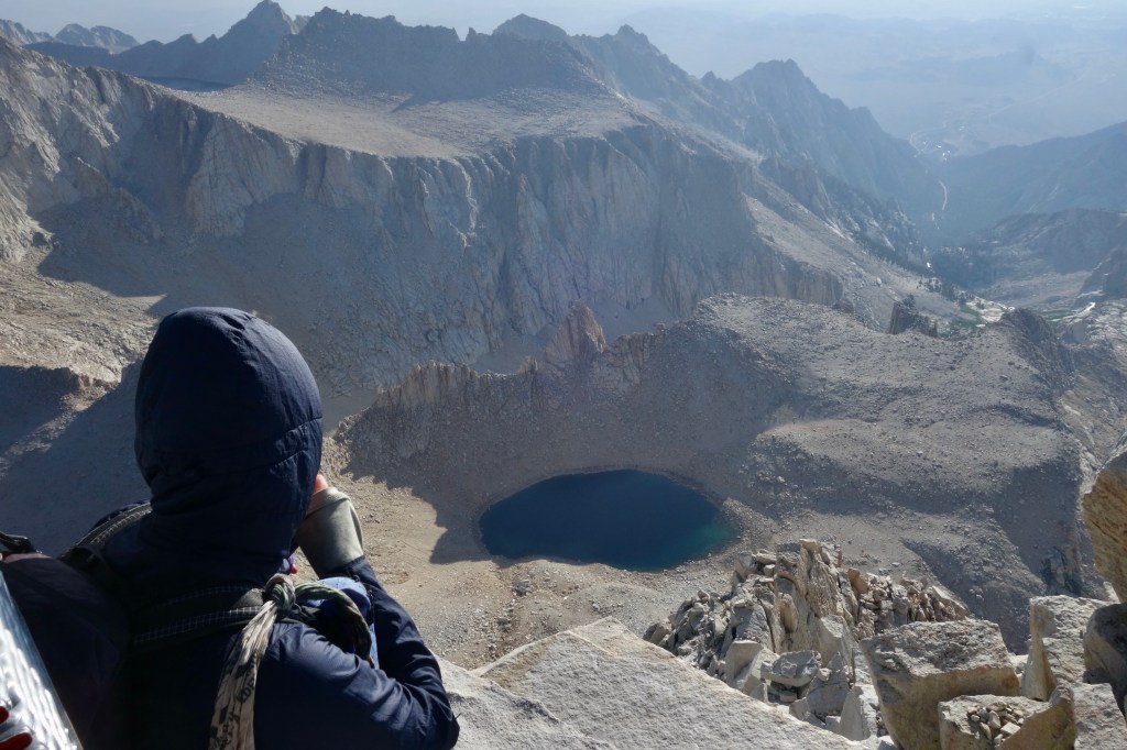
Iceberg Lake, way down there. Also, Russell-Carillon Col and a sliver of Tulainyo Lake (upper left). 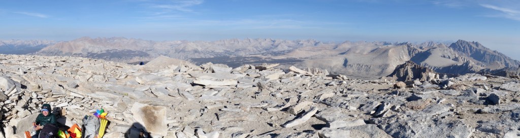
Cooking up summit tea and summit beans on the summit. Views for days. 
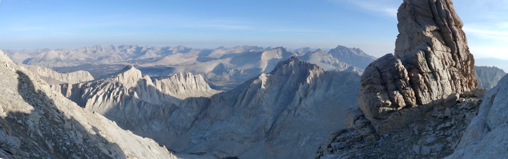
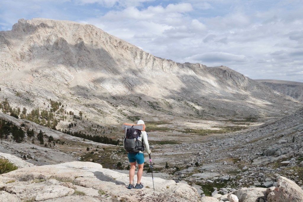
Looking south along the Whitney Crest. Practically all of the remaining SoSRH is there. 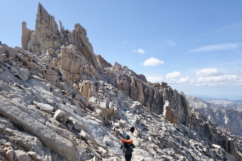
What a cool place for a trail.
At the first of the famous 99 Switchbacks, we turned off trail, uphill instead of down, finding ourselves immediately back on sketchy terrain. Of course. Fortunately the sketchiness was short-lived and we were soon skiing down a most pleasant mountainside of sand to Crabtree Lake. We each cried a little for any NOBOs who might try to reverse this route.
The water was way too cold for swimming, but we gave it a shot anyway only because the sun was plenty hot to thaw our bones. Lunch on the sandy beach followed, then a classic 30 minute talus scramble to the top of Crabtree Pass, our final off-trail pass of the whole trip.

I love this picture. SpiceRack and I found ourselves on sketchy talus not 50 feet after stepping off the trail. Those small hikers below have no idea how close they are to total chaos. 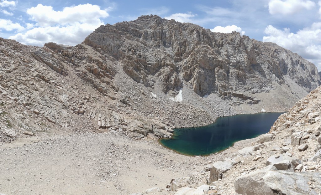
Loose sand down to ice-cold Crabtree Lake. Crabtree Pass directly ahead. 
This picture is misleading. We did not come down from there. Thank goodness. 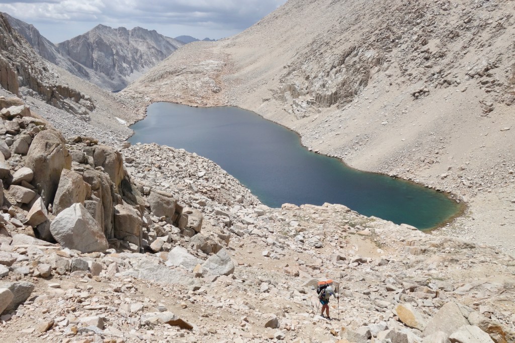
Up to Crabtree Pass. 
SpiceRack on the final off-trail pass of this High Route mashup.
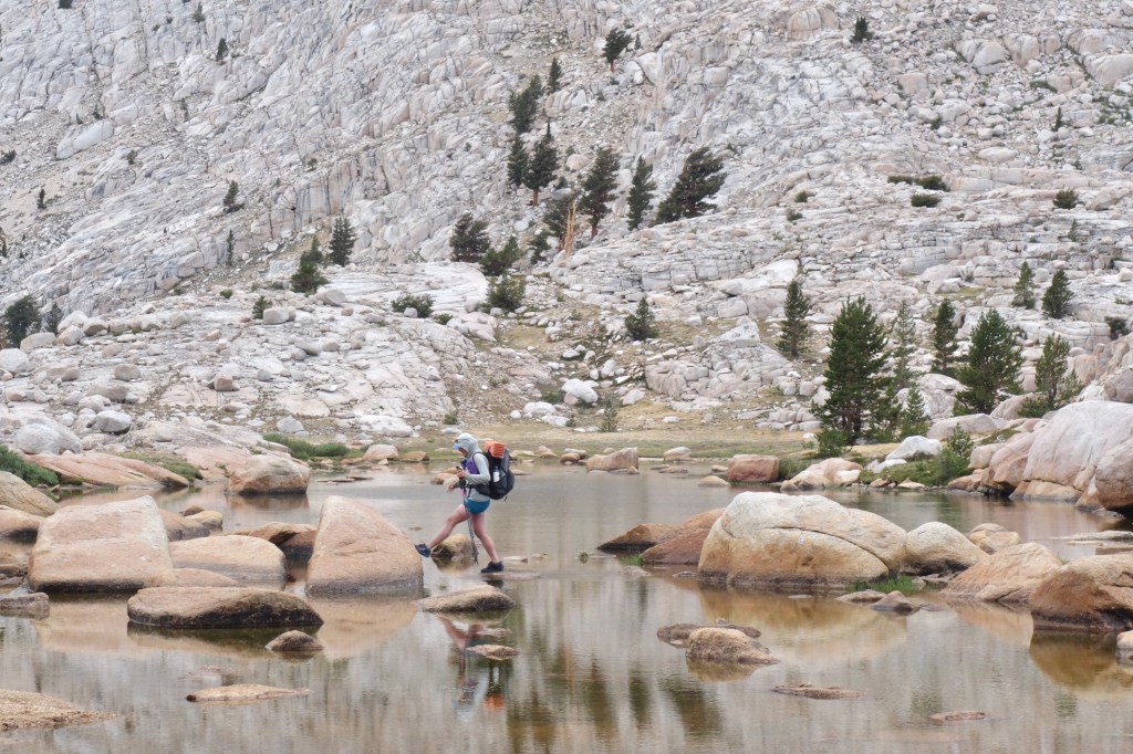
Navigating through the upper lumps and gullies of Miter Basin was twisted and unobvious, but our guide and maps did a good job of keeping us out of trouble. Low water levels eased our travel through, rather than around, numerous lakes. I might have expected the dark bathtub rings on the orange granite had we been here in October, but they were out of place under the high sun of July.
Around the splendid shores of Sky Blue Lake, Spice and I traded roles as we tried to stump one another with generic movie plot descriptions. What we discovered is that most movies boil down to “poor guy leaves home to go on an adventure, picks up a sidekick, falls in love.” Also, poor characters in movies have great adventures, while well-off characters end up murdered or haunted in horror movies. By the time we reached the lower flats of Miter Basin, I was dizzy with the effects of dehydration, too many Skittles, and too much thinking.

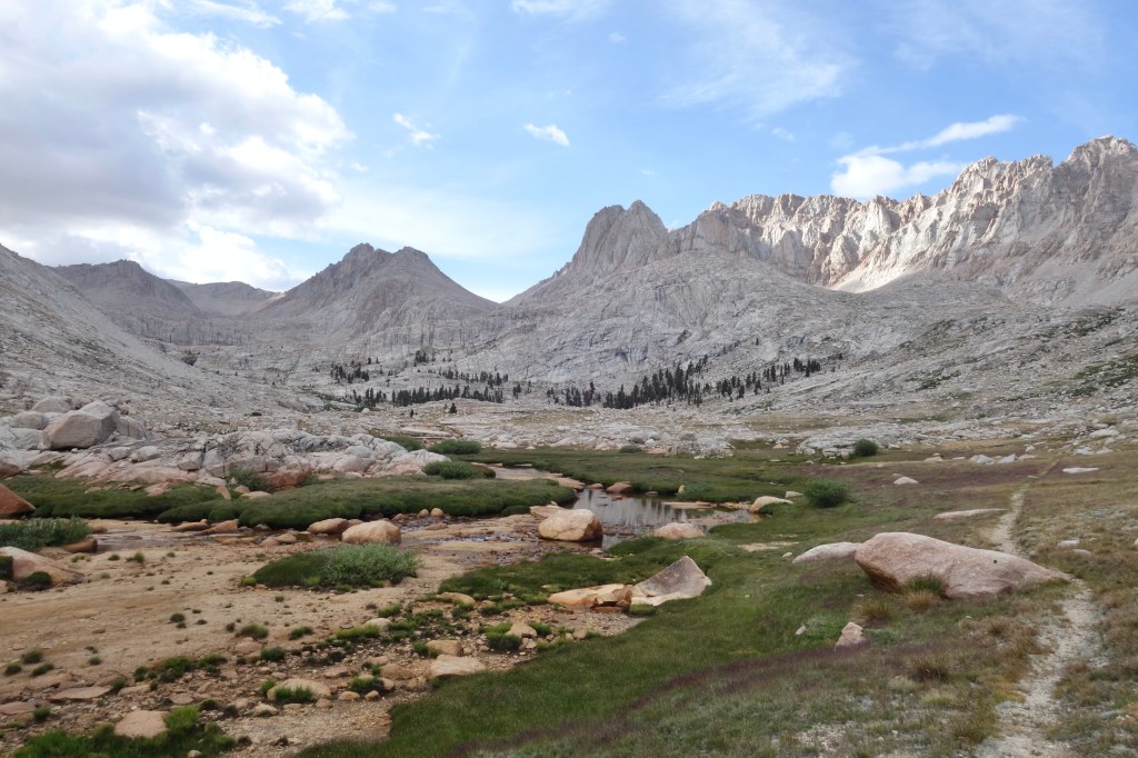
While filtering and guzzling some fresh agua to recuperate, we decided to go a little off-piste. Rather than pick up a use trail back to the JMT as the official SoSHR suggested, we began a traverse around the base of the Major General toward Upper Soldier Lake. It proved to be the right decision. The way was easy and it plopped us in an intimate basin full of gorgeous Foxtail Pine. The twisting red bark of these ancient trees impressed me. However, my impression was nothing compared to Spice’s. She was in tree heaven. In the end, it was an easy decision to camp right there at the lake rather than push up and over another pass into Cottonwood Lakes Basin. Hindsight painted it as an obvious decision, and I was thrilled to be spending one last night on the west side of the Sierra Crest.
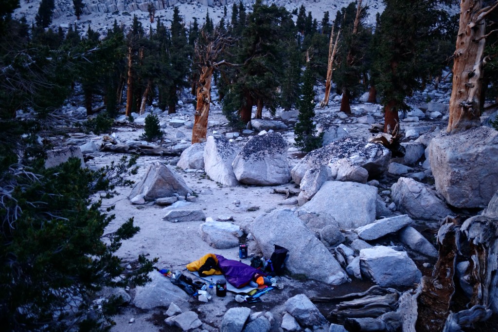
We easily found an awesome spot on the sandy ground. Our final high route camp would be a good one. A double portion of beans for me and mac n cheese for Spice were the last of our dinner rations and made a fine last-night feast. At sunset, we found a quiet spot next to the lake to watch the sky reflect in the water. I wasn’t digging for my emotions, but I teared up a few times nonetheless, both happy and sad to be at the end. Happy that we both made it safe and healthy without any major setbacks from fires or other things. Sad that it was over. I wondered, what fills the hole vacated by a realized dream? Certain that the answer was beyond even my most dedicated cogitation, I returned to camp to sleep it off. With 10 miles left to the trailhead at Horseshoe Meadow, I didn’t need to worry about tomorrow. It would be just like today. Get up and hike. Just the way I like it.

2 thoughts on “SHR Day 22”