
10/20/22
L2H Day 8
Whitney Portal to Mount Whitney (to Whitney Portal)
Carbo Load Camp to Living The Dream Camp
L2H miles: 19.38
L2H total: 143
Elevation change: 6500ft gain, 6500ft loss
The short night dragged on and on. I knew that I needed the rest, but all I wanted to do was start hiking. It didn’t help that it was the coldest night of the trip either. My feet never warmed up, and my patchy quilt insulation left many little doors open for the frigid air to chill various points on my body. I slept well at first, knocked out by our massive dinner, but slowly shifted awake as the needles of cold penetrated to the bone.
Then at around 1am, with a few tentative hoots and hollers, an epic Search And Rescue saga began in earnest. I tried to ignore the distant calls, but nevertheless learned all about David who was lost above the campground after falling and losing his headlamp and glasses. The lead rescuer’s voice crackled through a bullhorn, asking questions to help them locate the wayward hiker. David bleated his responses, frustratingly going quiet rather than answering the most relevant questions.
Arthur and I eventually gave up trying to sleep through it and listened to the drama unfold. Just how David got lost in the first place was a mystery, but it was obvious that he was in good hands. These people were pros. The hubbub eventually subsided, and I was able to snooze once more.
But not for long. At 3am the alarms jangled invisible notes into the infinite darkness. Finally, finally, finally, the final day was beginning. Arthur and I quickly packed up our camp, then moved everything to the trailhead after grabbing our remaining food from the bear locker. I ate a big cookie, and delayered, keeping my wind pants on in anticipation of the long remaining hours until sunrise. I unsuccessfully tried to poop in the convenient pit toilet, but it was too early for that function of my body to be operational. Nope, I’d need to poop in a bag at an awkward time instead.
We were ready to go by 3:40am, our earliest start of the L2H, and this time we weren’t trying to beat the heat. Instead, we were hoping to return to this spot before sunset. Even better, I wanted to be back at the portal before 4pm, before the sun disappeared behind the mountains. 10 miles up, 10 miles down. Easy peasy.
The light from the waning moon wasn’t enough for us this time, so we hiked by the red beams of our headlamps. As expected with such a popular trail, the tread was smooth and the switchbacks gradual. Navigation was straightforward, and I settled into an easy rhythm behind Arthur’s steady steps. As we climbed above the portal, from one pool of darkness into another, we could see the remnants of the SAR operation. There was a string of lights rising from the campground up the steep slope of avalanche debris that we’d crossed yesterday. That made sense to us. The trail didn’t exist there anymore, and it would be easy to get lost in the dark. Thankfully there had been a happy ending.
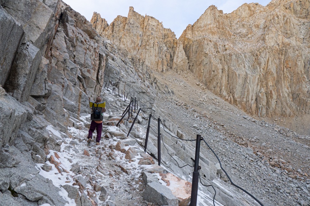
The air grew noticeably colder the higher we climbed. That was no surprise, but it was shocking nonetheless and kept us moving at a consistent clip. We passed a couple hiking with headlamps as bright as locomotives, then followed the trail through a small flat of huge trees. In the darkness, there was no context for our twists and turns. Going up was the only thing that was certain, and I learned to trust that this excellent trail was taking us to the summit in the best way possible. As we dipped and turned out of the trees, I focused on my power of smell rather than sight to provide a sense of place. The willows and the water smelled different, as did the bare granite when we climbed above them.

The spiderweb of tracks at Outpost Camp took us a little off course, but the blinding phone screen put us back on the red line. Soon after, we emerged from treeline on a narrow stretch of rocky switchbacks, officially marking our entrance into the alpine zone. Just like the meadow, it smelled different. Colder, harsher, but no less welcoming. Abruptly, there was only sky above. Cold, dark, brilliant sky. On either side of us, the featureless silhouettes of ragged ridgelines were somehow darker still. They could have been just a hundred feet higher than us, but I preferred to overestimate. They were 10,000ft above us! Okay, dude, dial it back. Wait, actually, the sky wasn’t that dark, after all. Dawn was coming. Hooray!
The sky lightened to a dull ombré, warming behind the distant ridge of the Inyo Mountains like a pilot light ready to set the world aflame. The patchy ceiling of clouds above followed a few shades of the color wheel behind as the world held its breath, waiting to see if the dawn would break or shudder to a disappointing stall.
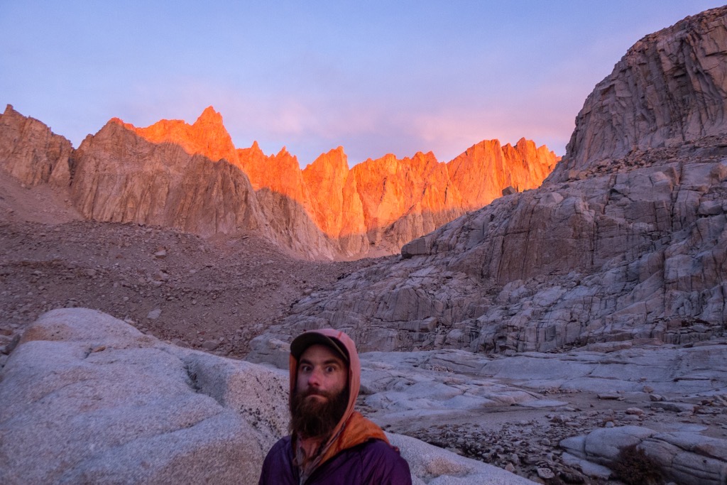
Fifteen minutes later, there was no question. As Arthur and I reconvened on the ridged slabs of granite at Trail Camp, I could practically hear the ‘whoosh’ as the clouds exploded with the warmest orange imaginable. For a few minutes, no one moved. Not us, and not the campers scattered amongst the boulders and flamboyant tents. The sun show could not be ignored, and like the most sacred ritual, it peacefully guided our minds into the new day. Wake up, headlamps off, sunscreen on.

My hands were frozen by the time I finished pooping in my wag bag and cramming it into my backpack mesh, hoping that I properly closed the ziplock. Then, following behind Arthur, we pointed to the scaleless moraine, and kept moving, hiking fast to refresh our warmth. And the numbing cold and three hours of hiking in the dark were totally worth it just to see the Whitney Crest erupt like spires of molten lava frozen in motion. “Gatorade glow” jumped to mind, but the peaks burned with an internal fire that defied comparison except to rock so hot that it flowed like molasses.
Even without the intense shock of the sunrise, this place would have stopped me dead in my tracks. The miles-long cliff of sheer granite, from Muir to Whitney, defied comprehension. It looked big, sure, but I couldn’t shake the thought that I was still underestimating the scale. And not to be ignored were similarly impressive teeth of granite in every other direction. What is this place? How could it be so huge? How could I be so small?

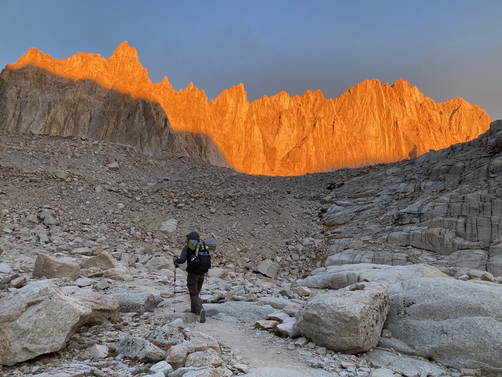
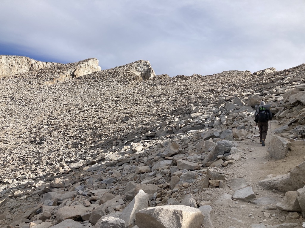
We’d already made a few turns when I realized that we were on the infamous 99 Switchbacks. I like switchbacks, so the number didn’t intimidate me, but the snow that dusted the shaded slope gave me pause. While Arthur hopped off trail to make another deposit in his wag bag, I moved purposefully, breathing steadily and testing my traction on the frozen covering. I was pleased to find that the snow was old and cold. It acted more like dust than ice, and so my tread bit and held without drama. The visual drama was undeniable though, and every step felt that much more epic because of it.
Together again, Arthur and I churned turn after turn up the massive slope into the thin mountain air, until somewhere along the way, I realized that I’d left my brain behind around 13,000ft. I didn’t feel truly dizzy, but I wasn’t fully there either. Beyond recognizing the phenomenon, there wasn’t anything to do besides monitor myself for changes. Fortunately, we soon rounded the final bend onto the last, level switchback, which allowed my breath to catch up to my pumping heart.

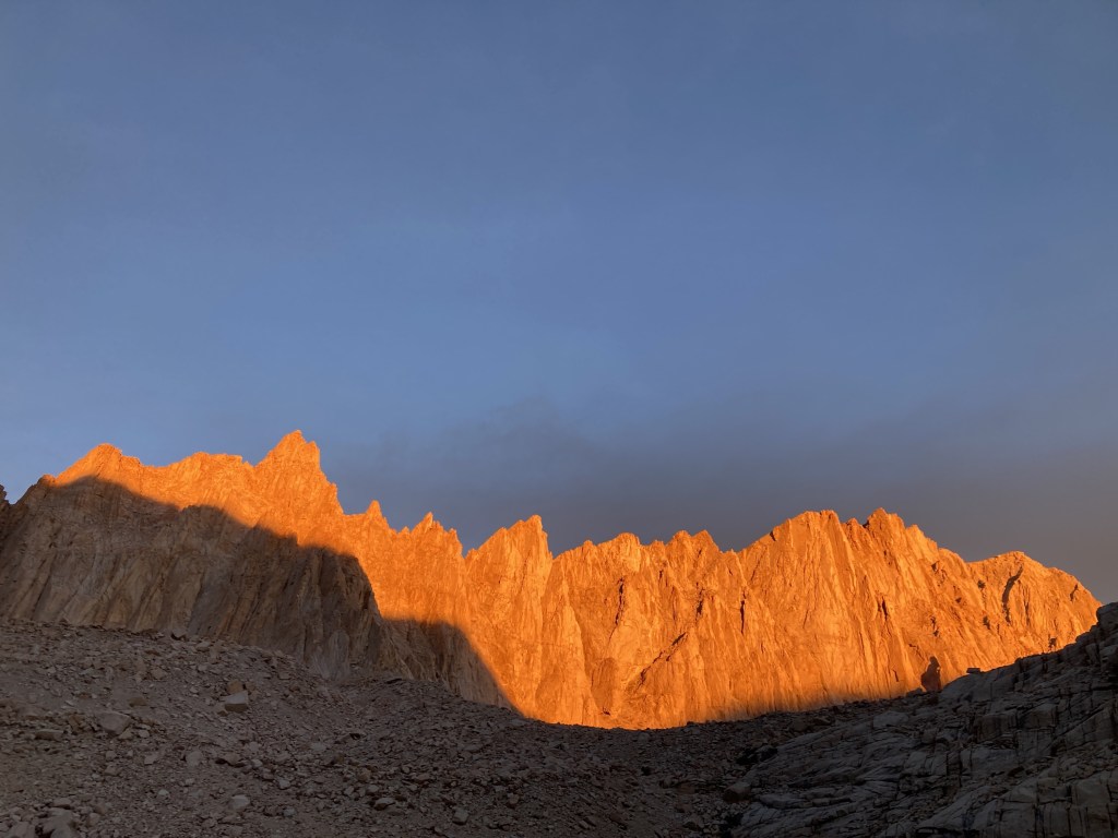
Light and shadow on the Whitney Crest. Not pictured, Mount Whitney, which is hiding behind the rightmost pointy thingy. 
Stopping to adjust the poles and catch the breath. 
The final switchback. Just a straight shot along the Crest to the summit. 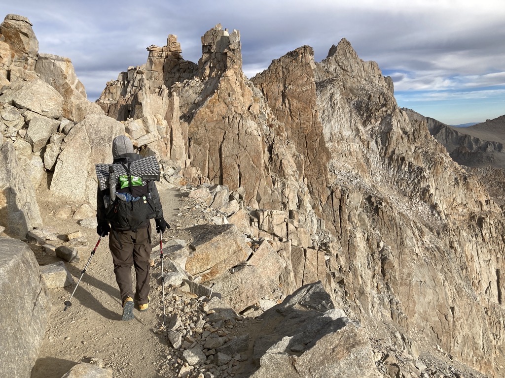
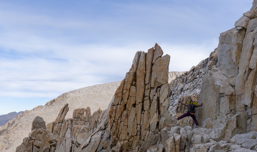
Gnarly rock just before the flip across the Crest to the interior of the High Sierra.
I stopped there to reminisce about the time Spice and I turned off the trail at this exact spot to travel cross-country during our final full day on the Sierra High Route. There was a lot of awesome stuff up that loose pile of talus, but I was glad to be on trail today. It was easier and faster. When I got hiking again, I was back to full brain power, or at least as full as I get. Oxygen is not overrated.
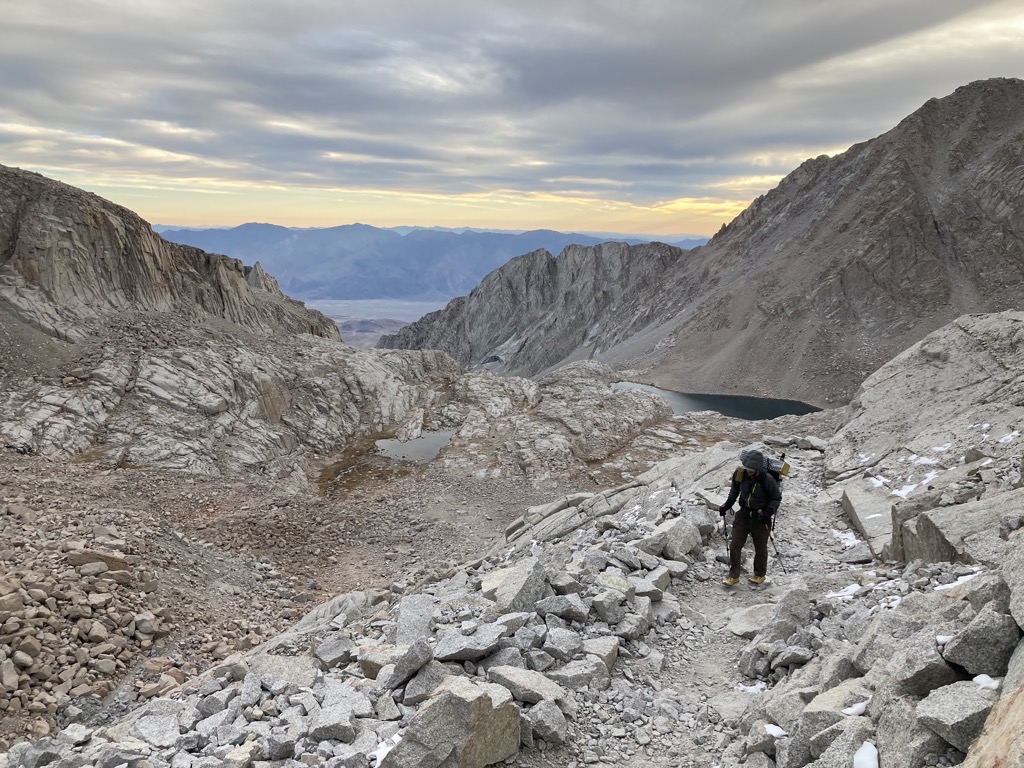
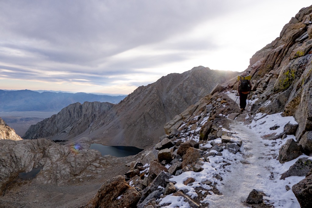
A short distance later, we flipped across the ridge at Trail Crest, and quite suddenly we were not just on the edge of the mountains, but deep within. The desert disappeared behind us. Now there were trees, water, and mountains for days. And it was all the best stuff, reminding me of even more trips I’d had the privilege of experiencing over the years. The Kaweahs are always a pleasure to see, as is the mighty glacial valley of the Kern River. Closer was seated the ridge of Mount Hitchcock and the twin lakes that puddled below like inky blotches of used motor oil. The morning sunlight, warm and filtered through the clouds, created a strange effect where every detail — crack, crevice, wrinkle — was enhanced, which brought the mountains closer. Phenomenal. I could have stared all day.

A short descent to the cliffside junction with the JMT followed, where began the final two-mile crest walk to the summit. Aside from Arthur’s untrustworthy farts, we were feeling fine. We hypothesized that all the salt on the fries last night had screwed up his gut, and now he was walking a dangerous line. It was an unenviable position to be in, for sure, and I left him to drop a seriously high-altitude dookie in his filling wag bag amidst a pile of boulders. While I waited, I jostled a misplaced bottle of water that I found, hoping to dump it out to ditch the weight before cramming it into my pack. In seconds, the liquid froze to slush and the cap froze shut. I had just managed to thaw it in my clenched fist when Arthur rounded the bend.

I haven’t described the trail here yet because I can’t do it justice. There is none like it in my experience, and it is one of my favorites, a truly special place. Contouring across a steep slope of broken granite, the trail provides a remarkably smooth path below the remarkably pointed peaks of the Whitney Crest. Even pictures fail to capture the distance and the outrageous spires. Once, then twice, it touches a ‘window’ in the ridge, wherein one can feel surrounded by air with the vast depths of the Sierra to the west and a sobering drop to the Owens Valley to the east. The view is both thrilling and terrifying. I love and hate it.


I stopped this time longer than I’d dared before. The sunlight glowed in the granite basin far below, and snow clung to the shaded north cliff. Something in the wildness of the mixture of warm and cold, high and low, safe and unsafe, held my attention. I was freezing on the dark side of the ridge while Lone Pine baked in the sunshine 10,000ft below. There was little threat to my well-being while I stuck to the trail, yet just two steps in the wrong direction and I would be gone in a blink. The beauty entrapped me, revealing more than I asked for. This was a window into my soul.

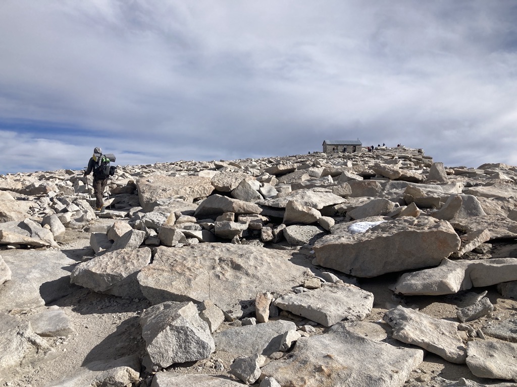
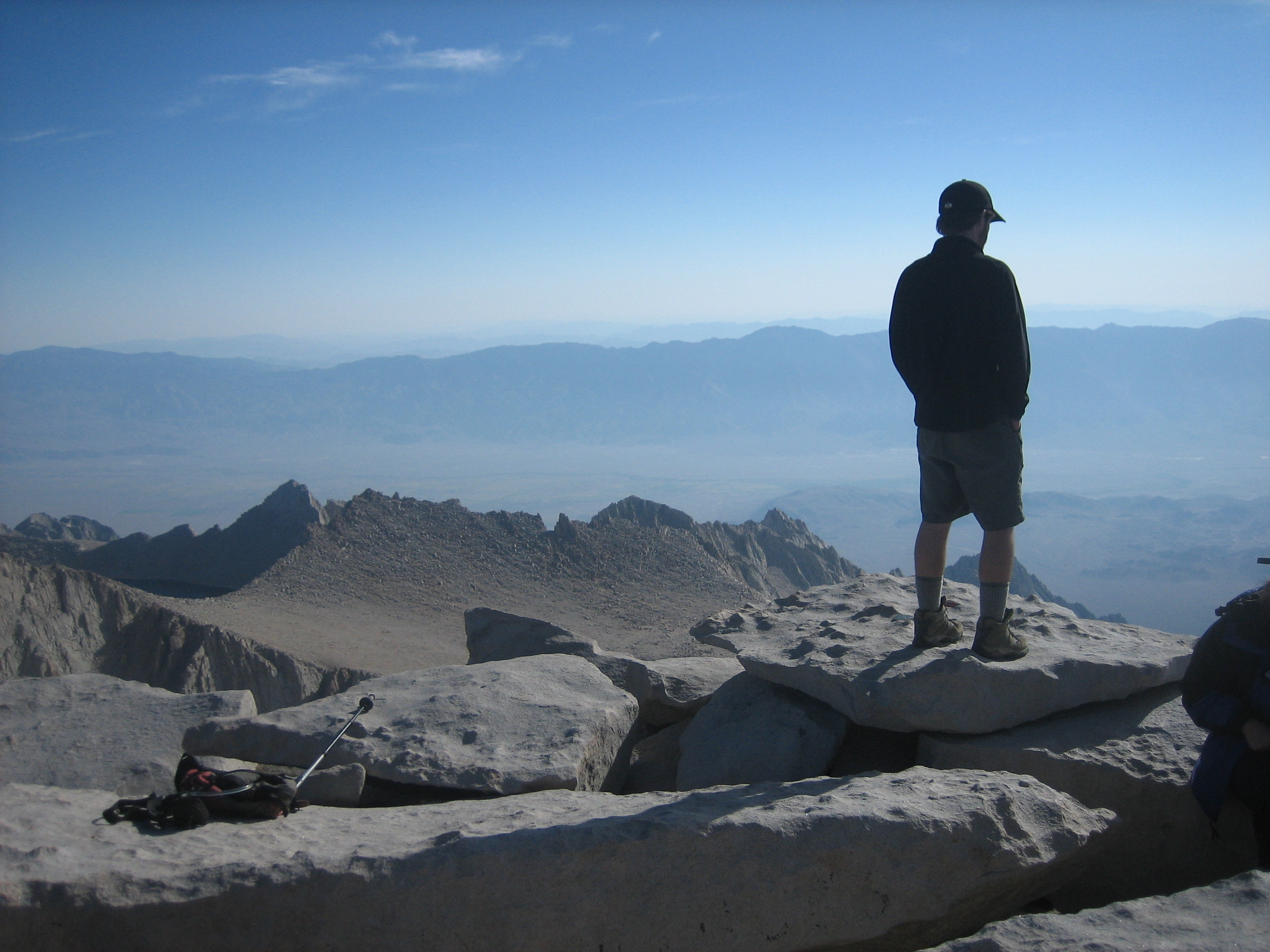
With a final, triumphant swoop up the gradual backside of the mountain, we were just a short flat walk from the summit hut. Arthur reached it first and signed his name in the logbook. I did the same, then followed him to the true summit, creeping closer to the sharp edge of the enormous east face. We congratulated one another with a hug and high-five. We made it. Amazing. From lowest to highest, Badwater -282ft to Whitney (Tumanguaya) +14,505ft.
Almost there. 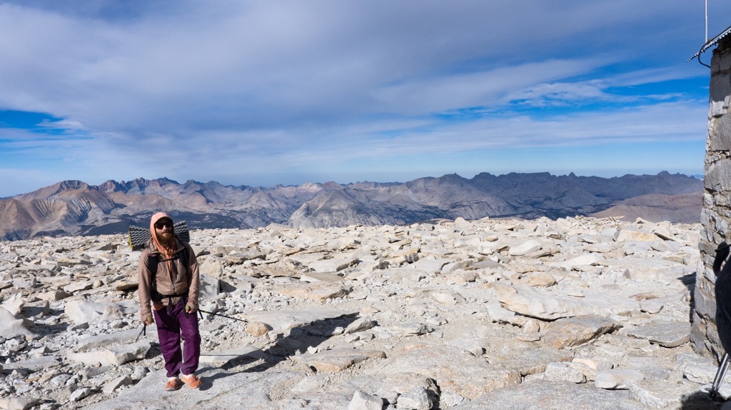
Whew! Huffing and puffing to the top. Photo cred: aeigenbrot 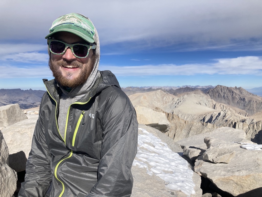
Nice work, brochacho. A well-deserved smile on the tippy top. 
Saving our butts from the cold rock. 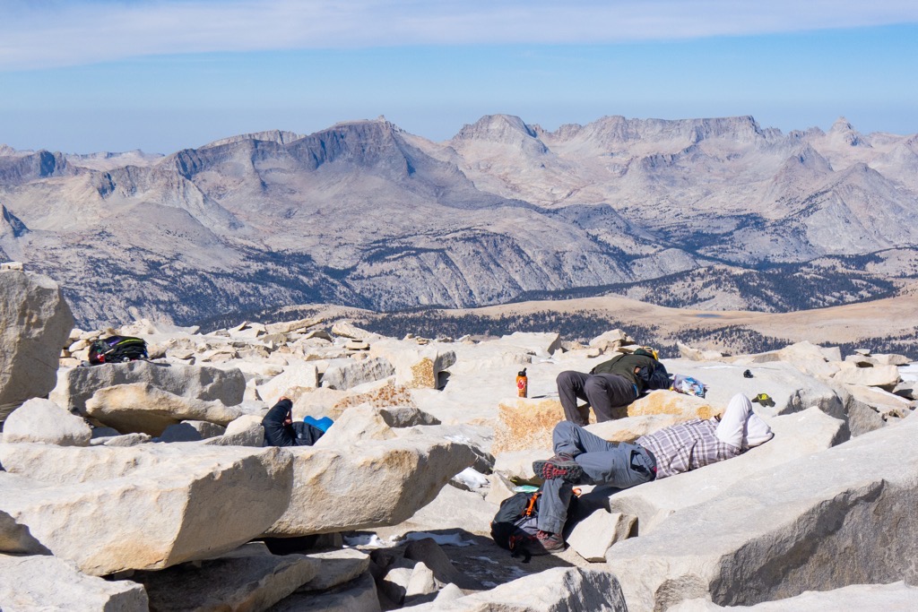
The Selfie Bros know how to relax. Besides, taking selfies is hard work. Photo cred: aeigenbrot 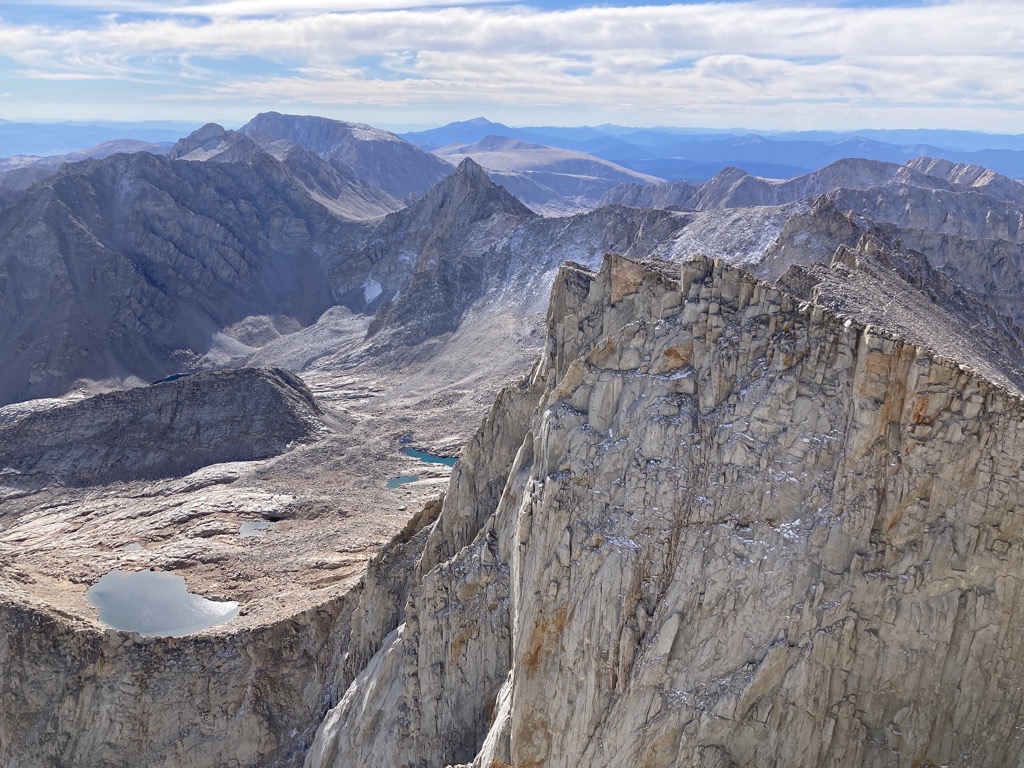
The view south along the Whitney Crest, all the way to Mexico, pretty much. 
As close as I dare get to the edge. Photo cred: aeigenbrot
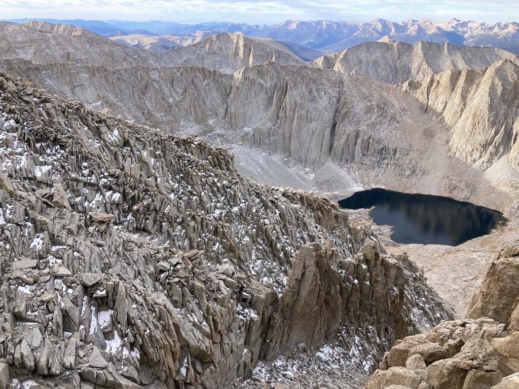
I unfurled my foam pad to cushion my tush on the hard stone and kept my head on a swivel. In each direction there was a scene that I could scrutinize for hours — Mount Russel’s sickening east ridge, back along the crest and beyond to Langley and Olancha. However, I favored the view east to Telescope Peak. That span encompassed most of the last week, and I now knew it intimately in a way that only walking can reveal. It was a long way, and the clear air shrunk the distances, making every ridge look smaller. But as we’d learned on Day 1, we were small and bad at judging distances.

Even more powerful than reliving the amazing week I’d just spent with my brother, was thinking back to 2008, when I first stood in this very same spot. I remember wondering where Death Valley hid out there between the ridges. I knew it was close-ish, but was it within view? With that tweak of inspiration, I’d mapped out a route on the computer when I got back home from Badwater to Whitney Portal. It was all on roads, probably close to the route taken by the Badwater Marathon, and felt like an impossible journey on foot. Biking it seemed doable, but my enthusiasm was quickly sidetracked by a move to college, and the concept remained half-baked and not even seriously considered.
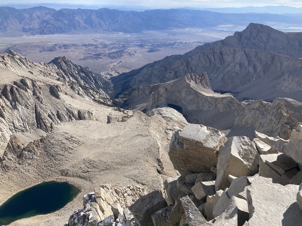
Pretty much the entire L2H is captured in this photo. Lone Pine sits in the flat of the Owens Valley. The Inyo Mountains rise behind, and the Panamint Range marks the far horizon on the right. Telescope Peak is the distant high point, with Badwater just on the other side. 
A blurry picture of Telescope Peak. 
A sharp picture of the blurry picture of Telescope Peak. Photo cred: aeigenbrot
Now here I was, my longest-standing dream realized. I had to thank Arthur, who was on that first trip in 2008. During the intervening years, he’d discovered the hiking route, the L2H, and nursed his own flames of desire. And this year he made it happen. Add a lot of encouragement from Spice, and I got to come along for the ride. After all these years, I was so grateful to have finally had the opportunity, strength, and luck to walk from there to here, to turn the desert into my temporary home.


Looking the other way, along the Sierra Crest, I wished for Summer and more food on my back. I wanted to keep going. However, after a long sit and lots of snacks, it was time to leave the selfie bros behind and head home.
The altitude was no longer limiting our pace or fogging our minds. We flew down the crest trail, offering encouragement to the few hikers that were still trudging up, then rapidly ticked off each of the 99 Switchbacks. My feet were aching at the bottom, but I didn’t care. They’d have a chance to rest soon.


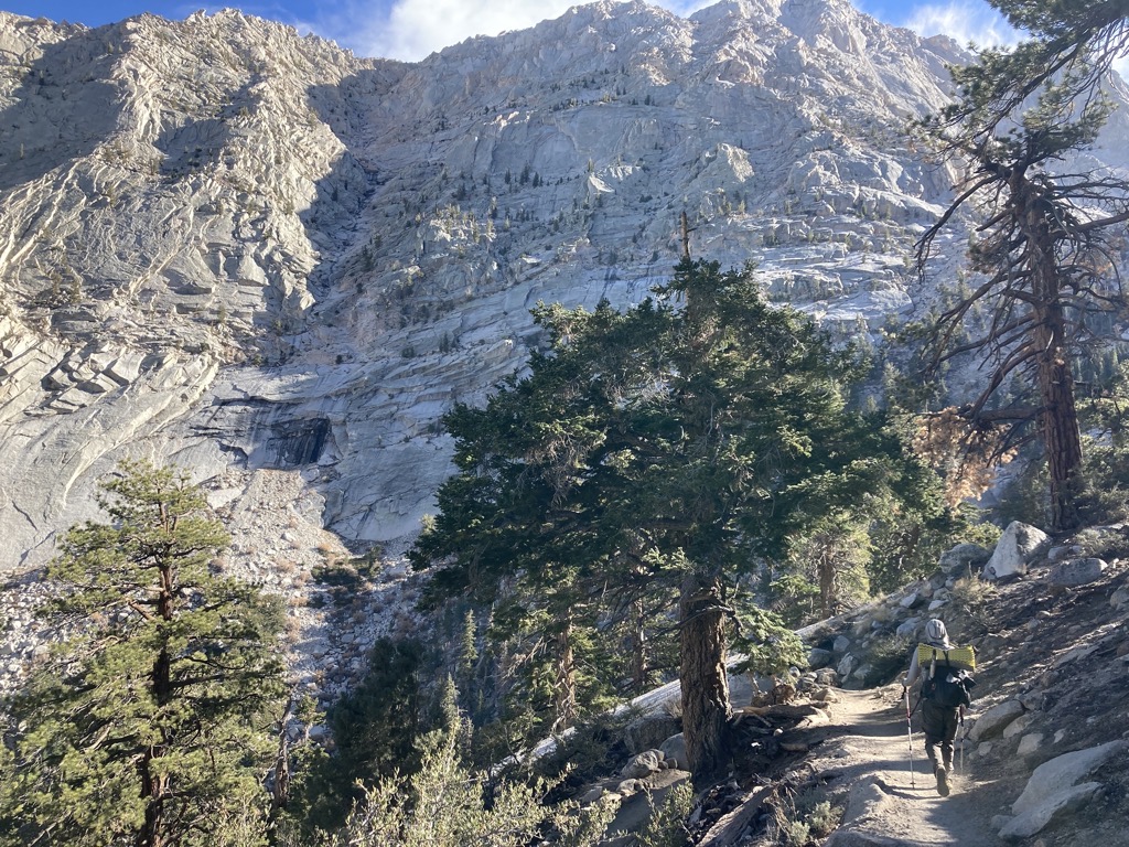
After filtering dirt-flavored water at a placid tarn, we plunged back below treeline, seeing for the first time what had been obscured by darkness as we climbed. The air warmed and the rising granite walls glowed with sunlight and my reflected joy as we pounded down, down, down. I ate bar after bar, ravenous and beyond the need to ration. Rounding one of the final switchbacks, I recognized a rock where I had rested during the final hour of that 2008 trip. I only knew it because I’d seen myself there in a photo, but I identified it instantly. It was an odd feeling. I gave the rock a pat.

A final tremendous switchback flipped us back into the trees and past the trailhead signs. There was the parking lot, and there were our parents. Hugs all around, then we dropped our bags of poop in the designated trash cans. Now we were really done. Minutes later, I was in the back seat, staring out the window as we curved out of the mountains, and into the valley. The trees shrunk and disappeared, and the hillside browned to desert. Behind us, the mountains remained, splendid and solid. They were unchanged.

I wasn’t sure I could claim the same for myself, but had no interest in digging further. Too fast. Everything was moving too fast, and I was just holding on. The mountains called, and I wanted nothing more than to turn around and climb back up. But there was a life to live. Besides, I had a date with a cold booch and a poolside recliner. For the rest of the day at least, those could be my mountains.

That’s it for the Lowest to Highest, y’all. Thanks for coming along for the ride!
❤

As always, thank you for taking us on your adventures… you’ve provided a lifetime of bucket list items for me to check! Congrats!
LikeLike
Ciao oww! 💜
LikeLike
What a trek Owen! Amazing photos and book worthy narative, well done.
LikeLike
It’s all so beautiful!
LikeLike
Congrats and thanks. Great photos and writing. I would really have missed trees if it was me.
Cheers!
LikeLike
Wow! Epic. SMH. Stunning photos – I felt like I was there with you. So inspiring! Thank you for sharing!
LikeLike